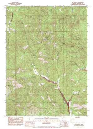
Mount Isabelle Topo Map Oregon
To zoom in, hover over the map of Mount Isabelle
USGS Topo Quad 42123c1 - 1:24,000 scale
| Topo Map Name: | Mount Isabelle |
| USGS Topo Quad ID: | 42123c1 |
| Print Size: | ca. 21 1/4" wide x 27" high |
| Southeast Coordinates: | 42.25° N latitude / 123° W longitude |
| Map Center Coordinates: | 42.3125° N latitude / 123.0625° W longitude |
| U.S. State: | OR |
| Filename: | o42123c1.jpg |
| Download Map JPG Image: | Mount Isabelle topo map 1:24,000 scale |
| Map Type: | Topographic |
| Topo Series: | 7.5´ |
| Map Scale: | 1:24,000 |
| Source of Map Images: | United States Geological Survey (USGS) |
| Alternate Map Versions: |
Mt. Isabelle OR 1983, updated 1983 Download PDF Buy paper map Mount Isabelle OR 2011 Download PDF Buy paper map Mount Isabelle OR 2014 Download PDF Buy paper map |
1:24,000 Topo Quads surrounding Mount Isabelle
> Back to 42123a1 at 1:100,000 scale
> Back to 42122a1 at 1:250,000 scale
> Back to U.S. Topo Maps home
Mount Isabelle topo map: Gazetteer
Mount Isabelle: Areas
Lilly Prairie elevation 966m 3169′Mount Isabelle: Dams
Jacksonville Dam elevation 601m 1971′Mount Isabelle: Flats
Bunny Meadows elevation 741m 2431′Mount Isabelle: Mines
Lucky Boy Mine elevation 693m 2273′Oregon Belle Mine elevation 1008m 3307′
Sturgis Mine elevation 579m 1899′
Mount Isabelle: Populated Places
Draper (historical) elevation 450m 1476′Mount Isabelle: Post Offices
Draper Post Office (historical) elevation 450m 1476′Herling Post Office (historical) elevation 562m 1843′
Mount Isabelle: Reservoirs
Jacksonville Reservoir elevation 601m 1971′Winningham Reservoir elevation 580m 1902′
Mount Isabelle: Springs
Deadhorse Spring elevation 706m 2316′Mount Isabelle: Streams
Cantrall Creek elevation 685m 2247′East Branch Galls Creek elevation 529m 1735′
Left Fork Foots Creek elevation 418m 1371′
Middle Fork Foots Creek elevation 421m 1381′
Oregon Belle Creek elevation 702m 2303′
Poormans Creek elevation 520m 1706′
Right Fork Forest Creek elevation 598m 1961′
West Branch Galls Creek elevation 529m 1735′
Mount Isabelle: Summits
Baldy Mountain elevation 1212m 3976′Miller Mountain elevation 1132m 3713′
Mount Isabelle elevation 1329m 4360′
Timber Mountain elevation 1342m 4402′
Wellington Butte elevation 1123m 3684′
Mount Isabelle: Valleys
Brushy Gulch elevation 408m 1338′George Black Gulch elevation 564m 1850′
Horn Gulch elevation 423m 1387′
Lennox Gulch elevation 848m 2782′
Lonesome Gulch elevation 431m 1414′
Lyons Gulch elevation 387m 1269′
Marshall Gulch elevation 653m 2142′
Max Gulch elevation 504m 1653′
Moore Gulch elevation 478m 1568′
Norling Gulch elevation 696m 2283′
Panther Gulch elevation 648m 2125′
Rail Gulch elevation 761m 2496′
Rock Gulch elevation 673m 2208′
Sailor Gulch elevation 616m 2020′
Mount Isabelle digital topo map on disk
Buy this Mount Isabelle topo map showing relief, roads, GPS coordinates and other geographical features, as a high-resolution digital map file on DVD:


