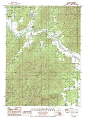
Murphy Topo Map Oregon
To zoom in, hover over the map of Murphy
USGS Topo Quad 42123c3 - 1:24,000 scale
| Topo Map Name: | Murphy |
| USGS Topo Quad ID: | 42123c3 |
| Print Size: | ca. 21 1/4" wide x 27" high |
| Southeast Coordinates: | 42.25° N latitude / 123.25° W longitude |
| Map Center Coordinates: | 42.3125° N latitude / 123.3125° W longitude |
| U.S. State: | OR |
| Filename: | o42123c3.jpg |
| Download Map JPG Image: | Murphy topo map 1:24,000 scale |
| Map Type: | Topographic |
| Topo Series: | 7.5´ |
| Map Scale: | 1:24,000 |
| Source of Map Images: | United States Geological Survey (USGS) |
| Alternate Map Versions: |
Murphy OR 1986, updated 1986 Download PDF Buy paper map Murphy OR 1996, updated 1999 Download PDF Buy paper map Murphy OR 2011 Download PDF Buy paper map Murphy OR 2014 Download PDF Buy paper map |
| FStopo: | US Forest Service topo Murphy is available: Download FStopo PDF Download FStopo TIF |
1:24,000 Topo Quads surrounding Murphy
> Back to 42123a1 at 1:100,000 scale
> Back to 42122a1 at 1:250,000 scale
> Back to U.S. Topo Maps home
Murphy topo map: Gazetteer
Murphy: Bridges
Murphy Bridge elevation 315m 1033′Murphy: Canals
Blodgett Ditch elevation 514m 1686′Murphy Ditch elevation 315m 1033′
Murphy: Dams
Lippert Dam Number Two elevation 404m 1325′Murphy: Flats
Cherry Flat elevation 469m 1538′Murphy: Gaps
Water Gap elevation 413m 1354′Murphy: Mines
Humdinger Mine elevation 730m 2395′Michigan Mine elevation 415m 1361′
Oregon Bonanza Mine elevation 742m 2434′
Snow Bird Mine elevation 943m 3093′
Murphy: Parks
Applegate County Park elevation 324m 1062′Murphy: Populated Places
Murphy elevation 324m 1062′New Hope elevation 317m 1040′
Murphy: Post Offices
Murphy Post Office elevation 324m 1062′Murphy: Reservoirs
Fifer Reservoir elevation 367m 1204′House Reservoir elevation 313m 1026′
Lincoln Savage Reservoir elevation 329m 1079′
Lippert Reservoir Number Two elevation 404m 1325′
Reinhardt Reservoir elevation 358m 1174′
Small Reservoir elevation 426m 1397′
Spalding Reservoir elevation 339m 1112′
Tobiason Reservoir elevation 398m 1305′
Webb Reservoir elevation 393m 1289′
Willson Reservoir elevation 342m 1122′
Wood Reservoir elevation 368m 1207′
Murphy: Springs
Miller Spring elevation 444m 1456′Murphy: Streams
Black Canyon Creek elevation 337m 1105′Blodgett Creek elevation 464m 1522′
Board Shanty Creek elevation 330m 1082′
Bricker Creek elevation 394m 1292′
Camp Meeting Creek elevation 392m 1286′
Caris Creek elevation 343m 1125′
Dales Bluff Creek elevation 340m 1115′
Dry Creek elevation 417m 1368′
Grays Creek elevation 318m 1043′
Honeysuckle Creek elevation 575m 1886′
Iron Creek elevation 321m 1053′
Johnston Creek elevation 338m 1108′
Madronna Creek elevation 339m 1112′
Meehan Slough elevation 325m 1066′
Miller Creek elevation 343m 1125′
Murphy Creek elevation 316m 1036′
Onion Creek elevation 310m 1017′
Oscar Creek elevation 333m 1092′
Panther Creek elevation 323m 1059′
Skunk Creek elevation 313m 1026′
Wallow Creek elevation 621m 2037′
Water Gap Creek elevation 364m 1194′
Murphy: Summits
Pennington Butte elevation 1258m 4127′Pennington Mountain elevation 603m 1978′
Murphy: Valleys
Maple Gulch elevation 372m 1220′Packers Gulch elevation 414m 1358′
Schoolhouse Gulch elevation 348m 1141′
Wildcat Gulch elevation 344m 1128′
Murphy digital topo map on disk
Buy this Murphy topo map showing relief, roads, GPS coordinates and other geographical features, as a high-resolution digital map file on DVD:


