Eden Ridge Valley Topo Map Oregon
To zoom in, hover over the map of Eden Ridge Valley
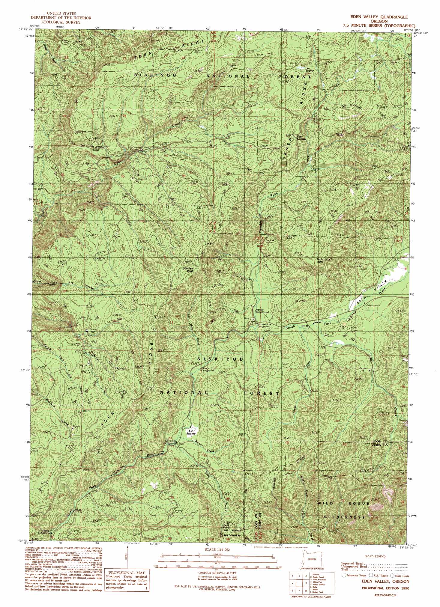
USGS Topo Quad 42123g8 - 1:24,000 scale
| Topo Map Name: | Eden Ridge Valley |
| USGS Topo Quad ID: | 42123g8 |
| Print Size: | ca. 21 1/4" wide x 27" high |
| Southeast Coordinates: | 42.75° N latitude / 123.875° W longitude |
| Map Center Coordinates: | 42.8125° N latitude / 123.9375° W longitude |
| U.S. State: | OR |
| Filename: | o42123g8.jpg |
| Download Map JPG Image: | Eden Ridge Valley topo map 1:24,000 scale |
| Map Type: | Topographic |
| Topo Series: | 7.5´ |
| Map Scale: | 1:24,000 |
| Source of Map Images: | United States Geological Survey (USGS) |
| Alternate Map Versions: |
Eden Valley OR 1990, updated 1990 Download PDF Buy paper map Eden Valley OR 1998, updated 2001 Download PDF Buy paper map Eden Valley OR 2011 Download PDF Buy paper map Eden Valley OR 2014 Download PDF Buy paper map |
| FStopo: | US Forest Service topo Eden Valley is available: Download FStopo PDF Download FStopo TIF |
1:24,000 Topo Quads surrounding Eden Ridge Valley
Myrtle Point |
Bridge |
Remote |
Kenyon Mountain |
Camas Valley |
Dement Creek |
Powers |
Rasler Creek |
Bone Mountain |
Chipmunk Ridge |
Barklow Mountain |
China Flat |
Eden Ridge Valley |
Mount Bolivar |
Dutchman Butte |
Ophir Mountain |
Illahe |
Marial |
Kelsey Peak |
Bunker Creek |
Soldier Camp Mountain |
Agness |
Brandy Peak |
Hobson Horn |
Mount Peavine |
> Back to 42123e1 at 1:100,000 scale
> Back to 42122a1 at 1:250,000 scale
> Back to U.S. Topo Maps home
Eden Ridge Valley topo map: Gazetteer
Eden Ridge Valley: Cliffs
Buck Point elevation 771m 2529′Eden Ridge Valley: Mines
Old Red Mine elevation 534m 1751′Eden Ridge Valley: Ridges
Eden Ridge elevation 994m 3261′Eden Ridge Valley: Streams
Barker Creek elevation 669m 2194′Buck Creek elevation 668m 2191′
Clear Creek elevation 691m 2267′
Elk Horn Creek elevation 679m 2227′
Foggy Creek elevation 690m 2263′
Wooden Rock Creek elevation 684m 2244′
Eden Ridge Valley: Summits
Gobblers Knob elevation 1118m 3667′Table Rock elevation 1144m 3753′
Eden Ridge Valley: Swamps
Ash Swamp elevation 687m 2253′Doe Swamp elevation 963m 3159′
Eden Ridge Valley: Valleys
Eden Valley elevation 695m 2280′Eden Ridge Valley digital topo map on disk
Buy this Eden Ridge Valley topo map showing relief, roads, GPS coordinates and other geographical features, as a high-resolution digital map file on DVD: