Chipmunk Ridge Topo Map Oregon
To zoom in, hover over the map of Chipmunk Ridge
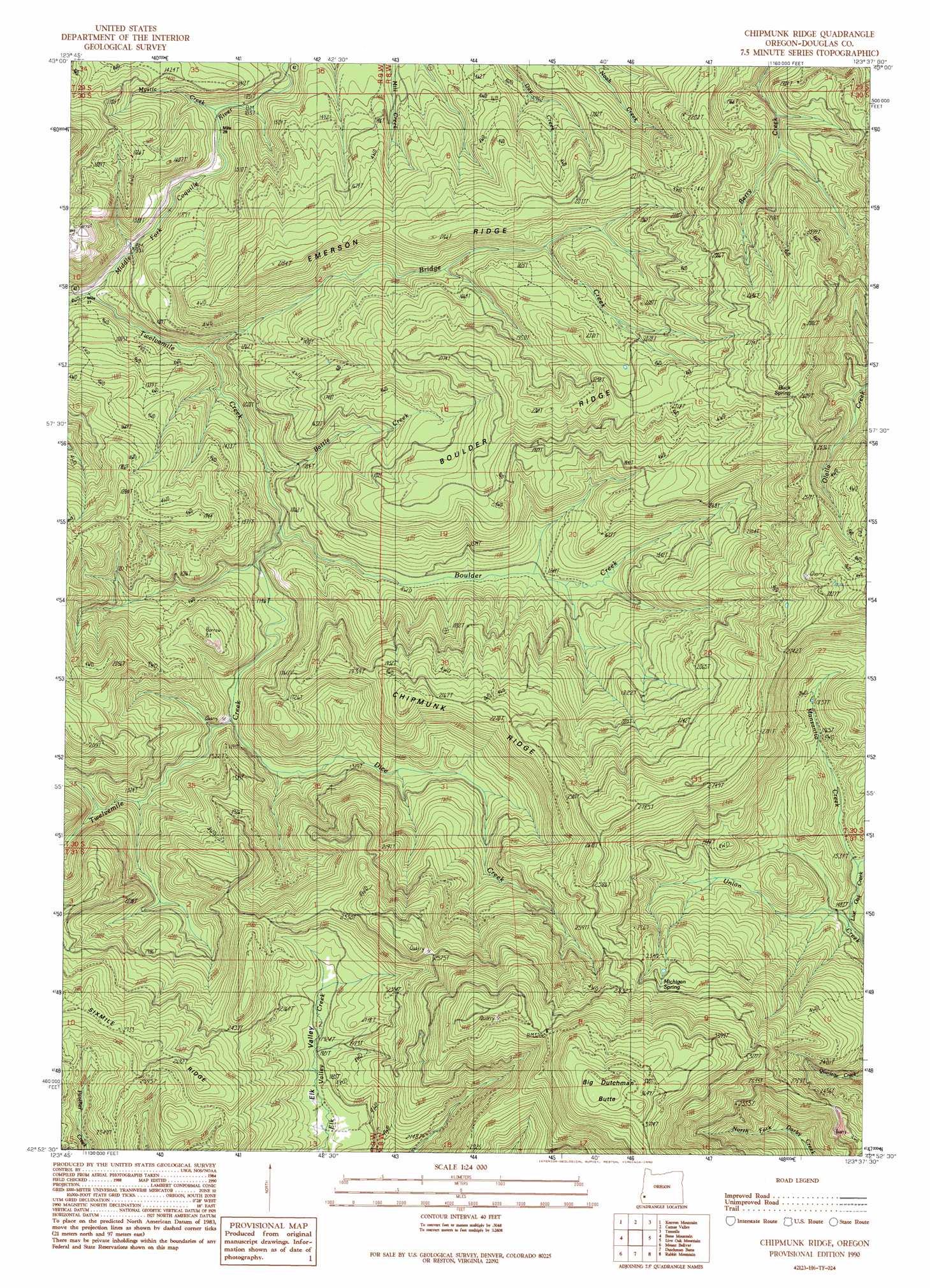
USGS Topo Quad 42123h6 - 1:24,000 scale
| Topo Map Name: | Chipmunk Ridge |
| USGS Topo Quad ID: | 42123h6 |
| Print Size: | ca. 21 1/4" wide x 27" high |
| Southeast Coordinates: | 42.875° N latitude / 123.625° W longitude |
| Map Center Coordinates: | 42.9375° N latitude / 123.6875° W longitude |
| U.S. State: | OR |
| Filename: | o42123h6.jpg |
| Download Map JPG Image: | Chipmunk Ridge topo map 1:24,000 scale |
| Map Type: | Topographic |
| Topo Series: | 7.5´ |
| Map Scale: | 1:24,000 |
| Source of Map Images: | United States Geological Survey (USGS) |
| Alternate Map Versions: |
Chipmunk Ridge OR 1990, updated 1990 Download PDF Buy paper map Chipmunk Ridge OR 2011 Download PDF Buy paper map Chipmunk Ridge OR 2014 Download PDF Buy paper map |
1:24,000 Topo Quads surrounding Chipmunk Ridge
Dora |
Sitkum |
Mount Gurney |
Reston |
Roseburg West |
Remote |
Kenyon Mountain |
Camas Valley |
Tenmile |
Winston |
Rasler Creek |
Bone Mountain |
Chipmunk Ridge |
Live Oak Mountain |
Nickel Mountain |
Eden Ridge Valley |
Mount Bolivar |
Dutchman Butte |
Rabbit Mountain |
Mccullough Creek |
Marial |
Kelsey Peak |
Bunker Creek |
Mount Reuben |
Glendale |
> Back to 42123e1 at 1:100,000 scale
> Back to 42122a1 at 1:250,000 scale
> Back to U.S. Topo Maps home
Chipmunk Ridge topo map: Gazetteer
Chipmunk Ridge: Ridges
Boulder Ridge elevation 704m 2309′Chipmunk Ridge elevation 702m 2303′
Emerson Ridge elevation 649m 2129′
Chipmunk Ridge: Springs
Buck Spring elevation 802m 2631′Michigan Spring elevation 792m 2598′
Chipmunk Ridge: Streams
Battle Creek elevation 312m 1023′Boulder Creek elevation 307m 1007′
Bridge Creek elevation 274m 898′
Dice Creek elevation 350m 1148′
Live Oak Creek elevation 444m 1456′
Manzanita Creek elevation 450m 1476′
Mystic Creek elevation 312m 1023′
Twelvemile Creek elevation 231m 757′
Chipmunk Ridge: Summits
Big Dutchman Butte elevation 1174m 3851′Chipmunk Ridge: Valleys
Elk Valley elevation 570m 1870′Chipmunk Ridge digital topo map on disk
Buy this Chipmunk Ridge topo map showing relief, roads, GPS coordinates and other geographical features, as a high-resolution digital map file on DVD: