Bone Mountain Topo Map Oregon
To zoom in, hover over the map of Bone Mountain
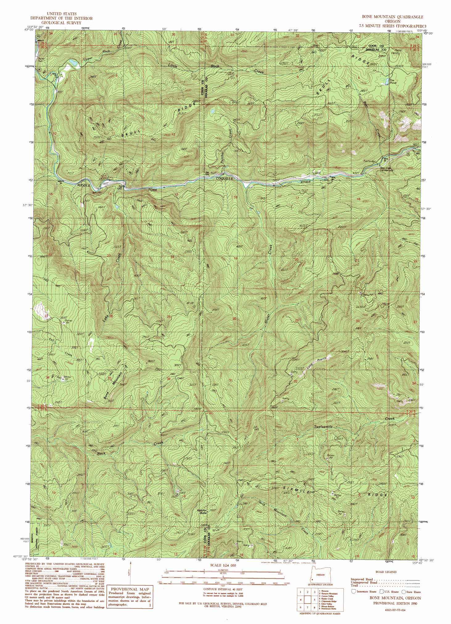
USGS Topo Quad 42123h7 - 1:24,000 scale
| Topo Map Name: | Bone Mountain |
| USGS Topo Quad ID: | 42123h7 |
| Print Size: | ca. 21 1/4" wide x 27" high |
| Southeast Coordinates: | 42.875° N latitude / 123.75° W longitude |
| Map Center Coordinates: | 42.9375° N latitude / 123.8125° W longitude |
| U.S. State: | OR |
| Filename: | o42123h7.jpg |
| Download Map JPG Image: | Bone Mountain topo map 1:24,000 scale |
| Map Type: | Topographic |
| Topo Series: | 7.5´ |
| Map Scale: | 1:24,000 |
| Source of Map Images: | United States Geological Survey (USGS) |
| Alternate Map Versions: |
Bone Mountain OR 1990, updated 1990 Download PDF Buy paper map Bone Mountain OR 1998, updated 2001 Download PDF Buy paper map Bone Mountain OR 2011 Download PDF Buy paper map Bone Mountain OR 2014 Download PDF Buy paper map |
| FStopo: | US Forest Service topo Bone Mountain is available: Download FStopo PDF Download FStopo TIF |
1:24,000 Topo Quads surrounding Bone Mountain
Mckinley |
Dora |
Sitkum |
Mount Gurney |
Reston |
Bridge |
Remote |
Kenyon Mountain |
Camas Valley |
Tenmile |
Powers |
Rasler Creek |
Bone Mountain |
Chipmunk Ridge |
Live Oak Mountain |
China Flat |
Eden Ridge Valley |
Mount Bolivar |
Dutchman Butte |
Rabbit Mountain |
Illahe |
Marial |
Kelsey Peak |
Bunker Creek |
Mount Reuben |
> Back to 42123e1 at 1:100,000 scale
> Back to 42122a1 at 1:250,000 scale
> Back to U.S. Topo Maps home
Bone Mountain topo map: Gazetteer
Bone Mountain: Cliffs
Elbow Point elevation 184m 603′Bone Mountain: Flats
Long Prairie elevation 863m 2831′Bone Mountain: Lakes
Fox Pond elevation 763m 2503′Bone Mountain: Reservoirs
Bone Mountain Pond elevation 204m 669′Cawrses Log Pond elevation 86m 282′
Bone Mountain: Ridges
Sixmile Ridge elevation 879m 2883′Skull Ridge elevation 603m 1978′
Bone Mountain: Streams
Bear Creek elevation 188m 616′Cabin Creek elevation 87m 285′
Hidden Creek elevation 92m 301′
Johnston Creek elevation 632m 2073′
Kleiner Creek elevation 747m 2450′
Lake Creek elevation 140m 459′
Little Rock Creek elevation 125m 410′
North Creek elevation 155m 508′
Panther Creek elevation 141m 462′
Slater Creek elevation 191m 626′
Smith Creek elevation 645m 2116′
Upper Rock Creek elevation 77m 252′
Bone Mountain: Summits
Bone Mountain elevation 1079m 3540′Ketchin Butte elevation 1106m 3628′
Bone Mountain digital topo map on disk
Buy this Bone Mountain topo map showing relief, roads, GPS coordinates and other geographical features, as a high-resolution digital map file on DVD: