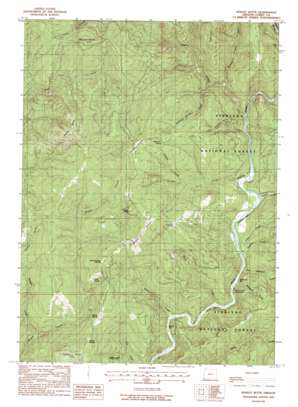
Bosley Butte Topo Map Oregon
To zoom in, hover over the map of Bosley Butte
USGS Topo Quad 42124b2 - 1:24,000 scale
| Topo Map Name: | Bosley Butte |
| USGS Topo Quad ID: | 42124b2 |
| Print Size: | ca. 21 1/4" wide x 27" high |
| Southeast Coordinates: | 42.125° N latitude / 124.125° W longitude |
| Map Center Coordinates: | 42.1875° N latitude / 124.1875° W longitude |
| U.S. State: | OR |
| Filename: | o42124b2.jpg |
| Download Map JPG Image: | Bosley Butte topo map 1:24,000 scale |
| Map Type: | Topographic |
| Topo Series: | 7.5´ |
| Map Scale: | 1:24,000 |
| Source of Map Images: | United States Geological Survey (USGS) |
| Alternate Map Versions: |
Bosley Butte OR 1989, updated 1989 Download PDF Buy paper map Bosley Butte OR 1998, updated 2001 Download PDF Buy paper map Bosley Butte OR 2011 Download PDF Buy paper map Bosley Butte OR 2014 Download PDF Buy paper map |
| FStopo: | US Forest Service topo Bosley Butte is available: Download FStopo PDF Download FStopo TIF |
1:24,000 Topo Quads surrounding Bosley Butte
> Back to 42124a1 at 1:100,000 scale
> Back to 42124a1 at 1:250,000 scale
> Back to U.S. Topo Maps home
Bosley Butte topo map: Gazetteer
Bosley Butte: Bars
Gardner Bar elevation 52m 170′Miller Bar elevation 54m 177′
Bosley Butte: Flats
Horse Prairie elevation 453m 1486′Looking-Glass Prairie elevation 529m 1735′
Northern Prairie elevation 569m 1866′
Stump Prairie elevation 517m 1696′
Wilson Prairie elevation 502m 1646′
Yank Prairie elevation 425m 1394′
Bosley Butte: Ridges
Panda Ridge elevation 396m 1299′Bosley Butte: Springs
Robinson Spring elevation 583m 1912′Bosley Butte: Streams
Big Redwood Creek elevation 40m 131′Eagle Creek elevation 76m 249′
First Creek elevation 78m 255′
Left Redwood Creek elevation 65m 213′
Mineral Hill Fork elevation 136m 446′
Nook Creek elevation 63m 206′
Panther Creek elevation 56m 183′
Prairie Creek elevation 186m 610′
Rainbow Creek elevation 80m 262′
Ransom Creek elevation 103m 337′
Robinson Spring Creek elevation 180m 590′
Second Creek elevation 36m 118′
South Fork Chetco River elevation 42m 137′
Wilson Creek elevation 42m 137′
Bosley Butte: Summits
Bosley Butte elevation 1038m 3405′Buzzard Roost elevation 860m 2821′
Cashner Butte elevation 737m 2417′
Palmer Butte elevation 628m 2060′
Bosley Butte digital topo map on disk
Buy this Bosley Butte topo map showing relief, roads, GPS coordinates and other geographical features, as a high-resolution digital map file on DVD:


