Sundown Mountain Topo Map Oregon
To zoom in, hover over the map of Sundown Mountain
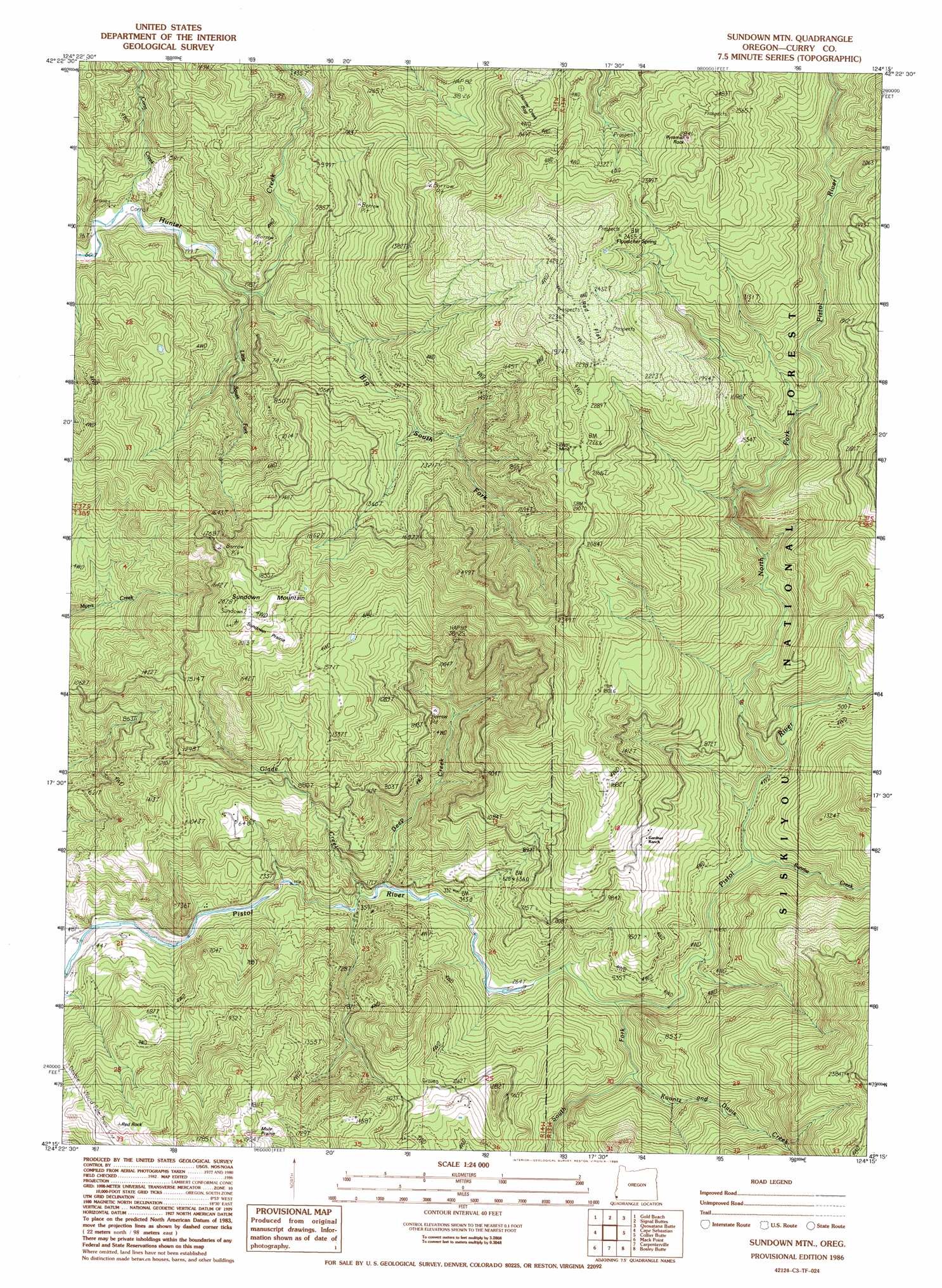
USGS Topo Quad 42124c3 - 1:24,000 scale
| Topo Map Name: | Sundown Mountain |
| USGS Topo Quad ID: | 42124c3 |
| Print Size: | ca. 21 1/4" wide x 27" high |
| Southeast Coordinates: | 42.25° N latitude / 124.25° W longitude |
| Map Center Coordinates: | 42.3125° N latitude / 124.3125° W longitude |
| U.S. State: | OR |
| Filename: | o42124c3.jpg |
| Download Map JPG Image: | Sundown Mountain topo map 1:24,000 scale |
| Map Type: | Topographic |
| Topo Series: | 7.5´ |
| Map Scale: | 1:24,000 |
| Source of Map Images: | United States Geological Survey (USGS) |
| Alternate Map Versions: |
Sundown Mtn OR 1986, updated 1986 Download PDF Buy paper map Sundown Mountain OR 1998, updated 2001 Download PDF Buy paper map Sundown Mountain OR 2011 Download PDF Buy paper map Sundown Mountain OR 2014 Download PDF Buy paper map |
| FStopo: | US Forest Service topo Sundown Mountain is available: Download FStopo PDF Download FStopo TIF |
1:24,000 Topo Quads surrounding Sundown Mountain
Ophir |
Brushy Bald Mountain |
Soldier Camp Mountain |
Agness |
|
Gold Beach |
Signal Buttes |
Quosatana Butte |
Horse Sign Butte |
|
Cape Sebastian |
Sundown Mountain |
Collier Butte |
Big Craggies |
|
Mack Point |
Carpenterville |
Bosley Butte |
Quail Prairie Mountain |
|
Brookings |
Mount Emily |
Fourth Of July Creek |
> Back to 42124a1 at 1:100,000 scale
> Back to 42124a1 at 1:250,000 scale
> Back to U.S. Topo Maps home
Sundown Mountain topo map: Gazetteer
Sundown Mountain: Areas
Mule Prairie elevation 507m 1663′Sundown Prairie elevation 605m 1984′
Sundown Mountain: Flats
Red Flat elevation 686m 2250′Sundown Mountain: Mines
Wests Mine elevation 676m 2217′Sundown Mountain: Pillars
Pyramid Rock elevation 870m 2854′Sundown Mountain: Springs
Flycatcher Spring elevation 761m 2496′Sundown Mountain: Streams
Big South Fork Hunter Creek elevation 75m 246′Conn Creek elevation 41m 134′
Deep Creek elevation 36m 118′
Glade Creek elevation 39m 127′
Koontz and Davis Creek elevation 139m 456′
Little South Fork Hunter Creek elevation 75m 246′
North Fork Pistol River elevation 382m 1253′
Sunrise Creek elevation 91m 298′
Sundown Mountain: Summits
Pine Point elevation 395m 1295′Red Rock elevation 396m 1299′
Sundown Mountain elevation 648m 2125′
Sundown Mountain: Swamps
Hunter Creek Bog elevation 510m 1673′Sundown Mountain: Trails
Hazel Camp Trail elevation 771m 2529′Sundown Mountain digital topo map on disk
Buy this Sundown Mountain topo map showing relief, roads, GPS coordinates and other geographical features, as a high-resolution digital map file on DVD: