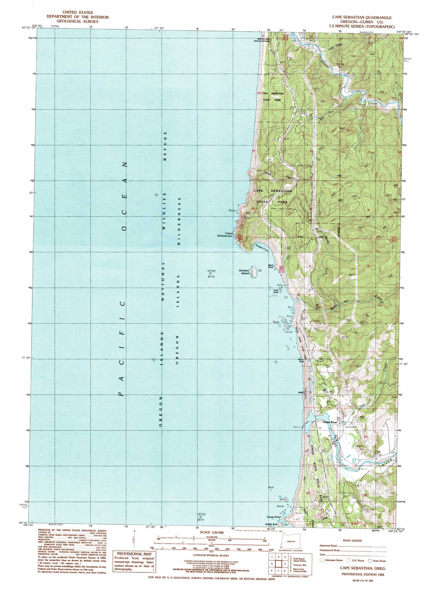
Cape Sebastian Topo Map Oregon
To zoom in, hover over the map of Cape Sebastian
USGS Topo Quad 42124c4 - 1:24,000 scale
| Topo Map Name: | Cape Sebastian |
| USGS Topo Quad ID: | 42124c4 |
| Print Size: | ca. 21 1/4" wide x 27" high |
| Southeast Coordinates: | 42.25° N latitude / 124.375° W longitude |
| Map Center Coordinates: | 42.3125° N latitude / 124.4375° W longitude |
| U.S. State: | OR |
| Filename: | o42124c4.jpg |
| Download Map JPG Image: | Cape Sebastian topo map 1:24,000 scale |
| Map Type: | Topographic |
| Topo Series: | 7.5´ |
| Map Scale: | 1:24,000 |
| Source of Map Images: | United States Geological Survey (USGS) |
| Alternate Map Versions: |
Cape Sebastian OR 1986, updated 1986 Download PDF Buy paper map Cape Sebastian OR 2011 Download PDF Buy paper map Cape Sebastian OR 2014 Download PDF Buy paper map |
| FStopo: | US Forest Service topo Cape Sebastian is available: Download FStopo PDF Download FStopo TIF |
1:24,000 Topo Quads surrounding Cape Sebastian
Ophir |
Brushy Bald Mountain |
Soldier Camp Mountain |
||
Gold Beach |
Signal Buttes |
Quosatana Butte |
||
Cape Sebastian |
Sundown Mountain |
Collier Butte |
||
Mack Point |
Carpenterville |
Bosley Butte |
||
Brookings |
Mount Emily |
> Back to 42124a1 at 1:100,000 scale
> Back to 42124a1 at 1:250,000 scale
> Back to U.S. Topo Maps home
Cape Sebastian topo map: Gazetteer
Cape Sebastian: Arches
Cave Rock Arch elevation 9m 29′Cape Sebastian: Bays
Hunters Cove elevation 0m 0′Cape Sebastian: Capes
Cape Sebastian elevation 13m 42′Crook Point elevation 27m 88′
Cape Sebastian: Islands
Black Rock elevation 0m 0′Cave Rock elevation 9m 29′
Hunters Island elevation 27m 88′
Saddle Rock elevation 18m 59′
Cape Sebastian: Parks
Cape Sebastian State Park elevation 79m 259′Pistol River State Park elevation 4m 13′
Cape Sebastian: Pillars
Henry Rock elevation 0m 0′Cape Sebastian: Populated Places
Pistol River elevation 10m 32′Cape Sebastian: Post Offices
Pistol River Post Office elevation 10m 32′Cape Sebastian: Reservoirs
Evans Log Ponds elevation 8m 26′Pistol River Log Pond elevation 9m 29′
Cape Sebastian: Streams
Crook Creek elevation 2m 6′Crossen Creek elevation 19m 62′
Daniels Creek elevation 0m 0′
Egans Creek elevation 25m 82′
Hidden Creek elevation 45m 147′
McKinley Creek elevation 11m 36′
Myers Creek elevation 6m 19′
North Fork Myers Creek elevation 86m 282′
Pistol River elevation 2m 6′
Sand Creek elevation 18m 59′
Smith Creek elevation 22m 72′
Taylor Creek elevation 16m 52′
Yorke Creek elevation 8m 26′
Cape Sebastian: Valleys
Long Hollow elevation 39m 127′Cape Sebastian digital topo map on disk
Buy this Cape Sebastian topo map showing relief, roads, GPS coordinates and other geographical features, as a high-resolution digital map file on DVD: