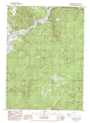
Signal Buttes Topo Map Oregon
To zoom in, hover over the map of Signal Buttes
USGS Topo Quad 42124d3 - 1:24,000 scale
| Topo Map Name: | Signal Buttes |
| USGS Topo Quad ID: | 42124d3 |
| Print Size: | ca. 21 1/4" wide x 27" high |
| Southeast Coordinates: | 42.375° N latitude / 124.25° W longitude |
| Map Center Coordinates: | 42.4375° N latitude / 124.3125° W longitude |
| U.S. State: | OR |
| Filename: | o42124d3.jpg |
| Download Map JPG Image: | Signal Buttes topo map 1:24,000 scale |
| Map Type: | Topographic |
| Topo Series: | 7.5´ |
| Map Scale: | 1:24,000 |
| Source of Map Images: | United States Geological Survey (USGS) |
| Alternate Map Versions: |
Signal Buttes OR 1986, updated 1986 Download PDF Buy paper map Signal Buttes OR 1998, updated 2001 Download PDF Buy paper map Signal Buttes OR 2011 Download PDF Buy paper map Signal Buttes OR 2014 Download PDF Buy paper map |
| FStopo: | US Forest Service topo Signal Buttes is available: Download FStopo PDF Download FStopo TIF |
1:24,000 Topo Quads surrounding Signal Buttes
> Back to 42124a1 at 1:100,000 scale
> Back to 42124a1 at 1:250,000 scale
> Back to U.S. Topo Maps home
Signal Buttes topo map: Gazetteer
Signal Buttes: Areas
Hooter Scooter Prairie elevation 602m 1975′Jacks Prairie elevation 217m 711′
Jackson Prairie elevation 519m 1702′
Johnson Prairie elevation 448m 1469′
Long Prairie elevation 633m 2076′
Wagontire Prairie elevation 673m 2208′
Signal Buttes: Bars
Canfield Bar elevation 13m 42′Coyote Bar elevation 10m 32′
Kimball Bar elevation 15m 49′
Orchard Bar elevation 14m 45′
Signal Buttes: Cliffs
Thoms Point elevation 33m 108′Signal Buttes: Flats
Jeerys Flat elevation 10m 32′Signal Buttes: Lakes
Frog Lake elevation 813m 2667′Frog Lake elevation 437m 1433′
Lake of the Woods elevation 708m 2322′
Signal Buttes: Mines
McKinley Mine elevation 878m 2880′Signal Buttes: Parks
Huntley Park elevation 22m 72′Pine Point Picnic Ground elevation 517m 1696′
Signal Buttes: Populated Places
Bagnell Ferry elevation 9m 29′Signal Buttes: Post Offices
Bagnell Post Office (historical) elevation 9m 29′Ragic Post Office (historical) elevation 21m 68′
Signal Buttes: Rapids
Canfield Riffle elevation 6m 19′Coyote Riffle elevation 5m 16′
Gillespie Riffle elevation 9m 29′
Hawkins Riffle elevation 14m 45′
Jimmy Davis Riffle elevation 10m 32′
Wakeman Riffle elevation 7m 22′
Signal Buttes: Reservoirs
Ferguson Pond elevation 108m 354′Libby Creek Pond elevation 19m 62′
Signal Buttes: Streams
Abe Creek elevation 9m 29′Elko Creek elevation 680m 2230′
Hafner Creek elevation 317m 1040′
Jim Hunt Creek elevation 10m 32′
Kimball Creek elevation 9m 29′
Libby Creek elevation 9m 29′
North Fork Hunter Creek elevation 161m 528′
Papoose Creek elevation 81m 265′
Squaw Creek elevation 4m 13′
Walen Creek elevation 9m 29′
William Creek elevation 20m 65′
William Miller Creek elevation 21m 68′
Signal Buttes: Summits
Canfield Hill elevation 357m 1171′Grizzly Mountain elevation 687m 2253′
Kimball Hill elevation 486m 1594′
Rumley Hill elevation 132m 433′
Signal Buttes elevation 1060m 3477′
Signal Buttes: Valleys
Pedro Gulch elevation 25m 82′Signal Buttes digital topo map on disk
Buy this Signal Buttes topo map showing relief, roads, GPS coordinates and other geographical features, as a high-resolution digital map file on DVD:


