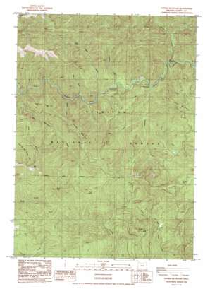
Father Mountain Topo Map Oregon
To zoom in, hover over the map of Father Mountain
USGS Topo Quad 42124f3 - 1:24,000 scale
| Topo Map Name: | Father Mountain |
| USGS Topo Quad ID: | 42124f3 |
| Print Size: | ca. 21 1/4" wide x 27" high |
| Southeast Coordinates: | 42.625° N latitude / 124.25° W longitude |
| Map Center Coordinates: | 42.6875° N latitude / 124.3125° W longitude |
| U.S. State: | OR |
| Filename: | o42124f3.jpg |
| Download Map JPG Image: | Father Mountain topo map 1:24,000 scale |
| Map Type: | Topographic |
| Topo Series: | 7.5´ |
| Map Scale: | 1:24,000 |
| Source of Map Images: | United States Geological Survey (USGS) |
| Alternate Map Versions: |
Father Mountain OR 1986, updated 1986 Download PDF Buy paper map Father Mountain OR 1996, updated 1999 Download PDF Buy paper map Father Mountain OR 2011 Download PDF Buy paper map Father Mountain OR 2014 Download PDF Buy paper map |
| FStopo: | US Forest Service topo Father Mountain is available: Download FStopo PDF Download FStopo TIF |
1:24,000 Topo Quads surrounding Father Mountain
> Back to 42124e1 at 1:100,000 scale
> Back to 42124a1 at 1:250,000 scale
> Back to U.S. Topo Maps home
Father Mountain topo map: Gazetteer
Father Mountain: Mines
Sunshine Mine elevation 185m 606′Father Mountain: Ridges
Oak Ridge elevation 525m 1722′Father Mountain: Springs
Salal Spring elevation 602m 1975′Father Mountain: Streams
Butler Creek elevation 184m 603′East Fork Panther Creek elevation 211m 692′
Lost Creek elevation 189m 620′
Mid Fork Panther Creek elevation 288m 944′
Milbury Creek elevation 364m 1194′
Panther Creek elevation 172m 564′
Platinum Creek elevation 109m 357′
Red Cedar Creek elevation 183m 600′
Stan Creek elevation 250m 820′
State Creek elevation 191m 626′
Sunshine Creek elevation 163m 534′
West Fork Panther Creek elevation 208m 682′
Father Mountain: Summits
Anvil Mountain elevation 714m 2342′Bald Mountain elevation 877m 2877′
Chismore Butte elevation 797m 2614′
Father Mountain elevation 781m 2562′
Milbury Mountain elevation 815m 2673′
Pearse Peak elevation 630m 2066′
Purple Mountain elevation 654m 2145′
Rocky Peak elevation 860m 2821′
Father Mountain: Wells
Mountain Well elevation 816m 2677′Father Mountain digital topo map on disk
Buy this Father Mountain topo map showing relief, roads, GPS coordinates and other geographical features, as a high-resolution digital map file on DVD:


