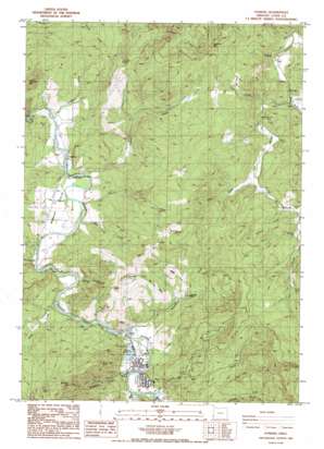
Powers Topo Map Oregon
To zoom in, hover over the map of Powers
USGS Topo Quad 42124h1 - 1:24,000 scale
| Topo Map Name: | Powers |
| USGS Topo Quad ID: | 42124h1 |
| Print Size: | ca. 21 1/4" wide x 27" high |
| Southeast Coordinates: | 42.875° N latitude / 124° W longitude |
| Map Center Coordinates: | 42.9375° N latitude / 124.0625° W longitude |
| U.S. State: | OR |
| Filename: | o42124h1.jpg |
| Download Map JPG Image: | Powers topo map 1:24,000 scale |
| Map Type: | Topographic |
| Topo Series: | 7.5´ |
| Map Scale: | 1:24,000 |
| Source of Map Images: | United States Geological Survey (USGS) |
| Alternate Map Versions: |
Powers OR 1986, updated 1986 Download PDF Buy paper map Powers OR 1998, updated 2001 Download PDF Buy paper map Powers OR 2011 Download PDF Buy paper map Powers OR 2014 Download PDF Buy paper map |
| FStopo: | US Forest Service topo Powers is available: Download FStopo PDF Download FStopo TIF |
1:24,000 Topo Quads surrounding Powers
> Back to 42124e1 at 1:100,000 scale
> Back to 42124a1 at 1:250,000 scale
> Back to U.S. Topo Maps home
Powers topo map: Gazetteer
Powers: Areas
Rowland Prairie elevation 57m 187′Taft Prairie elevation 283m 928′
Wilson Prairie elevation 287m 941′
Powers: Dams
Coos Bay Timber Company Dam elevation 86m 282′Powers: Parks
Bicentennial Park elevation 91m 298′Coquille Myrtle Grove State Park elevation 60m 196′
King Street Park elevation 84m 275′
Powers County Park elevation 95m 311′
Powers: Populated Places
Bancroft elevation 117m 383′Etelka (historical) elevation 41m 134′
Gaylord elevation 26m 85′
Powers elevation 83m 272′
Powers: Post Offices
Bancroft Post Office (historical) elevation 117m 383′Etelka Post Office (historical) elevation 41m 134′
Gaylord Post Office (historical) elevation 26m 85′
Powers Post Office elevation 83m 272′
Powers: Reservoirs
Powers Pond elevation 86m 282′Powers: Ridges
Ben Grant Ridge elevation 270m 885′Powers: Streams
Baker Creek elevation 46m 150′Beaver Creek elevation 32m 104′
Bingham Creek elevation 72m 236′
China Creek elevation 62m 203′
Coal Creek elevation 72m 236′
Cole Creek elevation 121m 396′
Grants Creek elevation 26m 85′
Hooker Creek elevation 111m 364′
Long Tom Creek elevation 32m 104′
Mill Creek elevation 88m 288′
Morris Creek elevation 90m 295′
Mystic Creek elevation 115m 377′
Rock Creek elevation 61m 200′
Rowland Creek elevation 40m 131′
Salmon Creek elevation 72m 236′
Snow Creek elevation 146m 479′
Whisky Creek elevation 64m 209′
Woodward Creek elevation 62m 203′
Yellow Creek elevation 25m 82′
Powers: Summits
Bingham Mountain elevation 683m 2240′Hood Mountain elevation 494m 1620′
Pyramid Rock elevation 469m 1538′
Samison Mountain elevation 428m 1404′
Suicide Rock elevation 197m 646′
Whoorey Mountain elevation 408m 1338′
Powers digital topo map on disk
Buy this Powers topo map showing relief, roads, GPS coordinates and other geographical features, as a high-resolution digital map file on DVD:


