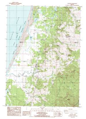
Langlois Topo Map Oregon
To zoom in, hover over the map of Langlois
USGS Topo Quad 42124h4 - 1:24,000 scale
| Topo Map Name: | Langlois |
| USGS Topo Quad ID: | 42124h4 |
| Print Size: | ca. 21 1/4" wide x 27" high |
| Southeast Coordinates: | 42.875° N latitude / 124.375° W longitude |
| Map Center Coordinates: | 42.9375° N latitude / 124.4375° W longitude |
| U.S. State: | OR |
| Filename: | o42124h4.jpg |
| Download Map JPG Image: | Langlois topo map 1:24,000 scale |
| Map Type: | Topographic |
| Topo Series: | 7.5´ |
| Map Scale: | 1:24,000 |
| Source of Map Images: | United States Geological Survey (USGS) |
| Alternate Map Versions: |
Langlois OR 1986, updated 1986 Download PDF Buy paper map Langlois OR 1996, updated 1999 Download PDF Buy paper map Langlois OR 2011 Download PDF Buy paper map Langlois OR 2014 Download PDF Buy paper map |
| FStopo: | US Forest Service topo Langlois is available: Download FStopo PDF Download FStopo TIF |
1:24,000 Topo Quads surrounding Langlois
> Back to 42124e1 at 1:100,000 scale
> Back to 42124a1 at 1:250,000 scale
> Back to U.S. Topo Maps home
Langlois topo map: Gazetteer
Langlois: Bridges
Russell Bridge elevation 23m 75′Langlois: Lakes
Croft Lake elevation 4m 13′Muddy Lake elevation 6m 19′
New Lake elevation 3m 9′
Langlois: Populated Places
Denmark elevation 27m 88′Lakeport (historical) elevation 7m 22′
Langlois elevation 25m 82′
Langlois: Post Offices
Denmark Post Office (historical) elevation 27m 88′Lakeport Post Office (historical) elevation 7m 22′
Langlois Post Office elevation 25m 82′
Langlois: Streams
Bethel Creek elevation 2m 6′Boulder Creek elevation 3m 9′
Butte Creek elevation 5m 16′
Clear Creek elevation 54m 177′
Conner Creek elevation 6m 19′
Davis Creek elevation 4m 13′
Floras Creek elevation 4m 13′
Jenny Creek elevation 37m 121′
Jim Creek elevation 7m 22′
Joe Cox Creek elevation 23m 75′
Johnson Creek elevation 26m 85′
Langlois Creek elevation 3m 9′
Mill Creek elevation 5m 16′
Morton Creek elevation 3m 9′
South Fork Fourmile Creek elevation 24m 78′
Willow Creek elevation 7m 22′
Langlois: Summits
Morton Butte elevation 159m 521′Round Top elevation 333m 1092′
White Mountain elevation 667m 2188′
Langlois digital topo map on disk
Buy this Langlois topo map showing relief, roads, GPS coordinates and other geographical features, as a high-resolution digital map file on DVD:


