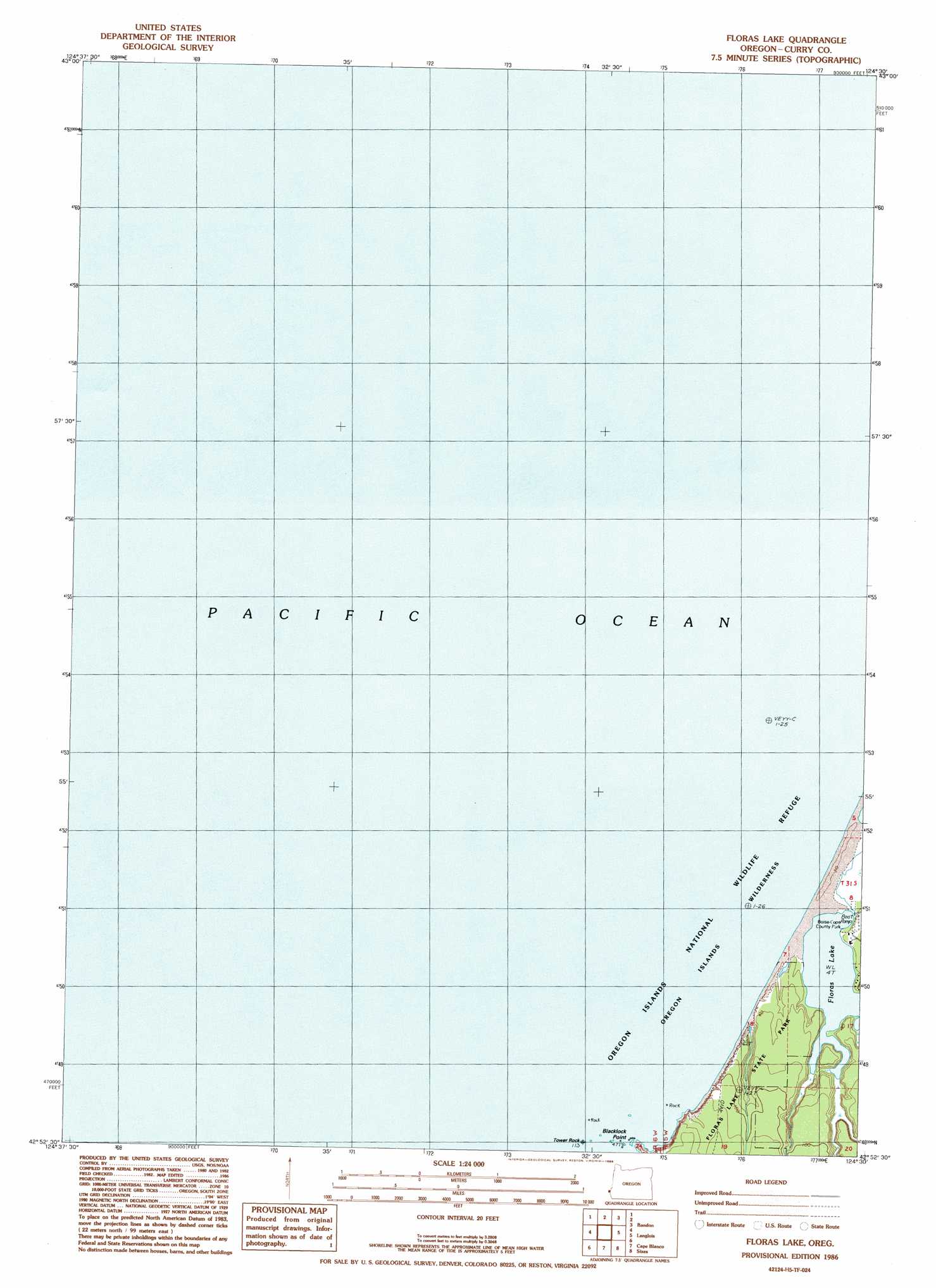
Floras Lake Topo Map Oregon
To zoom in, hover over the map of Floras Lake
USGS Topo Quad 42124h5 - 1:24,000 scale
| Topo Map Name: | Floras Lake |
| USGS Topo Quad ID: | 42124h5 |
| Print Size: | ca. 21 1/4" wide x 27" high |
| Southeast Coordinates: | 42.875° N latitude / 124.5° W longitude |
| Map Center Coordinates: | 42.9375° N latitude / 124.5625° W longitude |
| U.S. State: | OR |
| Filename: | o42124h5.jpg |
| Download Map JPG Image: | Floras Lake topo map 1:24,000 scale |
| Map Type: | Topographic |
| Topo Series: | 7.5´ |
| Map Scale: | 1:24,000 |
| Source of Map Images: | United States Geological Survey (USGS) |
| Alternate Map Versions: |
Floras Lake OR 1986, updated 1986 Download PDF Buy paper map Floras Lake OR 1996, updated 1999 Download PDF Buy paper map Floras Lake OR 2011 Download PDF Buy paper map Floras Lake OR 2014 Download PDF Buy paper map |
| FStopo: | US Forest Service topo Floras Lake is available: Download FStopo PDF Download FStopo TIF |
1:24,000 Topo Quads surrounding Floras Lake
Bullards |
Riverton |
|||
Bandon |
Bill Peak |
Floras Lake |
||
Langlois |
Calf Ranch Mountain |
Cape Blanco |
Sixes |
|
Mount Butler |
Port Orford |
Father Mountain |
> Back to 42124e1 at 1:100,000 scale
> Back to 42124a1 at 1:250,000 scale
> Back to U.S. Topo Maps home
Floras Lake topo map: Gazetteer
Floras Lake: Capes
Blacklock Point elevation 0m 0′Floras Lake: Islands
Tower Rock elevation 0m 0′Floras Lake: Lakes
Floras Lake elevation 2m 6′Floras Lake: Post Offices
Sandstone Post Office (historical) elevation 24m 78′Floras Lake digital topo map on disk
Buy this Floras Lake topo map showing relief, roads, GPS coordinates and other geographical features, as a high-resolution digital map file on DVD: