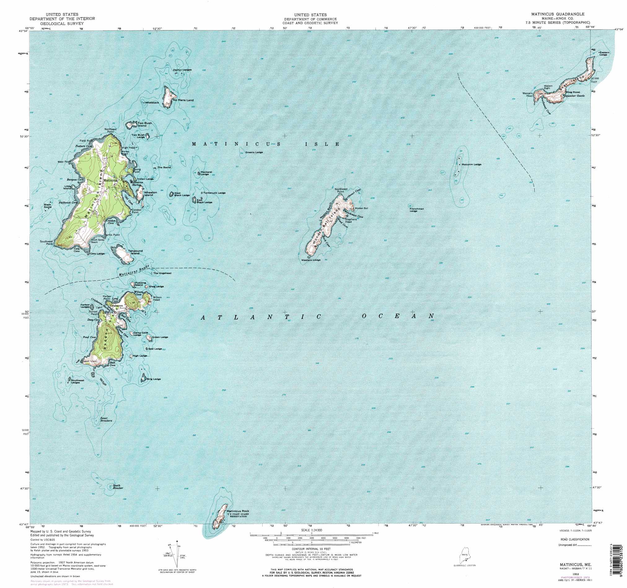
Matinicus Topo Map Maine
To zoom in, hover over the map of Matinicus
USGS Topo Quad 43068g6 - 1:24,000 scale
| Topo Map Name: | Matinicus |
| USGS Topo Quad ID: | 43068g6 |
| Print Size: | ca. 21 1/4" wide x 27" high |
| Southeast Coordinates: | 43.75° N latitude / 68.625° W longitude |
| Map Center Coordinates: | 43.8125° N latitude / 68.6875° W longitude |
| U.S. State: | ME |
| Filename: | o43068g6.jpg |
| Download Map JPG Image: | Matinicus topo map 1:24,000 scale |
| Map Type: | Topographic |
| Topo Series: | 7.5´ |
| Map Scale: | 1:24,000 |
| Source of Map Images: | United States Geological Survey (USGS) |
| Alternate Map Versions: |
Matinicus OE E ME 2014 Download PDF Buy paper map |
1:24,000 Topo Quads surrounding Matinicus
Leadbetter Island |
Vinalhaven |
Isle Au Haut West |
Isle Au Haut East |
Johns Island |
Matinicus |
||||
> Back to 43068e1 at 1:100,000 scale
> Back to 43068a1 at 1:250,000 scale
> Back to U.S. Topo Maps home
No gazetteer data is available for the Matinicus topo map sheet.
Matinicus digital topo map on disk
Buy this Matinicus topo map showing relief, roads, GPS coordinates and other geographical features, as a high-resolution digital map file on DVD:
Maine, New Hampshire, Rhode Island & Eastern Massachusetts
Buy digital topo maps: Maine, New Hampshire, Rhode Island & Eastern Massachusetts