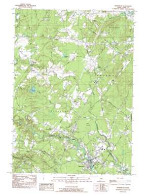
Kennebunk Topo Map Maine
To zoom in, hover over the map of Kennebunk
USGS Topo Quad 43070d5 - 1:24,000 scale
| Topo Map Name: | Kennebunk |
| USGS Topo Quad ID: | 43070d5 |
| Print Size: | ca. 21 1/4" wide x 27" high |
| Southeast Coordinates: | 43.375° N latitude / 70.5° W longitude |
| Map Center Coordinates: | 43.4375° N latitude / 70.5625° W longitude |
| U.S. State: | ME |
| Filename: | o43070d5.jpg |
| Download Map JPG Image: | Kennebunk topo map 1:24,000 scale |
| Map Type: | Topographic |
| Topo Series: | 7.5´ |
| Map Scale: | 1:24,000 |
| Source of Map Images: | United States Geological Survey (USGS) |
| Alternate Map Versions: |
Kennebunk ME 1983, updated 1984 Download PDF Buy paper map Kennebunk ME 1983, updated 1988 Download PDF Buy paper map Kennebunk ME 2011 Download PDF Buy paper map Kennebunk ME 2014 Download PDF Buy paper map |
1:24,000 Topo Quads surrounding Kennebunk
> Back to 43070a1 at 1:100,000 scale
> Back to 43070a1 at 1:250,000 scale
> Back to U.S. Topo Maps home
Kennebunk topo map: Gazetteer
Kennebunk: Bridges
Bartletts Bridge elevation 10m 32′Durrell Bridge elevation 1m 3′
Kennebunk: Crossings
Interchange 3 elevation 35m 114′Kennebunk: Lakes
Alewife Pond elevation 41m 134′Brimstone Pond elevation 30m 98′
Davis Pond elevation 30m 98′
Kennebunk: Parks
Kennebunk Historic District elevation 21m 68′Lafayette Park elevation 18m 59′
Parsons Field elevation 17m 55′
Rogers Park elevation 0m 0′
Rotary Park elevation 8m 26′
Kennebunk: Populated Places
Alewife elevation 55m 180′Bartlett Mills elevation 26m 85′
Days Mill elevation 48m 157′
Kennebunk elevation 22m 72′
Kennebunk Landing elevation 9m 29′
West Kennebunk elevation 43m 141′
Kennebunk: Post Offices
Kennebunk Post Office elevation 17m 55′Kennebunk: Reservoirs
Wiggins Pond elevation 21m 68′Kennebunk: Streams
Carlisle Brook elevation 44m 144′Day Brook elevation 13m 42′
Duck Brook elevation 20m 65′
East Outlet elevation 72m 236′
Sucker Brook elevation 51m 167′
Swan Pond Creek elevation 26m 85′
Ward Brook elevation 18m 59′
Kennebunk: Swamps
Punky Swamp elevation 22m 72′Kennebunk digital topo map on disk
Buy this Kennebunk topo map showing relief, roads, GPS coordinates and other geographical features, as a high-resolution digital map file on DVD:
Maine, New Hampshire, Rhode Island & Eastern Massachusetts
Buy digital topo maps: Maine, New Hampshire, Rhode Island & Eastern Massachusetts


