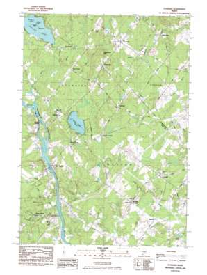
Standish Topo Map Maine
To zoom in, hover over the map of Standish
USGS Topo Quad 43070f5 - 1:24,000 scale
| Topo Map Name: | Standish |
| USGS Topo Quad ID: | 43070f5 |
| Print Size: | ca. 21 1/4" wide x 27" high |
| Southeast Coordinates: | 43.625° N latitude / 70.5° W longitude |
| Map Center Coordinates: | 43.6875° N latitude / 70.5625° W longitude |
| U.S. State: | ME |
| Filename: | o43070f5.jpg |
| Download Map JPG Image: | Standish topo map 1:24,000 scale |
| Map Type: | Topographic |
| Topo Series: | 7.5´ |
| Map Scale: | 1:24,000 |
| Source of Map Images: | United States Geological Survey (USGS) |
| Alternate Map Versions: |
Standish ME 1983, updated 1984 Download PDF Buy paper map Standish ME 2011 Download PDF Buy paper map Standish ME 2014 Download PDF Buy paper map |
1:24,000 Topo Quads surrounding Standish
> Back to 43070e1 at 1:100,000 scale
> Back to 43070a1 at 1:250,000 scale
> Back to U.S. Topo Maps home
Standish topo map: Gazetteer
Standish: Airports
Douglass Seaplane Base elevation 84m 275′Standish: Dams
Bonney Eagle Dam elevation 57m 187′West Buxton Dam elevation 51m 167′
Standish: Islands
Big Island elevation 84m 275′Blueberry Island elevation 84m 275′
Middle Island elevation 84m 275′
Treasure Island elevation 84m 275′
Standish: Lakes
Bonny Eagle Pond elevation 79m 259′Duck Pond elevation 52m 170′
Standish: Populated Places
Bonny Eagle elevation 83m 272′Buxton elevation 56m 183′
Buxton Center elevation 62m 203′
Chicopee elevation 96m 314′
Dow Corner elevation 100m 328′
Elmwood elevation 143m 469′
Groveville elevation 78m 255′
Kimbles Corner elevation 87m 285′
Shaw Mills elevation 78m 255′
Standish elevation 131m 429′
Two Trails elevation 90m 295′
Tylers Corner elevation 53m 173′
West Buxton elevation 52m 170′
Standish: Reservoirs
Saco River Reservoir elevation 64m 209′Saco River Reservoir elevation 51m 167′
Standish: Streams
Josies Brook elevation 65m 213′Junkins Brook elevation 48m 157′
Smith Brook elevation 48m 157′
Standish: Summits
Breakheart Hill elevation 144m 472′Oak Hill elevation 150m 492′
Standish digital topo map on disk
Buy this Standish topo map showing relief, roads, GPS coordinates and other geographical features, as a high-resolution digital map file on DVD:
Maine, New Hampshire, Rhode Island & Eastern Massachusetts
Buy digital topo maps: Maine, New Hampshire, Rhode Island & Eastern Massachusetts


