Epping Topo Map New Hampshire
To zoom in, hover over the map of Epping
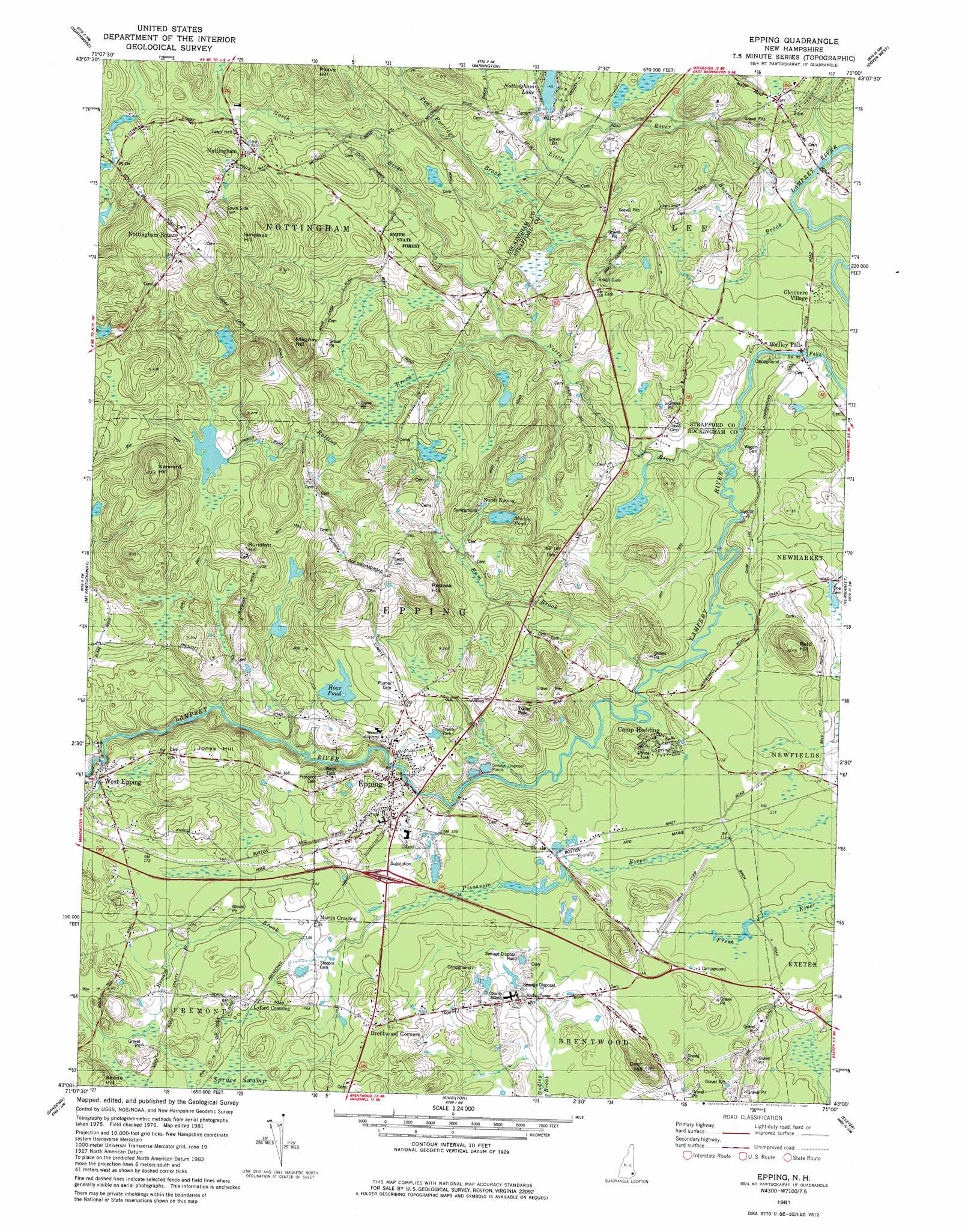
USGS Topo Quad 43071a1 - 1:24,000 scale
| Topo Map Name: | Epping |
| USGS Topo Quad ID: | 43071a1 |
| Print Size: | ca. 21 1/4" wide x 27" high |
| Southeast Coordinates: | 43° N latitude / 71° W longitude |
| Map Center Coordinates: | 43.0625° N latitude / 71.0625° W longitude |
| U.S. State: | NH |
| Filename: | o43071a1.jpg |
| Download Map JPG Image: | Epping topo map 1:24,000 scale |
| Map Type: | Topographic |
| Topo Series: | 7.5´ |
| Map Scale: | 1:24,000 |
| Source of Map Images: | United States Geological Survey (USGS) |
| Alternate Map Versions: |
Epping NH 1981, updated 1981 Download PDF Buy paper map Epping NH 1995, updated 1999 Download PDF Buy paper map Epping NH 2012 Download PDF Buy paper map Epping NH 2015 Download PDF Buy paper map |
1:24,000 Topo Quads surrounding Epping
Pittsfield |
Parker Mountain |
Baxter Lake |
Rochester |
Somersworth |
Gossville |
Northwood |
Barrington |
Dover West |
Dover East |
Candia |
Mount Pawtuckaway |
Epping |
Newmarket |
Portsmouth |
Derry |
Sandown |
Kingston |
Hampton |
|
Windham |
Haverhill |
Newburyport East |
> Back to 43071a1 at 1:100,000 scale
> Back to 43070a1 at 1:250,000 scale
> Back to U.S. Topo Maps home
Epping topo map: Gazetteer
Epping: Dams
Marston Pond Dam elevation 47m 154′Epping: Forests
Smith State Forest elevation 58m 190′Epping: Lakes
Muddy Pond elevation 46m 150′Epping: Parks
Star Speedway elevation 37m 121′Epping: Populated Places
Brentwood Corners elevation 50m 164′Camp Hedding elevation 45m 147′
Epping elevation 48m 157′
Glenmere Village elevation 28m 91′
Lee elevation 58m 190′
Lyford Crossing elevation 52m 170′
Martin Crossing elevation 45m 147′
North Epping elevation 60m 196′
Nottingham elevation 78m 255′
Nottingham Square elevation 148m 485′
South Lee elevation 51m 167′
Wadley Falls elevation 28m 91′
West Epping elevation 46m 150′
Epping: Post Offices
Epping Post Office elevation 46m 150′Epping: Reservoirs
Hoar Pond elevation 60m 196′Nottingham Lake elevation 47m 154′
Epping: Streams
Brown Brook elevation 40m 131′Little River elevation 23m 75′
North River elevation 26m 85′
Rollins Brook elevation 32m 104′
Epping: Summits
Bald Hill elevation 83m 272′Deer Hill elevation 66m 216′
Isinglass Hill elevation 136m 446′
Jones Hill elevation 82m 269′
Kennard Hill elevation 128m 419′
Magney Hill elevation 108m 354′
Redoak Hill elevation 120m 393′
Rundlett Hill elevation 95m 311′
Epping: Swamps
Spruce Swamp elevation 51m 167′Epping digital topo map on disk
Buy this Epping topo map showing relief, roads, GPS coordinates and other geographical features, as a high-resolution digital map file on DVD:
Maine, New Hampshire, Rhode Island & Eastern Massachusetts
Buy digital topo maps: Maine, New Hampshire, Rhode Island & Eastern Massachusetts