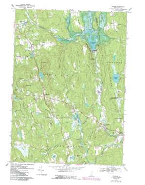
Weare Topo Map New Hampshire
To zoom in, hover over the map of Weare
USGS Topo Quad 43071a6 - 1:24,000 scale
| Topo Map Name: | Weare |
| USGS Topo Quad ID: | 43071a6 |
| Print Size: | ca. 21 1/4" wide x 27" high |
| Southeast Coordinates: | 43° N latitude / 71.625° W longitude |
| Map Center Coordinates: | 43.0625° N latitude / 71.6875° W longitude |
| U.S. State: | NH |
| Filename: | o43071a6.jpg |
| Download Map JPG Image: | Weare topo map 1:24,000 scale |
| Map Type: | Topographic |
| Topo Series: | 7.5´ |
| Map Scale: | 1:24,000 |
| Source of Map Images: | United States Geological Survey (USGS) |
| Alternate Map Versions: |
Weare NH 1967, updated 1971 Download PDF Buy paper map Weare NH 1967, updated 1985 Download PDF Buy paper map Weare NH 1967, updated 1987 Download PDF Buy paper map Weare NH 1995, updated 1999 Download PDF Buy paper map Weare NH 2012 Download PDF Buy paper map Weare NH 2015 Download PDF Buy paper map |
1:24,000 Topo Quads surrounding Weare
> Back to 43071a1 at 1:100,000 scale
> Back to 43070a1 at 1:250,000 scale
> Back to U.S. Topo Maps home
Weare topo map: Gazetteer
Weare: Airports
Lee Field elevation 91m 298′Weare: Cliffs
Raymond Cliff elevation 175m 574′Weare: Dams
Daniels Lake Dam elevation 116m 380′Everett Dam elevation 127m 416′
Gregg Mill Pond Dam elevation 114m 374′
Perkins Pond Dam elevation 214m 702′
Weare: Forests
Clough State Forest elevation 150m 492′Weare: Lakes
Beard Pond elevation 145m 475′Duck Pond elevation 193m 633′
Gorham Pond elevation 133m 436′
Mount William Pond elevation 253m 830′
Still Pond elevation 181m 593′
Weare: Parks
Clough State Park elevation 134m 439′Stark Pond Wildlife Management Area elevation 114m 374′
Weare: Populated Places
East Weare (historical) elevation 151m 495′Everett (historical) elevation 97m 318′
Fessenden (historical) elevation 133m 436′
North Weare elevation 158m 518′
Parker elevation 97m 318′
Riverdale elevation 93m 305′
Sargent (historical) elevation 101m 331′
South Weare elevation 191m 626′
Tavern Village elevation 142m 465′
Weare elevation 194m 636′
Weare: Reservoirs
Daniels Lake elevation 116m 380′Everett Lake elevation 127m 416′
Gregg Mill Pond elevation 114m 374′
Perkins Pond elevation 214m 702′
Weare: Streams
Barnard Brook elevation 113m 370′Breed Brook elevation 171m 561′
Buxton Brook elevation 154m 505′
Center Brook elevation 144m 472′
Choate Brook elevation 113m 370′
Currier Brook elevation 181m 593′
Gorham Brook elevation 91m 298′
Hillside Brook elevation 137m 449′
Huse Brook elevation 93m 305′
Meadow Brook elevation 116m 380′
Middle Branch Piscataquog River elevation 104m 341′
Otter Brook elevation 116m 380′
Peacock Brook elevation 126m 413′
Peaslee Meadow Brook elevation 114m 374′
Stark Brook elevation 113m 370′
Trout Brook elevation 118m 387′
Weare: Summits
Barnard Hill elevation 253m 830′Browns Hill elevation 193m 633′
Gove Hill elevation 287m 941′
Green Hill elevation 263m 862′
Griffin Hill elevation 209m 685′
Kuncanowet Hills elevation 165m 541′
Mine Hill elevation 354m 1161′
Mount Dearborn elevation 363m 1190′
Mount Wallingford elevation 364m 1194′
Mount William elevation 334m 1095′
Oak Hill elevation 192m 629′
Odiorne Hill elevation 310m 1017′
Weare: Swamps
Perkins Pond Marsh elevation 198m 649′Weare digital topo map on disk
Buy this Weare topo map showing relief, roads, GPS coordinates and other geographical features, as a high-resolution digital map file on DVD:
Maine, New Hampshire, Rhode Island & Eastern Massachusetts
Buy digital topo maps: Maine, New Hampshire, Rhode Island & Eastern Massachusetts


