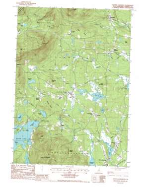
Center Sandwich Topo Map New Hampshire
To zoom in, hover over the map of Center Sandwich
USGS Topo Quad 43071g4 - 1:24,000 scale
| Topo Map Name: | Center Sandwich |
| USGS Topo Quad ID: | 43071g4 |
| Print Size: | ca. 21 1/4" wide x 27" high |
| Southeast Coordinates: | 43.75° N latitude / 71.375° W longitude |
| Map Center Coordinates: | 43.8125° N latitude / 71.4375° W longitude |
| U.S. State: | NH |
| Filename: | o43071g4.jpg |
| Download Map JPG Image: | Center Sandwich topo map 1:24,000 scale |
| Map Type: | Topographic |
| Topo Series: | 7.5´ |
| Map Scale: | 1:24,000 |
| Source of Map Images: | United States Geological Survey (USGS) |
| Alternate Map Versions: |
Center Sandwich NH 1987 Download PDF Buy paper map Center Sandwich NH 1987, updated 1987 Download PDF Buy paper map Center Sandwich NH 1995, updated 2000 Download PDF Buy paper map Center Sandwich NH 2012 Download PDF Buy paper map Center Sandwich NH 2015 Download PDF Buy paper map |
| FStopo: | US Forest Service topo Center Sandwich is available: Download FStopo PDF Download FStopo TIF |
1:24,000 Topo Quads surrounding Center Sandwich
> Back to 43071e1 at 1:100,000 scale
> Back to 43070a1 at 1:250,000 scale
> Back to U.S. Topo Maps home
Center Sandwich topo map: Gazetteer
Center Sandwich: Airports
Moultonboro Airport elevation 176m 577′Center Sandwich: Bays
Hale Cove elevation 171m 561′Otter Cove elevation 171m 561′
Sandwich Bay elevation 171m 561′
Center Sandwich: Benches
Bragg Ledge elevation 205m 672′Watson Ledge elevation 355m 1164′
Center Sandwich: Capes
Browns Point elevation 171m 561′Fore Point elevation 171m 561′
Center Sandwich: Cliffs
Eagle Cliff elevation 420m 1377′Center Sandwich: Falls
Beede Falls elevation 354m 1161′Center Sandwich: Islands
Kent Island elevation 179m 587′Center Sandwich: Lakes
Barville Pond elevation 180m 590′Berry Pond elevation 172m 564′
Braga Pond elevation 184m 603′
Dinsmore Pond elevation 249m 816′
Garland Pond elevation 161m 528′
Guinea Pond elevation 439m 1440′
Kusumpe Pond elevation 204m 669′
Little Pond elevation 199m 652′
Red Hill Pond elevation 192m 629′
Teacup Lake elevation 298m 977′
Center Sandwich: Parks
Center Sandwich Historic District elevation 202m 662′Lower Corner Historic District elevation 241m 790′
Thompson Sanctuary elevation 181m 593′
Center Sandwich: Populated Places
Big Rock Corner elevation 209m 685′Center Sandwich elevation 202m 662′
Chicks Corner elevation 237m 777′
Moultonborough elevation 186m 610′
North Sandwich elevation 208m 682′
Sandwich elevation 241m 790′
Sandwich Landing elevation 173m 567′
Wentworth Hill elevation 253m 830′
Whiteface elevation 213m 698′
Center Sandwich: Post Offices
Center Sandwich Post Office elevation 198m 649′North Sandwich Post Office elevation 210m 688′
Sandwich Post Office elevation 243m 797′
Center Sandwich: Ridges
Buzzell Ridge elevation 266m 872′Maple Ridge elevation 350m 1148′
Center Sandwich: Streams
Burrows Brook elevation 180m 590′Cook Brook elevation 182m 597′
Heath Brook elevation 181m 593′
Montgomery Brook elevation 183m 600′
Pond Brook elevation 216m 708′
Skinner Brook elevation 169m 554′
Stanton Brook elevation 192m 629′
Tilton Brook elevation 216m 708′
Weed Brook elevation 163m 534′
Whiteface River elevation 208m 682′
Center Sandwich: Summits
Burley Hill elevation 253m 830′Diamond Ledge elevation 353m 1158′
Dinsmore Mountain elevation 687m 2253′
Guinea Hill elevation 538m 1765′
Mount Israel elevation 800m 2624′
Red Hill elevation 612m 2007′
Top of the World elevation 252m 826′
Center Sandwich: Trails
Black Mountain Pond Trail elevation 445m 1459′Guinea Pond Trail elevation 445m 1459′
Mead Trail elevation 572m 1876′
Wentworth Trail elevation 492m 1614′
Center Sandwich digital topo map on disk
Buy this Center Sandwich topo map showing relief, roads, GPS coordinates and other geographical features, as a high-resolution digital map file on DVD:
Maine, New Hampshire, Rhode Island & Eastern Massachusetts
Buy digital topo maps: Maine, New Hampshire, Rhode Island & Eastern Massachusetts


