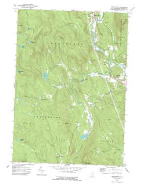
Wentworth Topo Map New Hampshire
To zoom in, hover over the map of Wentworth
USGS Topo Quad 43071g8 - 1:24,000 scale
| Topo Map Name: | Wentworth |
| USGS Topo Quad ID: | 43071g8 |
| Print Size: | ca. 21 1/4" wide x 27" high |
| Southeast Coordinates: | 43.75° N latitude / 71.875° W longitude |
| Map Center Coordinates: | 43.8125° N latitude / 71.9375° W longitude |
| U.S. State: | NH |
| Filename: | o43071g8.jpg |
| Download Map JPG Image: | Wentworth topo map 1:24,000 scale |
| Map Type: | Topographic |
| Topo Series: | 7.5´ |
| Map Scale: | 1:24,000 |
| Source of Map Images: | United States Geological Survey (USGS) |
| Alternate Map Versions: |
Wentworth NH 1974, updated 1975 Download PDF Buy paper map Wentworth NH 1974, updated 1984 Download PDF Buy paper map Wentworth NH 1974, updated 1989 Download PDF Buy paper map Wentworth NH 1995, updated 2000 Download PDF Buy paper map Wentworth NH 2012 Download PDF Buy paper map Wentworth NH 2015 Download PDF Buy paper map |
| FStopo: | US Forest Service topo Wentworth is available: Download FStopo PDF Download FStopo TIF |
1:24,000 Topo Quads surrounding Wentworth
> Back to 43071e1 at 1:100,000 scale
> Back to 43070a1 at 1:250,000 scale
> Back to U.S. Topo Maps home
Wentworth topo map: Gazetteer
Wentworth: Dams
Baker Floodwater Reservoir Site 11 Dam elevation 206m 675′Baker Floodwater Reservoir Site 11a Dam elevation 206m 675′
Baker Floodwater Reservoir Site 6A Dam elevation 282m 925′
Baker Floodwater Reservoir Site 8 Dam elevation 318m 1043′
Wentworth: Lakes
Brackett Pond elevation 638m 2093′Line Pond elevation 362m 1187′
Little Rocky Pond elevation 570m 1870′
McCutcheon Pond elevation 603m 1978′
Mudgetts Pond elevation 521m 1709′
Rocky Pond elevation 612m 2007′
Wentworth: Parks
Dorchester Common Historic District elevation 413m 1354′Wentworth: Populated Places
Cheever elevation 293m 961′Dorchester elevation 421m 1381′
North Dorchester elevation 400m 1312′
Wentworth elevation 188m 616′
Wentworth: Post Offices
West Rumney Post Office (historical) elevation 189m 620′Wentworth: Reservoirs
Baker Floodwater Reservoir Site elevation 206m 675′Baker Floodwater Reservoir Site elevation 206m 675′
South Branch Baker River Reservoir elevation 318m 1043′
Wentworth: Ridges
Ellsworth Hill elevation 315m 1033′Norris Hill elevation 611m 2004′
Wentworth: Streams
Atwell Brook elevation 186m 610′Clifford Brook elevation 182m 597′
Pond Brook elevation 179m 587′
Rocky Brook elevation 279m 915′
South Branch Baker River elevation 164m 538′
Stevens Brook elevation 163m 534′
Tural Brook elevation 385m 1263′
Wentworth: Summits
Ames Mountain elevation 628m 2060′Bailey Hill elevation 548m 1797′
Black Hill elevation 793m 2601′
Prospect Hill elevation 280m 918′
Streeter Mountain elevation 580m 1902′
Wentworth digital topo map on disk
Buy this Wentworth topo map showing relief, roads, GPS coordinates and other geographical features, as a high-resolution digital map file on DVD:
Maine, New Hampshire, Rhode Island & Eastern Massachusetts
Buy digital topo maps: Maine, New Hampshire, Rhode Island & Eastern Massachusetts


