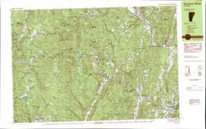
Saxtons River Topo Map Vermont
To zoom in, hover over the map of Saxtons River
USGS Topo Quad 43072b5 - 1:25,000 scale
| Topo Map Name: | Saxtons River |
| USGS Topo Quad ID: | 43072b5 |
| Print Size: | ca. 39" wide x 24" high |
| Southeast Coordinates: | 43.125° N latitude / 72.5° W longitude |
| Map Center Coordinates: | 43.1875° N latitude / 72.625° W longitude |
| U.S. State: | VT |
| Filename: | k43072b5.jpg |
| Download Map JPG Image: | Saxtons River topo map 1:25,000 scale |
| Map Type: | Topographic |
| Topo Series: | 7.5´x15´ |
| Map Scale: | 1:25,000 |
| Source of Map Images: | United States Geological Survey (USGS) |
| Alternate Map Versions: |
Saxtons River VT 1984, updated 1984 Download PDF Buy paper map Saxtons River VT 1984, updated 1984 Download PDF Buy paper map |
1:24,000 Topo Quads surrounding Saxtons River
Mount Holly |
Ludlow |
Cavendish |
Claremont North |
|
Weston |
Andover |
Chester |
Claremont South |
|
Londonderry |
Saxtons River |
Alstead |
||
Jamaica |
Westminster West |
Gilsum |
||
West Dover |
Putney |
Keene |
> Back to 43072a1 at 1:100,000 scale
> Back to 43072a1 at 1:250,000 scale
> Back to U.S. Topo Maps home
Saxtons River topo map: Gazetteer
Saxtons River: Airports
North Windham Airport elevation 525m 1722′Saxtons River: Bridges
Bartonsville Covered Bridge elevation 146m 479′Kidder Covered Bridge elevation 251m 823′
Worralls Covered Bridge elevation 135m 442′
Saxtons River: Dams
Burbee Pond Dam elevation 495m 1624′Saxtons River: Forests
Grafton State Forest elevation 437m 1433′John J Dorand State Forest elevation 224m 734′
John J Dorano State Forest elevation 304m 997′
Rockingham Town Forest elevation 275m 902′
William C Putnam State Forest elevation 365m 1197′
Williams River State Forest elevation 427m 1400′
Saxtons River: Parks
Saxtons River Village Historic District elevation 150m 492′South Windham Village Historic District elevation 436m 1430′
Windham Village Historic District elevation 674m 2211′
Saxtons River: Populated Places
Athens elevation 201m 659′Bartonsville elevation 150m 492′
Brockways Mills elevation 115m 377′
Cambridgeport elevation 186m 610′
Grafton elevation 256m 839′
Houghtonville elevation 339m 1112′
Houghtonville elevation 342m 1122′
North Windham elevation 458m 1502′
Saxtons River elevation 142m 465′
South Windham elevation 439m 1440′
Windham elevation 590m 1935′
Saxtons River: Post Offices
Grafton Post Office elevation 254m 833′Saxtons River Post Office elevation 150m 492′
Saxtons River: Reservoirs
Burbee Pond elevation 495m 1624′Burbees Pond elevation 494m 1620′
Saxtons River: Streams
Bull Creek elevation 174m 570′Hall Brook elevation 157m 515′
Hinkley Brook elevation 279m 915′
Howe Brook elevation 312m 1023′
Lily Brook elevation 100m 328′
South Branch Saxtons River elevation 248m 813′
Stiles Brook elevation 324m 1062′
Weaver Brook elevation 174m 570′
Willie Brook elevation 317m 1040′
Saxtons River: Summits
Bear Hill elevation 527m 1729′Blake Hill elevation 529m 1735′
Bull Hill elevation 486m 1594′
Burt Hill elevation 651m 2135′
Roundy Mountain elevation 703m 2306′
Spring Hill elevation 528m 1732′
Sugarloaf elevation 550m 1804′
Timber Ridge Mountain elevation 635m 2083′
Turkey Mountain elevation 675m 2214′
Saxtons River: Valleys
Atcherson Hollow elevation 197m 646′Pleasant Valley elevation 159m 521′
Popple Dungeon elevation 256m 839′
Saxtons River digital topo map on disk
Buy this Saxtons River topo map showing relief, roads, GPS coordinates and other geographical features, as a high-resolution digital map file on DVD:
New York, Vermont, Connecticut & Western Massachusetts
Buy digital topo maps: New York, Vermont, Connecticut & Western Massachusetts


