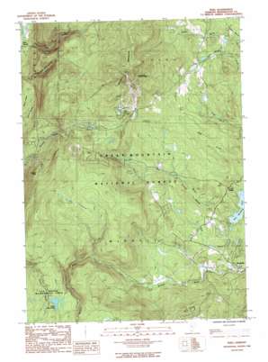
Peru Topo Map Vermont
To zoom in, hover over the map of Peru
USGS Topo Quad 43072b8 - 1:24,000 scale
| Topo Map Name: | Peru |
| USGS Topo Quad ID: | 43072b8 |
| Print Size: | ca. 21 1/4" wide x 27" high |
| Southeast Coordinates: | 43.125° N latitude / 72.875° W longitude |
| Map Center Coordinates: | 43.1875° N latitude / 72.9375° W longitude |
| U.S. State: | VT |
| Filename: | o43072b8.jpg |
| Download Map JPG Image: | Peru topo map 1:24,000 scale |
| Map Type: | Topographic |
| Topo Series: | 7.5´ |
| Map Scale: | 1:24,000 |
| Source of Map Images: | United States Geological Survey (USGS) |
| Alternate Map Versions: |
Peru VT 1986, updated 1987 Download PDF Buy paper map Peru VT 1986, updated 1987 Download PDF Buy paper map Peru VT 1997, updated 2000 Download PDF Buy paper map Peru VT 2012 Download PDF Buy paper map Peru VT 2015 Download PDF Buy paper map |
| FStopo: | US Forest Service topo Peru is available: Download FStopo PDF Download FStopo TIF |
1:24,000 Topo Quads surrounding Peru
> Back to 43072a1 at 1:100,000 scale
> Back to 43072a1 at 1:250,000 scale
> Back to U.S. Topo Maps home
Peru topo map: Gazetteer
Peru: Airports
Red Fox Airport elevation 431m 1414′Red Fox Landing Field elevation 431m 1414′
Peru: Areas
Big Bromley Ski Area elevation 808m 2650′Snow Valley Ski Area elevation 672m 2204′
Peru: Dams
Farnum Dam elevation 467m 1532′Peru: Forests
Hapgood State Forest elevation 896m 2939′Peru: Lakes
Little Mud Pond elevation 705m 2312′Peru: Populated Places
Bondville elevation 390m 1279′Bromley Village elevation 679m 2227′
Forest Farms elevation 635m 2083′
French Hollow elevation 463m 1519′
Intervale elevation 410m 1345′
Peru elevation 514m 1686′
Piper Ridge elevation 445m 1459′
Stratton Acres elevation 462m 1515′
Stratton Valley elevation 555m 1820′
Strattonwald elevation 448m 1469′
Vermont Ventures elevation 464m 1522′
Peru: Post Offices
Bondville Post Office elevation 413m 1354′Peru Post Office elevation 516m 1692′
Peru: Reservoirs
Lyons Pond elevation 493m 1617′Peru: Streams
Farnum Brook elevation 442m 1450′Peru: Summits
Bromley Mountain elevation 987m 3238′Spruce Peak elevation 621m 2037′
Peru: Trails
Mad Tom Trail elevation 442m 1450′Peru: Valleys
French Hollow elevation 417m 1368′Peru digital topo map on disk
Buy this Peru topo map showing relief, roads, GPS coordinates and other geographical features, as a high-resolution digital map file on DVD:
New York, Vermont, Connecticut & Western Massachusetts
Buy digital topo maps: New York, Vermont, Connecticut & Western Massachusetts


