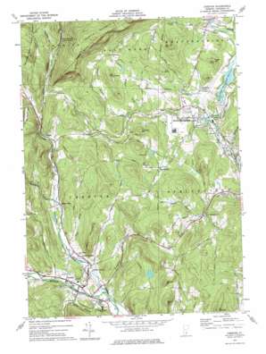
Chester Topo Map Vermont
To zoom in, hover over the map of Chester
USGS Topo Quad 43072c5 - 1:24,000 scale
| Topo Map Name: | Chester |
| USGS Topo Quad ID: | 43072c5 |
| Print Size: | ca. 21 1/4" wide x 27" high |
| Southeast Coordinates: | 43.25° N latitude / 72.5° W longitude |
| Map Center Coordinates: | 43.3125° N latitude / 72.5625° W longitude |
| U.S. State: | VT |
| Filename: | o43072c5.jpg |
| Download Map JPG Image: | Chester topo map 1:24,000 scale |
| Map Type: | Topographic |
| Topo Series: | 7.5´ |
| Map Scale: | 1:24,000 |
| Source of Map Images: | United States Geological Survey (USGS) |
| Alternate Map Versions: |
Chester VT 1972, updated 1975 Download PDF Buy paper map Chester VT 1972, updated 1975 Download PDF Buy paper map Chester VT 2012 Download PDF Buy paper map Chester VT 2015 Download PDF Buy paper map |
1:24,000 Topo Quads surrounding Chester
> Back to 43072a1 at 1:100,000 scale
> Back to 43072a1 at 1:250,000 scale
> Back to U.S. Topo Maps home
Chester topo map: Gazetteer
Chester: Airports
Hartness State Airport elevation 176m 577′Chester: Bridges
Downers Covered Bridge elevation 223m 731′Chester: Dams
North Springfield Dam elevation 143m 469′Chester: Lakes
Quarry Pond elevation 334m 1095′Chester: Parks
North Springfield Lake Recreation Area elevation 148m 485′Springfield Nature Area elevation 182m 597′
Chester: Populated Places
Baileys Mills elevation 191m 626′Baltimore elevation 331m 1085′
Chester elevation 185m 606′
Gassetts elevation 218m 715′
Kendricks Corner elevation 187m 613′
North Chester elevation 182m 597′
North Springfield elevation 151m 495′
Perkinsville elevation 171m 561′
Spoonerville elevation 215m 705′
West Springfield elevation 243m 797′
Chester: Reservoirs
Chester Reservoir elevation 191m 626′North Springfield Reservoir elevation 143m 469′
Chester: Streams
Beaver Meadow Brook elevation 188m 616′Chandler Meadow Brook elevation 192m 629′
Great Brook elevation 140m 459′
Middle Branch Williams River elevation 170m 557′
South Branch Williams River elevation 172m 564′
Trebo Brook elevation 180m 590′
Whitmore Brook elevation 194m 636′
Chester: Summits
Bond Hill elevation 385m 1263′Davidson Hill elevation 321m 1053′
Hawks Mountain elevation 645m 2116′
Litchfield Hill elevation 402m 1318′
Mount Ephraim elevation 448m 1469′
Mount Flamstead elevation 344m 1128′
Old Shincracker elevation 367m 1204′
Tolles Hill elevation 278m 912′
Whitney Hill elevation 377m 1236′
Chester: Swamps
North Springfield Bog elevation 141m 462′Chester: Valleys
Duttonville Gulf elevation 233m 764′Kingdom Valley elevation 182m 597′
Proctorsville Gulf elevation 255m 836′
Chester digital topo map on disk
Buy this Chester topo map showing relief, roads, GPS coordinates and other geographical features, as a high-resolution digital map file on DVD:
New York, Vermont, Connecticut & Western Massachusetts
Buy digital topo maps: New York, Vermont, Connecticut & Western Massachusetts


