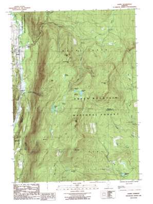
Danby Topo Map Vermont
To zoom in, hover over the map of Danby
USGS Topo Quad 43072c8 - 1:24,000 scale
| Topo Map Name: | Danby |
| USGS Topo Quad ID: | 43072c8 |
| Print Size: | ca. 21 1/4" wide x 27" high |
| Southeast Coordinates: | 43.25° N latitude / 72.875° W longitude |
| Map Center Coordinates: | 43.3125° N latitude / 72.9375° W longitude |
| U.S. State: | VT |
| Filename: | o43072c8.jpg |
| Download Map JPG Image: | Danby topo map 1:24,000 scale |
| Map Type: | Topographic |
| Topo Series: | 7.5´ |
| Map Scale: | 1:24,000 |
| Source of Map Images: | United States Geological Survey (USGS) |
| Alternate Map Versions: |
Danby VT 1986, updated 1987 Download PDF Buy paper map Danby VT 1986, updated 1987 Download PDF Buy paper map Danby VT 1997, updated 2000 Download PDF Buy paper map Danby VT 2012 Download PDF Buy paper map Danby VT 2015 Download PDF Buy paper map |
| FStopo: | US Forest Service topo Danby is available: Download FStopo PDF Download FStopo TIF |
1:24,000 Topo Quads surrounding Danby
> Back to 43072a1 at 1:100,000 scale
> Back to 43072a1 at 1:250,000 scale
> Back to U.S. Topo Maps home
Danby topo map: Gazetteer
Danby: Flats
Swale Meadow elevation 811m 2660′Danby: Forests
Emerald Lake State Forest elevation 392m 1286′Danby: Gaps
Devils Den elevation 657m 2155′Mad Tom Notch elevation 744m 2440′
Danby: Lakes
Big Mud Pond elevation 789m 2588′Griffith Lake elevation 786m 2578′
Hapgood Pond elevation 465m 1525′
Little Mud Pond elevation 786m 2578′
Long Hole elevation 778m 2552′
Lost Pond elevation 826m 2709′
Danby: Parks
Danby Village Historic District elevation 213m 698′Danby: Populated Places
Danby elevation 211m 692′Mount Tabor elevation 209m 685′
South End elevation 209m 685′
Danby: Post Offices
Danby Post Office elevation 217m 711′Post Office R C Winter Sports Area elevation 498m 1633′
Danby: Streams
Big Black Branch elevation 384m 1259′Big Branch elevation 198m 649′
Lake Brook elevation 503m 1650′
Little Black Branch elevation 437m 1433′
McGinn Brook elevation 204m 669′
Mill Brook elevation 202m 662′
Mount Tabor Brook elevation 485m 1591′
Styles Brook elevation 462m 1515′
Ten Kilns Brook elevation 545m 1788′
Three Shanties Brook elevation 598m 1961′
Danby: Summits
Baker Peak elevation 862m 2828′Buckball Peak elevation 871m 2857′
Mount Tabor elevation 930m 3051′
Peru Peak elevation 1042m 3418′
Pete Parent Peak elevation 900m 2952′
South Buckball Peak elevation 866m 2841′
Styles Peak elevation 1029m 3375′
Danby: Swamps
Elbow Swamp elevation 784m 2572′Danby: Trails
Baker Peak Trail elevation 737m 2417′Jones Brook Trail elevation 553m 1814′
Lake Trail elevation 621m 2037′
Little Michigan Trail elevation 495m 1624′
Old Job Trail elevation 676m 2217′
Staples Trail elevation 924m 3031′
Utley Brook Trail elevation 489m 1604′
Danby digital topo map on disk
Buy this Danby topo map showing relief, roads, GPS coordinates and other geographical features, as a high-resolution digital map file on DVD:
New York, Vermont, Connecticut & Western Massachusetts
Buy digital topo maps: New York, Vermont, Connecticut & Western Massachusetts


