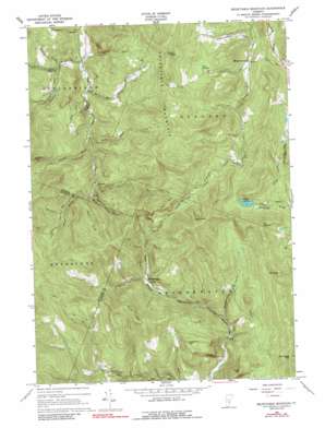
Delectable Mountain Topo Map Vermont
To zoom in, hover over the map of Delectable Mountain
USGS Topo Quad 43072f6 - 1:24,000 scale
| Topo Map Name: | Delectable Mountain |
| USGS Topo Quad ID: | 43072f6 |
| Print Size: | ca. 21 1/4" wide x 27" high |
| Southeast Coordinates: | 43.625° N latitude / 72.625° W longitude |
| Map Center Coordinates: | 43.6875° N latitude / 72.6875° W longitude |
| U.S. State: | VT |
| Filename: | o43072f6.jpg |
| Download Map JPG Image: | Delectable Mountain topo map 1:24,000 scale |
| Map Type: | Topographic |
| Topo Series: | 7.5´ |
| Map Scale: | 1:24,000 |
| Source of Map Images: | United States Geological Survey (USGS) |
| Alternate Map Versions: |
Delectable Mountain VT 1966, updated 1968 Download PDF Buy paper map Delectable Mountain VT 1966, updated 1989 Download PDF Buy paper map Delectable Mountain VT 1966, updated 1989 Download PDF Buy paper map Delectable Mountain VT 1996, updated 2000 Download PDF Buy paper map Delectable Mountain VT 2012 Download PDF Buy paper map Delectable Mountain VT 2015 Download PDF Buy paper map |
| FStopo: | US Forest Service topo Delectable Mountain is available: Download FStopo PDF Download FStopo TIF |
1:24,000 Topo Quads surrounding Delectable Mountain
> Back to 43072e1 at 1:100,000 scale
> Back to 43072a1 at 1:250,000 scale
> Back to U.S. Topo Maps home
Delectable Mountain topo map: Gazetteer
Delectable Mountain: Dams
Lakota Lake Dam elevation 579m 1899′Delectable Mountain: Forests
Barnard Town Forest elevation 619m 2030′Delectable Mountain: Populated Places
Chateauguay elevation 434m 1423′Morgan Corners elevation 332m 1089′
Notown elevation 392m 1286′
Delectable Mountain: Reservoirs
Lakota Lake elevation 579m 1899′Delectable Mountain: Streams
Basin Brook elevation 431m 1414′Boutwell Brook elevation 319m 1046′
Broughton Brook elevation 248m 813′
Dalton Brook elevation 261m 856′
Davis Hill Brook elevation 291m 954′
Dimick Brook elevation 418m 1371′
Fletcher Brook elevation 265m 869′
Johnson Brook elevation 346m 1135′
Mink Brook elevation 410m 1345′
Perkins Brook elevation 331m 1085′
Taggart Brook elevation 332m 1089′
Windfall Brook elevation 486m 1594′
Delectable Mountain: Summits
Bull Hill elevation 758m 2486′Burbee Peak elevation 795m 2608′
Cobb Hill elevation 630m 2066′
Dana Hill elevation 757m 2483′
Delectable Mountain elevation 736m 2414′
Freestone Hill elevation 635m 2083′
Montague Hill elevation 767m 2516′
Mount Hunger elevation 734m 2408′
Pinnacle elevation 776m 2545′
The Lookout elevation 742m 2434′
Delectable Mountain: Swamps
Nyes Swamp elevation 490m 1607′Delectable Mountain: Trails
Barnard Trail elevation 628m 2060′Delectable Mountain: Valleys
Bridgewater Hollow elevation 369m 1210′Delectable Mountain digital topo map on disk
Buy this Delectable Mountain topo map showing relief, roads, GPS coordinates and other geographical features, as a high-resolution digital map file on DVD:
New York, Vermont, Connecticut & Western Massachusetts
Buy digital topo maps: New York, Vermont, Connecticut & Western Massachusetts


