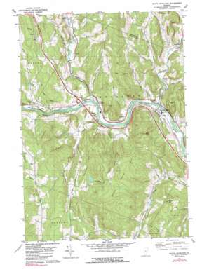
South Royalton Topo Map Vermont
To zoom in, hover over the map of South Royalton
USGS Topo Quad 43072g5 - 1:24,000 scale
| Topo Map Name: | South Royalton |
| USGS Topo Quad ID: | 43072g5 |
| Print Size: | ca. 21 1/4" wide x 27" high |
| Southeast Coordinates: | 43.75° N latitude / 72.5° W longitude |
| Map Center Coordinates: | 43.8125° N latitude / 72.5625° W longitude |
| U.S. State: | VT |
| Filename: | o43072g5.jpg |
| Download Map JPG Image: | South Royalton topo map 1:24,000 scale |
| Map Type: | Topographic |
| Topo Series: | 7.5´ |
| Map Scale: | 1:24,000 |
| Source of Map Images: | United States Geological Survey (USGS) |
| Alternate Map Versions: |
South Royalton VT 1981, updated 1981 Download PDF Buy paper map South Royalton VT 1981, updated 1990 Download PDF Buy paper map South Royalton VT 2012 Download PDF Buy paper map South Royalton VT 2015 Download PDF Buy paper map |
1:24,000 Topo Quads surrounding South Royalton
> Back to 43072e1 at 1:100,000 scale
> Back to 43072a1 at 1:250,000 scale
> Back to U.S. Topo Maps home
South Royalton topo map: Gazetteer
South Royalton: Benches
Kents Ledge elevation 390m 1279′South Royalton: Crossings
Interchange 3 elevation 164m 538′South Royalton: Lakes
Ansel Pond elevation 248m 813′South Royalton: Populated Places
East Bethel elevation 177m 580′North Royalton elevation 152m 498′
Royalton elevation 153m 501′
South Royalton elevation 150m 492′
South Tunbridge elevation 163m 534′
South Royalton: Streams
First Branch White River elevation 136m 446′Russell Brook elevation 152m 498′
Second Branch White River elevation 143m 469′
Sewall Brook elevation 152m 498′
South Royalton: Summits
Boyds Hill elevation 446m 1463′Broad Brook Mountain elevation 417m 1368′
Christian Hill elevation 415m 1361′
Elephant Hill elevation 332m 1089′
Quarry Hill elevation 425m 1394′
Royalton Hill elevation 449m 1473′
Russ Hill elevation 449m 1473′
South Royalton: Valleys
Happy Hollow elevation 144m 472′South Royalton digital topo map on disk
Buy this South Royalton topo map showing relief, roads, GPS coordinates and other geographical features, as a high-resolution digital map file on DVD:
New York, Vermont, Connecticut & Western Massachusetts
Buy digital topo maps: New York, Vermont, Connecticut & Western Massachusetts


