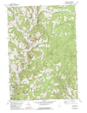
Chelsea Topo Map Vermont
To zoom in, hover over the map of Chelsea
USGS Topo Quad 43072h4 - 1:24,000 scale
| Topo Map Name: | Chelsea |
| USGS Topo Quad ID: | 43072h4 |
| Print Size: | ca. 21 1/4" wide x 27" high |
| Southeast Coordinates: | 43.875° N latitude / 72.375° W longitude |
| Map Center Coordinates: | 43.9375° N latitude / 72.4375° W longitude |
| U.S. State: | VT |
| Filename: | o43072h4.jpg |
| Download Map JPG Image: | Chelsea topo map 1:24,000 scale |
| Map Type: | Topographic |
| Topo Series: | 7.5´ |
| Map Scale: | 1:24,000 |
| Source of Map Images: | United States Geological Survey (USGS) |
| Alternate Map Versions: |
Chelsea VT 1981, updated 1981 Download PDF Buy paper map Chelsea VT 1981, updated 1981 Download PDF Buy paper map Chelsea VT 1981, updated 1981 Download PDF Buy paper map Chelsea VT 2012 Download PDF Buy paper map Chelsea VT 2015 Download PDF Buy paper map |
1:24,000 Topo Quads surrounding Chelsea
> Back to 43072e1 at 1:100,000 scale
> Back to 43072a1 at 1:250,000 scale
> Back to U.S. Topo Maps home
Chelsea topo map: Gazetteer
Chelsea: Bridges
Flint Covered Bridge elevation 208m 682′Larkin Covered Bridge elevation 188m 616′
Mill Covered Bridge elevation 162m 531′
Moxley Covered Bridge elevation 209m 685′
Chelsea: Dams
Keyser Dam elevation 375m 1230′Chelsea: Forests
Chelsea Municipal Forest elevation 585m 1919′Strafford Municipal Forest elevation 456m 1496′
Chelsea: Parks
Chelsea Historic District elevation 250m 820′Kibling Hill Wildlife Management Area elevation 572m 1876′
Chelsea: Populated Places
Chelsea elevation 250m 820′North Tunbridge elevation 191m 626′
Tunbridge elevation 173m 567′
Chelsea: Reservoirs
Keyser Pond elevation 375m 1230′Chelsea: Streams
Beaver Meadow Brook elevation 378m 1240′Bicknell Brook elevation 201m 659′
Cram Brook elevation 213m 698′
Dickerman Brook elevation 195m 639′
Jail Brook elevation 248m 813′
Jenkins Brook elevation 239m 784′
Old City Brook elevation 292m 958′
Chelsea: Summits
Beacon Hill elevation 521m 1709′Brocklebank Hill elevation 642m 2106′
Curtis Hill elevation 447m 1466′
East Hill elevation 469m 1538′
Holt Hill elevation 542m 1778′
Whitney Hill elevation 414m 1358′
Williams Hill elevation 591m 1938′
Chelsea: Valleys
Hart Hollow elevation 263m 862′Chelsea digital topo map on disk
Buy this Chelsea topo map showing relief, roads, GPS coordinates and other geographical features, as a high-resolution digital map file on DVD:
New York, Vermont, Connecticut & Western Massachusetts
Buy digital topo maps: New York, Vermont, Connecticut & Western Massachusetts


