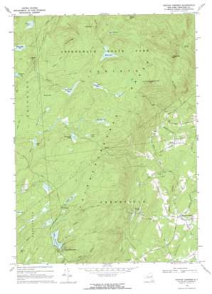
Porter Corners Topo Map New York
To zoom in, hover over the map of Porter Corners
USGS Topo Quad 43073b8 - 1:24,000 scale
| Topo Map Name: | Porter Corners |
| USGS Topo Quad ID: | 43073b8 |
| Print Size: | ca. 21 1/4" wide x 27" high |
| Southeast Coordinates: | 43.125° N latitude / 73.875° W longitude |
| Map Center Coordinates: | 43.1875° N latitude / 73.9375° W longitude |
| U.S. State: | NY |
| Filename: | o43073b8.jpg |
| Download Map JPG Image: | Porter Corners topo map 1:24,000 scale |
| Map Type: | Topographic |
| Topo Series: | 7.5´ |
| Map Scale: | 1:24,000 |
| Source of Map Images: | United States Geological Survey (USGS) |
| Alternate Map Versions: |
Porter Corners NY 1968, updated 1969 Download PDF Buy paper map Porter Corners NY 1968, updated 1970 Download PDF Buy paper map Porter Corners NY 2010 Download PDF Buy paper map Porter Corners NY 2013 Download PDF Buy paper map Porter Corners NY 2016 Download PDF Buy paper map |
1:24,000 Topo Quads surrounding Porter Corners
> Back to 43073a1 at 1:100,000 scale
> Back to 43072a1 at 1:250,000 scale
> Back to U.S. Topo Maps home
Porter Corners topo map: Gazetteer
Porter Corners: Lakes
Archer Vly elevation 528m 1732′Black Pond elevation 509m 1669′
Bucket Pond elevation 325m 1066′
John West Vly elevation 541m 1774′
Lake Desolation elevation 476m 1561′
Little Lake elevation 552m 1811′
Mulleyville Pond elevation 538m 1765′
Palmer Lake elevation 449m 1473′
Porter Corners: Populated Places
Della Mobile Estates elevation 202m 662′Lake Desolation elevation 478m 1568′
Mount Pleasant elevation 525m 1722′
Porter Corners elevation 202m 662′
Sky Ranch elevation 342m 1122′
Porter Corners: Ranges
Kayaderosseras Range elevation 557m 1827′Porter Corners: Ridges
Pompy Ridge elevation 532m 1745′Porter Corners: Streams
Balsam Brook elevation 477m 1564′Burnt Mill Creek elevation 443m 1453′
Randall Creek elevation 493m 1617′
South Branch Kayaderosseras Creek elevation 174m 570′
Vly Creek elevation 171m 561′
Porter Corners: Summits
Hedgehog Mountain elevation 601m 1971′Miner Hill elevation 527m 1729′
Negro Hill elevation 605m 1984′
Nick Mountain elevation 501m 1643′
Spruce Mountain elevation 612m 2007′
Porter Corners: Swamps
Bear Swamp elevation 479m 1571′Big Brewer Vly elevation 515m 1689′
Brewer Vly elevation 528m 1732′
Burnt Mill Vly elevation 539m 1768′
Cady Vly elevation 463m 1519′
Graves Vly elevation 449m 1473′
Johns Vly elevation 485m 1591′
Macomber Vly elevation 549m 1801′
Miner Mill Vly elevation 479m 1571′
Niffin Vly elevation 469m 1538′
Porter Corners digital topo map on disk
Buy this Porter Corners topo map showing relief, roads, GPS coordinates and other geographical features, as a high-resolution digital map file on DVD:
New York, Vermont, Connecticut & Western Massachusetts
Buy digital topo maps: New York, Vermont, Connecticut & Western Massachusetts


