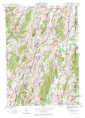
West Pawlet Topo Map New York
To zoom in, hover over the map of West Pawlet
USGS Topo Quad 43073c3 - 1:24,000 scale
| Topo Map Name: | West Pawlet |
| USGS Topo Quad ID: | 43073c3 |
| Print Size: | ca. 21 1/4" wide x 27" high |
| Southeast Coordinates: | 43.25° N latitude / 73.25° W longitude |
| Map Center Coordinates: | 43.3125° N latitude / 73.3125° W longitude |
| U.S. States: | NY, VT |
| Filename: | o43073c3.jpg |
| Download Map JPG Image: | West Pawlet topo map 1:24,000 scale |
| Map Type: | Topographic |
| Topo Series: | 7.5´ |
| Map Scale: | 1:24,000 |
| Source of Map Images: | United States Geological Survey (USGS) |
| Alternate Map Versions: |
West Pawlet VT 1944, updated 1958 Download PDF Buy paper map West Pawlet VT 1944, updated 1969 Download PDF Buy paper map West Pawlet VT 1995, updated 2000 Download PDF Buy paper map West Pawlet VT 1995, updated 2000 Download PDF Buy paper map West Pawlet VT 2011 Download PDF Buy paper map West Pawlet VT 2015 Download PDF Buy paper map |
| FStopo: | US Forest Service topo West Pawlet is available: Download FStopo PDF Download FStopo TIF |
1:24,000 Topo Quads surrounding West Pawlet
> Back to 43073a1 at 1:100,000 scale
> Back to 43072a1 at 1:250,000 scale
> Back to U.S. Topo Maps home
West Pawlet topo map: Gazetteer
West Pawlet: Lakes
Green Pond elevation 224m 734′Lily Pond elevation 208m 682′
Smith Pond elevation 282m 925′
West Pawlet: Populated Places
East Hebron elevation 185m 606′North Hebron elevation 239m 784′
Porter elevation 176m 577′
Slateville elevation 185m 606′
South Granville elevation 133m 436′
Tiplady elevation 204m 669′
West Pawlet elevation 163m 534′
West Pawlet: Streams
Dead Creek elevation 192m 629′West Pawlet: Summits
Dick Hill elevation 318m 1043′Grimes Hill elevation 325m 1066′
Mount Tom elevation 399m 1309′
Pine Hill elevation 317m 1040′
Pumpkin Hill elevation 282m 925′
Round Mountain elevation 380m 1246′
West Pawlet: Woods
Castle Green elevation 262m 859′West Pawlet digital topo map on disk
Buy this West Pawlet topo map showing relief, roads, GPS coordinates and other geographical features, as a high-resolution digital map file on DVD:
New York, Vermont, Connecticut & Western Massachusetts
Buy digital topo maps: New York, Vermont, Connecticut & Western Massachusetts


