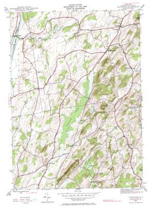
Hartford Topo Map New York
To zoom in, hover over the map of Hartford
USGS Topo Quad 43073c4 - 1:24,000 scale
| Topo Map Name: | Hartford |
| USGS Topo Quad ID: | 43073c4 |
| Print Size: | ca. 21 1/4" wide x 27" high |
| Southeast Coordinates: | 43.25° N latitude / 73.375° W longitude |
| Map Center Coordinates: | 43.3125° N latitude / 73.4375° W longitude |
| U.S. State: | NY |
| Filename: | o43073c4.jpg |
| Download Map JPG Image: | Hartford topo map 1:24,000 scale |
| Map Type: | Topographic |
| Topo Series: | 7.5´ |
| Map Scale: | 1:24,000 |
| Source of Map Images: | United States Geological Survey (USGS) |
| Alternate Map Versions: |
Hartford NY 1944, updated 1958 Download PDF Buy paper map Hartford NY 1944, updated 1967 Download PDF Buy paper map Hartford NY 1944, updated 1967 Download PDF Buy paper map Hartford NY 2010 Download PDF Buy paper map Hartford NY 2013 Download PDF Buy paper map Hartford NY 2016 Download PDF Buy paper map |
1:24,000 Topo Quads surrounding Hartford
> Back to 43073a1 at 1:100,000 scale
> Back to 43072a1 at 1:250,000 scale
> Back to U.S. Topo Maps home
Hartford topo map: Gazetteer
Hartford: Airports
Argyle Airport elevation 94m 308′Hartford: Lakes
Halls Pond elevation 300m 984′Mud Pond elevation 220m 721′
Hartford: Populated Places
Adamsville elevation 112m 367′Belcher elevation 241m 790′
East Hartford elevation 181m 593′
Goose Island elevation 219m 718′
Hartford elevation 119m 390′
North Argyle elevation 98m 321′
South Hartford elevation 114m 374′
Hartford: Streams
Big Creek elevation 39m 127′Wood Creek elevation 40m 131′
Hartford: Summits
Black Mountain elevation 331m 1085′Christian Hill elevation 148m 485′
Mount Rascal elevation 331m 1085′
Todd Mountain elevation 315m 1033′
Hartford: Swamps
Tamarack Swamp elevation 101m 331′Hartford digital topo map on disk
Buy this Hartford topo map showing relief, roads, GPS coordinates and other geographical features, as a high-resolution digital map file on DVD:
New York, Vermont, Connecticut & Western Massachusetts
Buy digital topo maps: New York, Vermont, Connecticut & Western Massachusetts


