West Rutland Topo Map Vermont
To zoom in, hover over the map of West Rutland
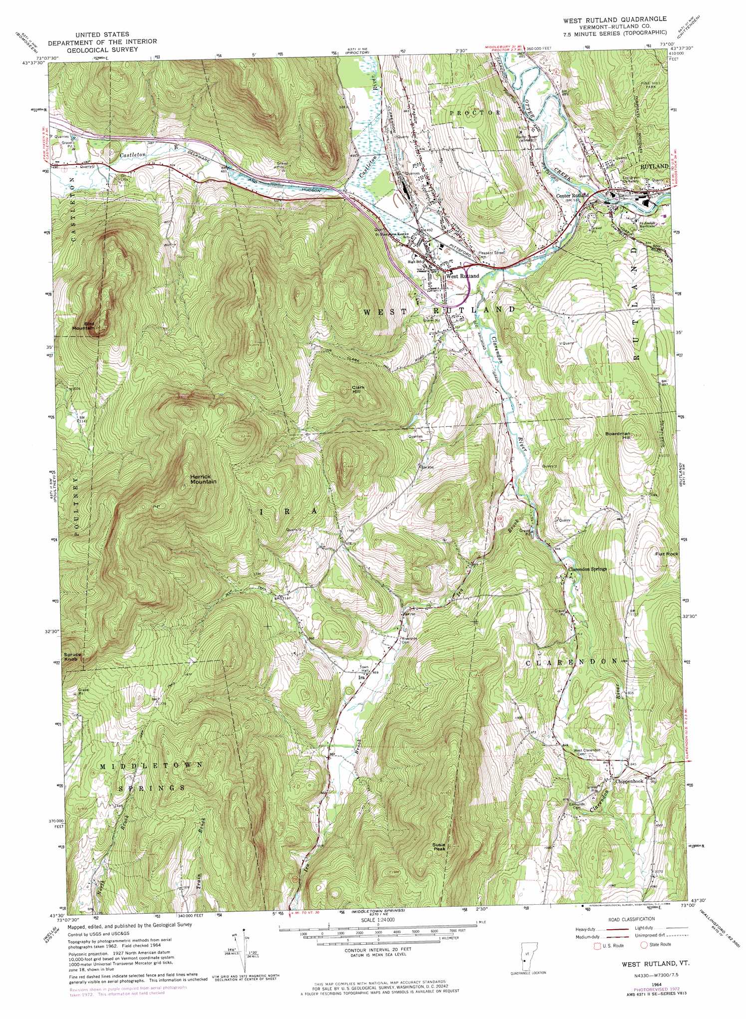
USGS Topo Quad 43073e1 - 1:24,000 scale
| Topo Map Name: | West Rutland |
| USGS Topo Quad ID: | 43073e1 |
| Print Size: | ca. 21 1/4" wide x 27" high |
| Southeast Coordinates: | 43.5° N latitude / 73° W longitude |
| Map Center Coordinates: | 43.5625° N latitude / 73.0625° W longitude |
| U.S. State: | VT |
| Filename: | o43073e1.jpg |
| Download Map JPG Image: | West Rutland topo map 1:24,000 scale |
| Map Type: | Topographic |
| Topo Series: | 7.5´ |
| Map Scale: | 1:24,000 |
| Source of Map Images: | United States Geological Survey (USGS) |
| Alternate Map Versions: |
West Rutland VT 1964, updated 1965 Download PDF Buy paper map West Rutland VT 1964, updated 1973 Download PDF Buy paper map West Rutland VT 1964, updated 1984 Download PDF Buy paper map West Rutland VT 1964, updated 1984 Download PDF Buy paper map West Rutland VT 2012 Download PDF Buy paper map West Rutland VT 2015 Download PDF Buy paper map |
1:24,000 Topo Quads surrounding West Rutland
Orwell |
Sudbury |
Brandon |
Mount Carmel |
Rochester |
Benson |
Bomoseen |
Proctor |
Chittenden |
Pico Peak |
Thorn Hill |
Poultney |
West Rutland |
Rutland |
Killington Peak |
Granville |
Wells |
Middletown Springs |
Wallingford |
Mount Holly |
West Pawlet |
Pawlet |
Dorset |
Danby |
Weston |
> Back to 43073e1 at 1:100,000 scale
> Back to 43072a1 at 1:250,000 scale
> Back to U.S. Topo Maps home
West Rutland topo map: Gazetteer
West Rutland: Dams
Center Rutland Dam elevation 146m 479′Youngs Brook Dam elevation 256m 839′
West Rutland: Falls
Center Rutland Falls elevation 145m 475′West Rutland: Forests
West Rutland Municipal Forest elevation 401m 1315′West Rutland: Parks
Bird Mountain Wildlife Management Area elevation 335m 1099′Marble Street Historic District elevation 149m 488′
West Rutland: Populated Places
Center Rutland elevation 158m 518′Chippenhook elevation 260m 853′
Clarendon Springs elevation 208m 682′
Durgy Hill Heights elevation 198m 649′
Ira elevation 261m 856′
West Rutland elevation 151m 495′
West Rutland: Post Offices
West Rutland Post Office elevation 151m 495′West Rutland: Reservoirs
Youngs Brook Reservoir elevation 256m 839′West Rutland: Streams
Clarendon River elevation 146m 479′Ira Brook elevation 177m 580′
West Rutland: Summits
Bird Mountain elevation 669m 2194′Boardman Hill elevation 399m 1309′
Clark Hill elevation 504m 1653′
Edmunds Peak elevation 725m 2378′
Flat Rock elevation 375m 1230′
Herrick Mountain elevation 827m 2713′
Spruce Knob elevation 736m 2414′
West Rutland: Valleys
Whipple Hollow elevation 149m 488′West Rutland digital topo map on disk
Buy this West Rutland topo map showing relief, roads, GPS coordinates and other geographical features, as a high-resolution digital map file on DVD:
New York, Vermont, Connecticut & Western Massachusetts
Buy digital topo maps: New York, Vermont, Connecticut & Western Massachusetts