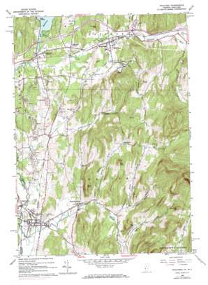
Poultney Topo Map Vermont
To zoom in, hover over the map of Poultney
USGS Topo Quad 43073e2 - 1:24,000 scale
| Topo Map Name: | Poultney |
| USGS Topo Quad ID: | 43073e2 |
| Print Size: | ca. 21 1/4" wide x 27" high |
| Southeast Coordinates: | 43.5° N latitude / 73.125° W longitude |
| Map Center Coordinates: | 43.5625° N latitude / 73.1875° W longitude |
| U.S. States: | VT, NY |
| Filename: | o43073e2.jpg |
| Download Map JPG Image: | Poultney topo map 1:24,000 scale |
| Map Type: | Topographic |
| Topo Series: | 7.5´ |
| Map Scale: | 1:24,000 |
| Source of Map Images: | United States Geological Survey (USGS) |
| Alternate Map Versions: |
Poultney VT 1964, updated 1965 Download PDF Buy paper map Poultney VT 1964, updated 1973 Download PDF Buy paper map Poultney VT 1964, updated 1973 Download PDF Buy paper map Poultney VT 1964, updated 1973 Download PDF Buy paper map Poultney VT 2012 Download PDF Buy paper map Poultney VT 2012 Download PDF Buy paper map Poultney VT 2015 Download PDF Buy paper map |
1:24,000 Topo Quads surrounding Poultney
> Back to 43073e1 at 1:100,000 scale
> Back to 43072a1 at 1:250,000 scale
> Back to U.S. Topo Maps home
Poultney topo map: Gazetteer
Poultney: Bays
Indian Bay elevation 125m 410′Poultney: Crossings
Interchange 4 elevation 141m 462′Interchange 5 elevation 140m 459′
Poultney: Dams
Lake Bomossen Dam elevation 126m 413′Poultney: Parks
Blueberry Hill Wildlife Management Area elevation 287m 941′Castleton Village Historic District elevation 133m 436′
East Poultney Historic District elevation 157m 515′
Poultney Main Street Historic District elevation 131m 429′
Poultney: Populated Places
Blissville elevation 132m 433′Castleton elevation 134m 439′
Castleton Corners elevation 138m 452′
East Poultney elevation 156m 511′
Gorhamtown elevation 191m 626′
Hydeville elevation 133m 436′
Point of Pines elevation 134m 439′
Poultney elevation 131m 429′
Poultney: Post Offices
Bomoseen Post Office elevation 136m 446′Castleton Post Office elevation 133m 436′
Poultney Post Office elevation 132m 433′
Poultney: Reservoirs
Lake Bomoseen elevation 126m 413′Poultney: Streams
Clark Hollow Brook elevation 186m 610′Finel Hollow Brook elevation 156m 511′
Gully Brook elevation 142m 465′
Hampshire Hollow Brook elevation 168m 551′
Lavery Brook elevation 188m 616′
Lewis Brook elevation 98m 321′
North Breton Brook elevation 128m 419′
Pond Hill Brook elevation 125m 410′
Poultney: Summits
Graham Hill elevation 182m 597′Old Knob elevation 351m 1151′
Parker Hill elevation 162m 531′
Pond Hill elevation 351m 1151′
Spaulding Hill elevation 481m 1578′
Town Hill elevation 318m 1043′
Poultney: Valleys
Clark Hollow elevation 189m 620′Finel Hollow elevation 165m 541′
Hampshire Hollow elevation 188m 616′
Morse Hollow elevation 193m 633′
Poultney digital topo map on disk
Buy this Poultney topo map showing relief, roads, GPS coordinates and other geographical features, as a high-resolution digital map file on DVD:
New York, Vermont, Connecticut & Western Massachusetts
Buy digital topo maps: New York, Vermont, Connecticut & Western Massachusetts


