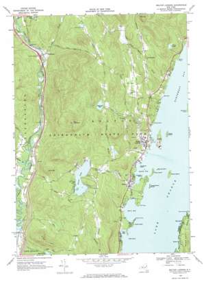
Bolton Landing Topo Map New York
To zoom in, hover over the map of Bolton Landing
USGS Topo Quad 43073e6 - 1:24,000 scale
| Topo Map Name: | Bolton Landing |
| USGS Topo Quad ID: | 43073e6 |
| Print Size: | ca. 21 1/4" wide x 27" high |
| Southeast Coordinates: | 43.5° N latitude / 73.625° W longitude |
| Map Center Coordinates: | 43.5625° N latitude / 73.6875° W longitude |
| U.S. State: | NY |
| Filename: | o43073e6.jpg |
| Download Map JPG Image: | Bolton Landing topo map 1:24,000 scale |
| Map Type: | Topographic |
| Topo Series: | 7.5´ |
| Map Scale: | 1:24,000 |
| Source of Map Images: | United States Geological Survey (USGS) |
| Alternate Map Versions: |
Bolton Landing NY 1966, updated 1969 Download PDF Buy paper map Bolton Landing NY 1966, updated 1969 Download PDF Buy paper map Bolton Landing NY 2010 Download PDF Buy paper map Bolton Landing NY 2013 Download PDF Buy paper map Bolton Landing NY 2016 Download PDF Buy paper map |
1:24,000 Topo Quads surrounding Bolton Landing
> Back to 43073e1 at 1:100,000 scale
> Back to 43072a1 at 1:250,000 scale
> Back to U.S. Topo Maps home
Bolton Landing topo map: Gazetteer
Bolton Landing: Bays
Barber Bay elevation 97m 318′Basin Bay elevation 97m 318′
Boon Bay elevation 97m 318′
Huddle Bay elevation 97m 318′
Bolton Landing: Capes
Bell Point elevation 97m 318′Braley Point elevation 97m 318′
Cotton Point elevation 97m 318′
Fish Point elevation 97m 318′
Montcalm Point elevation 97m 318′
Point Comfort elevation 97m 318′
Walker Point elevation 97m 318′
Bolton Landing: Crossings
Interchange 24 elevation 230m 754′Bolton Landing: Islands
Clay Island elevation 105m 344′Cotton Island elevation 97m 318′
Crown Island elevation 106m 347′
Dome Island elevation 116m 380′
Green Island elevation 110m 360′
Hiawatha Island elevation 98m 321′
Recluse Island elevation 98m 321′
Rush Island elevation 97m 318′
Sweetbriar Island elevation 97m 318′
Three Brothers Islands elevation 98m 321′
Bolton Landing: Lakes
Edgecomb Pond elevation 317m 1040′Trout Lake elevation 240m 787′
Wing Pond elevation 162m 531′
Bolton Landing: Populated Places
Bolton elevation 114m 374′Bolton Landing elevation 110m 360′
North Bolton elevation 206m 675′
Pilot Knob elevation 99m 324′
Riverbank elevation 215m 705′
Bolton Landing: Streams
Alder Brook elevation 207m 679′Butternut Brook elevation 97m 318′
Finkle Brook elevation 103m 337′
Huddle Brook elevation 98m 321′
Huggins Brook elevation 206m 675′
Indian Brook elevation 97m 318′
Bolton Landing: Summits
Cat Mountain elevation 593m 1945′Dixon Hill elevation 462m 1515′
Federal Hill elevation 306m 1003′
Lamb Hill elevation 441m 1446′
Pole Hill elevation 482m 1581′
Bolton Landing digital topo map on disk
Buy this Bolton Landing topo map showing relief, roads, GPS coordinates and other geographical features, as a high-resolution digital map file on DVD:
New York, Vermont, Connecticut & Western Massachusetts
Buy digital topo maps: New York, Vermont, Connecticut & Western Massachusetts


