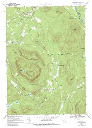
Johnsburg Topo Map New York
To zoom in, hover over the map of Johnsburg
USGS Topo Quad 43073e8 - 1:24,000 scale
| Topo Map Name: | Johnsburg |
| USGS Topo Quad ID: | 43073e8 |
| Print Size: | ca. 21 1/4" wide x 27" high |
| Southeast Coordinates: | 43.5° N latitude / 73.875° W longitude |
| Map Center Coordinates: | 43.5625° N latitude / 73.9375° W longitude |
| U.S. State: | NY |
| Filename: | o43073e8.jpg |
| Download Map JPG Image: | Johnsburg topo map 1:24,000 scale |
| Map Type: | Topographic |
| Topo Series: | 7.5´ |
| Map Scale: | 1:24,000 |
| Source of Map Images: | United States Geological Survey (USGS) |
| Alternate Map Versions: |
Johnsburg NY 1968, updated 1970 Download PDF Buy paper map Johnsburg NY 1968, updated 1989 Download PDF Buy paper map Johnsburg NY 1968, updated 1989 Download PDF Buy paper map Johnsburg NY 2010 Download PDF Buy paper map Johnsburg NY 2013 Download PDF Buy paper map Johnsburg NY 2016 Download PDF Buy paper map |
1:24,000 Topo Quads surrounding Johnsburg
> Back to 43073e1 at 1:100,000 scale
> Back to 43072a1 at 1:250,000 scale
> Back to U.S. Topo Maps home
Johnsburg topo map: Gazetteer
Johnsburg: Lakes
Crane Mountain Pond elevation 795m 2608′Dippikill Pond elevation 362m 1187′
Little Pond elevation 576m 1889′
Mud Pond elevation 575m 1886′
Snowshoe Pond elevation 509m 1669′
Johnsburg: Populated Places
Johnsburg elevation 391m 1282′Thurman elevation 401m 1315′
Johnsburg: Ridges
Cherry Ridge elevation 741m 2431′Pine Ridge elevation 578m 1896′
Johnsburg: Streams
Crystal Brook elevation 345m 1131′Kibby Creek elevation 366m 1200′
Number Twentysix Brook elevation 317m 1040′
Paintbed Brook elevation 390m 1279′
Johnsburg: Summits
Crane Mountain elevation 869m 2851′Gage Mountain elevation 621m 2037′
Huckleberry Mountain elevation 745m 2444′
Little Mountain elevation 735m 2411′
Mill Mountain elevation 587m 1925′
Number Nine Mountain elevation 646m 2119′
Number Twentysix Mountain elevation 507m 1663′
Partridge Mountain elevation 587m 1925′
Pine Mountain elevation 615m 2017′
Stockton Mountain elevation 547m 1794′
Wolf Pond Mountain elevation 784m 2572′
Johnsburg digital topo map on disk
Buy this Johnsburg topo map showing relief, roads, GPS coordinates and other geographical features, as a high-resolution digital map file on DVD:
New York, Vermont, Connecticut & Western Massachusetts
Buy digital topo maps: New York, Vermont, Connecticut & Western Massachusetts


