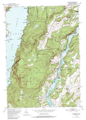
Putnam Topo Map New York
To zoom in, hover over the map of Putnam
USGS Topo Quad 43073f4 - 1:24,000 scale
| Topo Map Name: | Putnam |
| USGS Topo Quad ID: | 43073f4 |
| Print Size: | ca. 21 1/4" wide x 27" high |
| Southeast Coordinates: | 43.625° N latitude / 73.375° W longitude |
| Map Center Coordinates: | 43.6875° N latitude / 73.4375° W longitude |
| U.S. States: | NY, VT |
| Filename: | o43073f4.jpg |
| Download Map JPG Image: | Putnam topo map 1:24,000 scale |
| Map Type: | Topographic |
| Topo Series: | 7.5´ |
| Map Scale: | 1:24,000 |
| Source of Map Images: | United States Geological Survey (USGS) |
| Alternate Map Versions: |
Putnam NY 1950, updated 1952 Download PDF Buy paper map Putnam NY 1950, updated 1958 Download PDF Buy paper map Putnam NY 1950, updated 1971 Download PDF Buy paper map Putnam NY 1950, updated 1988 Download PDF Buy paper map Putnam NY 1950, updated 1988 Download PDF Buy paper map Putnam NY 2012 Download PDF Buy paper map Putnam NY 2013 Download PDF Buy paper map Putnam NY 2016 Download PDF Buy paper map |
1:24,000 Topo Quads surrounding Putnam
> Back to 43073e1 at 1:100,000 scale
> Back to 43072a1 at 1:250,000 scale
> Back to U.S. Topo Maps home
Putnam topo map: Gazetteer
Putnam: Bays
Barret Bay elevation 29m 95′Clark Hollow Bay elevation 97m 318′
Dark Bay elevation 97m 318′
Gull Bay elevation 97m 318′
Lamb Shanty Bay elevation 97m 318′
Mill Bay elevation 28m 91′
Red Rock Bay elevation 29m 95′
Smith Bay elevation 97m 318′
Putnam: Bends
Chilson Bend elevation 128m 419′Maple Bend elevation 30m 98′
Putnam: Capes
Bluff Head elevation 97m 318′Burnt Point elevation 103m 337′
Crow Point elevation 97m 318′
Gallup Point elevation 37m 121′
Green Point elevation 97m 318′
Jenkins Point elevation 98m 321′
Pardo Point elevation 98m 321′
Pulpit Point elevation 31m 101′
Skerrey Point elevation 97m 318′
Stark Point elevation 98m 321′
Putnam: Gaps
The Narrows elevation 29m 95′Putnam: Islands
Agnes Island elevation 99m 324′Gull Island elevation 97m 318′
Mallory Island elevation 97m 318′
Maple Bend Island elevation 29m 95′
Odell Islands elevation 97m 318′
Pudding Island elevation 97m 318′
Racket Island elevation 97m 318′
Rock Brothers elevation 97m 318′
Scotch Bonnet Island elevation 97m 318′
Skipper Island elevation 97m 318′
Putnam: Lakes
Mud Pond elevation 175m 574′Putnam: Populated Places
Chubbs Dock elevation 46m 150′Clemons elevation 115m 377′
Cold Spring elevation 36m 118′
Dresden elevation 42m 137′
Dresden Center elevation 105m 344′
Hague elevation 101m 331′
Putnam elevation 102m 334′
Putnam: Post Offices
Dresden Station Post Office elevation 40m 131′Putnam Station Post Office elevation 128m 419′
Putnam: Streams
Hague Brook elevation 97m 318′Horton Brook elevation 29m 95′
Jabe Pond Brook elevation 97m 318′
Mill Brook elevation 29m 95′
Putnam: Summits
Brimstone Hill elevation 287m 941′Cedar Mountain elevation 153m 501′
Fish Hill elevation 164m 538′
Hogback Mountain elevation 500m 1640′
Kline Hill elevation 121m 396′
Moore Hill elevation 319m 1046′
Mount Tom elevation 193m 633′
Sheldrick Hill elevation 190m 623′
Spruce Mountain elevation 604m 1981′
Putnam: Swamps
Horton Marsh elevation 30m 98′Putnam: Valleys
Clark Hollow elevation 98m 321′Putnam digital topo map on disk
Buy this Putnam topo map showing relief, roads, GPS coordinates and other geographical features, as a high-resolution digital map file on DVD:
New York, Vermont, Connecticut & Western Massachusetts
Buy digital topo maps: New York, Vermont, Connecticut & Western Massachusetts


