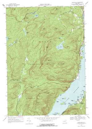
Silver Bay Topo Map New York
To zoom in, hover over the map of Silver Bay
USGS Topo Quad 43073f5 - 1:24,000 scale
| Topo Map Name: | Silver Bay |
| USGS Topo Quad ID: | 43073f5 |
| Print Size: | ca. 21 1/4" wide x 27" high |
| Southeast Coordinates: | 43.625° N latitude / 73.5° W longitude |
| Map Center Coordinates: | 43.6875° N latitude / 73.5625° W longitude |
| U.S. State: | NY |
| Filename: | o43073f5.jpg |
| Download Map JPG Image: | Silver Bay topo map 1:24,000 scale |
| Map Type: | Topographic |
| Topo Series: | 7.5´ |
| Map Scale: | 1:24,000 |
| Source of Map Images: | United States Geological Survey (USGS) |
| Alternate Map Versions: |
Silver Bay NY 1966, updated 1970 Download PDF Buy paper map Silver Bay NY 1966, updated 1977 Download PDF Buy paper map Silver Bay NY 2010 Download PDF Buy paper map Silver Bay NY 2013 Download PDF Buy paper map Silver Bay NY 2016 Download PDF Buy paper map |
1:24,000 Topo Quads surrounding Silver Bay
> Back to 43073e1 at 1:100,000 scale
> Back to 43072a1 at 1:250,000 scale
> Back to U.S. Topo Maps home
Silver Bay topo map: Gazetteer
Silver Bay: Bays
Bass Bay elevation 97m 318′Cook Bay elevation 97m 318′
Davis Bay elevation 97m 318′
Kitchal Bay elevation 97m 318′
Silver Bay elevation 97m 318′
Van Buren Bay elevation 97m 318′
Silver Bay: Capes
Meadow Point elevation 97m 318′Sabbath-Day Point elevation 98m 321′
Slim Point elevation 97m 318′
Silver Bay: Cliffs
Deer Leap elevation 329m 1079′Silver Bay: Islands
Burgess Island elevation 98m 321′Harbor Islands elevation 98m 321′
Huletts Island elevation 98m 321′
Loon Island elevation 97m 318′
Narrow Island elevation 97m 318′
Nobles Island elevation 98m 321′
Rock Dunder Island elevation 98m 321′
Saint Sacrament Island elevation 98m 321′
Steere Island elevation 98m 321′
Vicars Island elevation 103m 337′
Silver Bay: Lakes
Brown Pond elevation 278m 912′Buttermilk Pond elevation 430m 1410′
Jabe Pond elevation 400m 1312′
Little Jabe Pond elevation 424m 1391′
North Pond elevation 505m 1656′
Spectacle Pond elevation 418m 1371′
Swede Pond elevation 508m 1666′
Wolf Pond elevation 456m 1496′
Silver Bay: Populated Places
Huletts Landing elevation 113m 370′Sabbath Day Point elevation 102m 334′
Silver Bay elevation 106m 347′
Silver Bay: Ranges
Tongue Mountain Range elevation 527m 1729′Silver Bay: Streams
Fly Brook elevation 145m 475′Round Pond Brook elevation 131m 429′
Silver Bay: Summits
Barton Mountain elevation 613m 2011′Beech Mountain elevation 630m 2066′
Bloomer Mountain elevation 485m 1591′
Brace Hill elevation 513m 1683′
Brown Mountain elevation 599m 1965′
Catamount Mountain elevation 702m 2303′
Fivemile Mountain elevation 682m 2237′
Indian Mountain elevation 511m 1676′
Middle Mountain elevation 568m 1863′
Number One Hundred and Eight Mountain elevation 509m 1669′
Round Mountain elevation 591m 1938′
Spruce Mountain elevation 582m 1909′
Swede Mountain elevation 579m 1899′
Silver Bay digital topo map on disk
Buy this Silver Bay topo map showing relief, roads, GPS coordinates and other geographical features, as a high-resolution digital map file on DVD:
New York, Vermont, Connecticut & Western Massachusetts
Buy digital topo maps: New York, Vermont, Connecticut & Western Massachusetts


