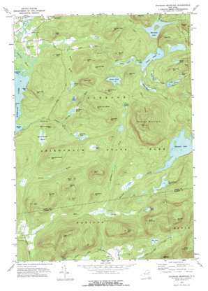
Pharaoh Mountain Topo Map New York
To zoom in, hover over the map of Pharaoh Mountain
USGS Topo Quad 43073g6 - 1:24,000 scale
| Topo Map Name: | Pharaoh Mountain |
| USGS Topo Quad ID: | 43073g6 |
| Print Size: | ca. 21 1/4" wide x 27" high |
| Southeast Coordinates: | 43.75° N latitude / 73.625° W longitude |
| Map Center Coordinates: | 43.8125° N latitude / 73.6875° W longitude |
| U.S. State: | NY |
| Filename: | o43073g6.jpg |
| Download Map JPG Image: | Pharaoh Mountain topo map 1:24,000 scale |
| Map Type: | Topographic |
| Topo Series: | 7.5´ |
| Map Scale: | 1:24,000 |
| Source of Map Images: | United States Geological Survey (USGS) |
| Alternate Map Versions: |
Pharaoh Mountain NY 1973, updated 1976 Download PDF Buy paper map Pharaoh Mountain NY 2010 Download PDF Buy paper map Pharaoh Mountain NY 2013 Download PDF Buy paper map Pharaoh Mountain NY 2016 Download PDF Buy paper map |
1:24,000 Topo Quads surrounding Pharaoh Mountain
> Back to 43073e1 at 1:100,000 scale
> Back to 43072a1 at 1:250,000 scale
> Back to U.S. Topo Maps home
Pharaoh Mountain topo map: Gazetteer
Pharaoh Mountain: Airports
Schroon Lake Airport elevation 252m 826′Pharaoh Mountain: Bays
Lockwood Bay elevation 246m 807′Meadow Cove elevation 246m 807′
Steep Bay elevation 246m 807′
Pharaoh Mountain: Lakes
Alder Pond elevation 328m 1076′Burge Pond elevation 405m 1328′
Chub Pond elevation 304m 997′
Coffee Pond elevation 395m 1295′
Crab Pond elevation 391m 1282′
Crab Pond elevation 321m 1053′
Crane Pond elevation 329m 1079′
Goose Pond elevation 359m 1177′
Gull Pond elevation 350m 1148′
Horseshoe Pond elevation 412m 1351′
Oxshoe Pond elevation 356m 1167′
Pharoah Lake elevation 349m 1145′
Pyramid Lake elevation 296m 971′
Spectacle Pond elevation 353m 1158′
Whortleberry Pond elevation 338m 1108′
Wilcox Pond elevation 302m 990′
Pharaoh Mountain: Streams
Alder Creek elevation 246m 807′Desolate Brook elevation 286m 938′
Pharoah Lake Brook elevation 286m 938′
Platt Brook elevation 250m 820′
Pyramid Brook elevation 296m 971′
Rock Pond Brook elevation 333m 1092′
Shanty Bottom Brook elevation 302m 990′
Wilson Brook elevation 252m 826′
Pharaoh Mountain: Summits
Antwine Hill elevation 510m 1673′Bear Mountain elevation 502m 1646′
Beaver Meadow Hill elevation 367m 1204′
Blue Hill elevation 504m 1653′
Burnt Hill elevation 438m 1437′
Carey Hill elevation 486m 1594′
Desolate Hill elevation 520m 1706′
Franks Hill elevation 508m 1666′
Goose Pond Hill elevation 473m 1551′
Little Stevens elevation 524m 1719′
Meadow Hill elevation 463m 1519′
Number Eight Hill elevation 566m 1856′
Number Eight Mountain elevation 592m 1942′
Number Seven Hill elevation 495m 1624′
Number Six Hill elevation 422m 1384′
Orange Hill elevation 499m 1637′
Owls Head elevation 380m 1246′
Park Mountain elevation 611m 2004′
Pharaoh Mountain elevation 772m 2532′
Pharoah Mountain elevation 772m 2532′
Pine Hill elevation 461m 1512′
Pine Hill elevation 581m 1906′
Plank Bridge Hill elevation 446m 1463′
Ragged Mountain elevation 459m 1505′
Smith and Leland Hill elevation 525m 1722′
Spectacle Pond Hill elevation 494m 1620′
Steep Bay Hill elevation 385m 1263′
Stevens Mountain elevation 659m 2162′
Sucker Hole Hill elevation 410m 1345′
Sugar Hill elevation 347m 1138′
The Dam Hill elevation 404m 1325′
Third Brother elevation 609m 1998′
Wilson Hill elevation 455m 1492′
Pharaoh Mountain: Swamps
Beaver Meadow Marsh elevation 277m 908′Desolate Swamp elevation 350m 1148′
Glidden Marsh elevation 344m 1128′
Harrison Marsh elevation 314m 1030′
Pharaoh Mountain: Trails
Long Swing Trail elevation 357m 1171′Pharoah Mountain Trail elevation 463m 1519′
Spectacle Pond Trail elevation 332m 1089′
Pharaoh Mountain digital topo map on disk
Buy this Pharaoh Mountain topo map showing relief, roads, GPS coordinates and other geographical features, as a high-resolution digital map file on DVD:
New York, Vermont, Connecticut & Western Massachusetts
Buy digital topo maps: New York, Vermont, Connecticut & Western Massachusetts


