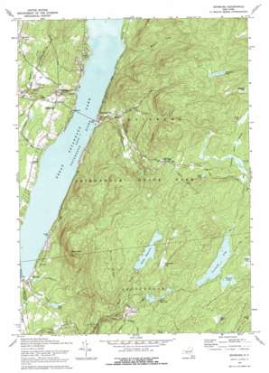
Edinburg Topo Map New York
To zoom in, hover over the map of Edinburg
USGS Topo Quad 43074b1 - 1:24,000 scale
| Topo Map Name: | Edinburg |
| USGS Topo Quad ID: | 43074b1 |
| Print Size: | ca. 21 1/4" wide x 27" high |
| Southeast Coordinates: | 43.125° N latitude / 74° W longitude |
| Map Center Coordinates: | 43.1875° N latitude / 74.0625° W longitude |
| U.S. State: | NY |
| Filename: | o43074b1.jpg |
| Download Map JPG Image: | Edinburg topo map 1:24,000 scale |
| Map Type: | Topographic |
| Topo Series: | 7.5´ |
| Map Scale: | 1:24,000 |
| Source of Map Images: | United States Geological Survey (USGS) |
| Alternate Map Versions: |
Edinburg NY 1945, updated 1962 Download PDF Buy paper map Edinburg NY 1946, updated 1946 Download PDF Buy paper map Edinburg NY 1970, updated 1972 Download PDF Buy paper map Edinburg NY 1970, updated 1978 Download PDF Buy paper map Edinburg NY 1997, updated 2000 Download PDF Buy paper map Edinburg NY 2010 Download PDF Buy paper map Edinburg NY 2013 Download PDF Buy paper map Edinburg NY 2016 Download PDF Buy paper map |
1:24,000 Topo Quads surrounding Edinburg
> Back to 43074a1 at 1:100,000 scale
> Back to 43074a1 at 1:250,000 scale
> Back to U.S. Topo Maps home
Edinburg topo map: Gazetteer
Edinburg: Airports
Circle K Ranch Airport elevation 275m 902′Plateau Sky Ranch elevation 324m 1062′
The Farm Airport elevation 279m 915′
Edinburg: Bridges
Copeland Covered Bridge elevation 251m 823′Edinburg: Lakes
Albia Pond elevation 522m 1712′Johnnycake Lake elevation 517m 1696′
Ronna Pond elevation 473m 1551′
Round Lake elevation 458m 1502′
Edinburg: Populated Places
Batchellerville elevation 239m 784′Clarkville elevation 373m 1223′
Edinburg elevation 271m 889′
Fayville elevation 237m 777′
Fox Hill elevation 460m 1509′
Glenwild elevation 409m 1341′
Edinburg: Reservoirs
Cooks Reservoir elevation 416m 1364′Ireland Vly elevation 452m 1482′
Shew Pond elevation 270m 885′
Steele Reservoir elevation 458m 1502′
Edinburg: Ridges
Maxon Ridge elevation 524m 1719′Edinburg: Streams
Batcheller Creek elevation 235m 770′Beecher Creek elevation 236m 774′
Cloutler Creek elevation 235m 770′
Deming Creek elevation 255m 836′
Fayville Creek elevation 242m 793′
Gordons Creek elevation 235m 770′
Little Hans Creek elevation 458m 1502′
Steele Creek elevation 364m 1194′
West Vly Creek elevation 456m 1496′
Edinburg: Summits
Bald Bluff elevation 500m 1640′Edinburg: Swamps
Blodgett Vly elevation 480m 1574′Loon Vly elevation 502m 1646′
Tamarack Vly elevation 448m 1469′
Thousand Acre Swamp elevation 502m 1646′
Edinburg digital topo map on disk
Buy this Edinburg topo map showing relief, roads, GPS coordinates and other geographical features, as a high-resolution digital map file on DVD:
New York, Vermont, Connecticut & Western Massachusetts
Buy digital topo maps: New York, Vermont, Connecticut & Western Massachusetts


