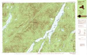
Sabael Topo Map New York
To zoom in, hover over the map of Sabael
USGS Topo Quad 43074f3 - 1:25,000 scale
| Topo Map Name: | Sabael |
| USGS Topo Quad ID: | 43074f3 |
| Print Size: | ca. 39" wide x 24" high |
| Southeast Coordinates: | 43.625° N latitude / 74.25° W longitude |
| Map Center Coordinates: | 43.6875° N latitude / 74.375° W longitude |
| U.S. State: | NY |
| Filename: | k43074f3.jpg |
| Download Map JPG Image: | Sabael topo map 1:25,000 scale |
| Map Type: | Topographic |
| Topo Series: | 7.5´x15´ |
| Map Scale: | 1:25,000 |
| Source of Map Images: | United States Geological Survey (USGS) |
| Alternate Map Versions: |
Indian Lake NY 1990, updated 1990 Download PDF Buy paper map Indian Lake NY 1997, updated 1999 Download PDF Buy paper map |
1:24,000 Topo Quads surrounding Sabael
> Back to 43074e1 at 1:100,000 scale
> Back to 43074a1 at 1:250,000 scale
> Back to U.S. Topo Maps home
Sabael topo map: Gazetteer
Sabael: Bays
John Mack Bay elevation 503m 1650′Sabael: Capes
Poplar Point elevation 504m 1653′Sabael: Channels
The Narrows elevation 503m 1650′Sabael: Dams
Wakely Dam elevation 642m 2106′Sabael: Islands
Camp Island elevation 506m 1660′Crotched Pond Island elevation 511m 1676′
Doherty Island elevation 503m 1650′
Green Island elevation 503m 1650′
Kirpens Island elevation 509m 1669′
Long Island elevation 514m 1686′
Moose Island elevation 512m 1679′
Sabael: Lakes
Brown Pond elevation 919m 3015′Carry Pond elevation 653m 2142′
Crotched Pond elevation 555m 1820′
Jerry Pond elevation 503m 1650′
John Mack Pond elevation 532m 1745′
Lewey Lake elevation 503m 1650′
Long Pond elevation 567m 1860′
Rock Pond elevation 569m 1866′
Round Pond elevation 566m 1856′
Wakely Pond elevation 648m 2125′
Sabael: Populated Places
Sabael elevation 532m 1745′Sabael: Reservoirs
Cedar River Flow elevation 636m 2086′Sabael: Ridges
Blue Ridge elevation 1127m 3697′Long Pond Ridge elevation 680m 2230′
Sabael: Streams
Beaver Brook elevation 503m 1650′Buell Brook elevation 642m 2106′
Cellar Brook elevation 498m 1633′
Colvin Brook elevation 654m 2145′
Cosgrove Brook elevation 659m 2162′
Dillon Brook elevation 670m 2198′
Doherty Brook elevation 503m 1650′
Falls Brook elevation 503m 1650′
Forks Brook elevation 504m 1653′
Griffin Brook elevation 511m 1676′
John Mack Brook elevation 503m 1650′
Little Squaw Brook elevation 642m 2106′
Lowrence Brook elevation 503m 1650′
McGinn Brook elevation 509m 1669′
Miami River elevation 503m 1650′
Payne Brook elevation 642m 2106′
Pease Brook elevation 503m 1650′
Squaw Brook elevation 503m 1650′
Sucker Brook elevation 504m 1653′
Willow Brook elevation 507m 1663′
Wilson Brook elevation 642m 2106′
Woodland Brook elevation 505m 1656′
Sabael: Summits
Baldface Mountain elevation 680m 2230′Buck Mountain elevation 1020m 3346′
Buell Mountain elevation 1113m 3651′
Cellar Mountain elevation 1001m 3284′
Crotched Pond Mountain elevation 846m 2775′
Driftwood Mountain elevation 653m 2142′
Gates Hill elevation 613m 2011′
Hemlock Cobble elevation 623m 2043′
Kunjamuk Mountain elevation 905m 2969′
Lewey Mountain elevation 1117m 3664′
Little Hardwood Hill elevation 655m 2148′
Moose Mountain elevation 711m 2332′
Onion Hill elevation 883m 2896′
Panther Mountain elevation 1147m 3763′
Payne Mountain elevation 970m 3182′
Petes Hill elevation 648m 2125′
Pine Hill elevation 635m 2083′
Pine Peak elevation 655m 2148′
Porter Mountain elevation 763m 2503′
Snowy Mountain elevation 1166m 3825′
Squaw Mountain elevation 981m 3218′
Sturges Hills elevation 750m 2460′
Water Barrel Mountain elevation 752m 2467′
Windfall Hill elevation 693m 2273′
Sabael: Trails
Sucker Brook Trail elevation 877m 2877′Sabael digital topo map on disk
Buy this Sabael topo map showing relief, roads, GPS coordinates and other geographical features, as a high-resolution digital map file on DVD:
New York, Vermont, Connecticut & Western Massachusetts
Buy digital topo maps: New York, Vermont, Connecticut & Western Massachusetts


