South Trenton Topo Map New York
To zoom in, hover over the map of South Trenton
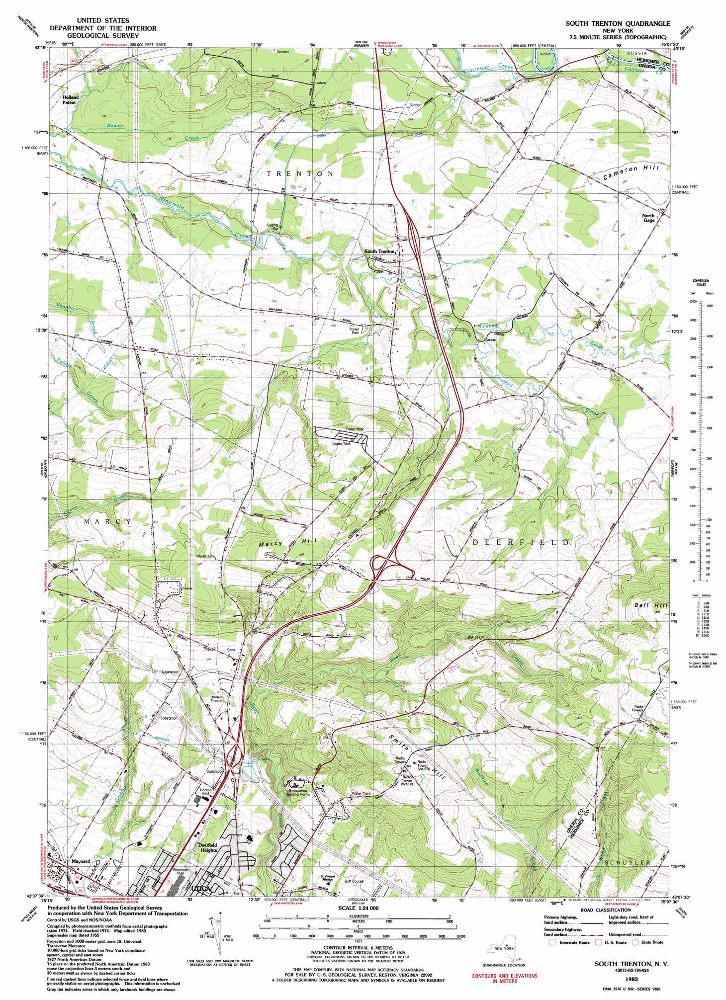
USGS Topo Quad 43075b2 - 1:24,000 scale
| Topo Map Name: | South Trenton |
| USGS Topo Quad ID: | 43075b2 |
| Print Size: | ca. 21 1/4" wide x 27" high |
| Southeast Coordinates: | 43.125° N latitude / 75.125° W longitude |
| Map Center Coordinates: | 43.1875° N latitude / 75.1875° W longitude |
| U.S. State: | NY |
| Filename: | o43075b2.jpg |
| Download Map JPG Image: | South Trenton topo map 1:24,000 scale |
| Map Type: | Topographic |
| Topo Series: | 7.5´ |
| Map Scale: | 1:24,000 |
| Source of Map Images: | United States Geological Survey (USGS) |
| Alternate Map Versions: |
South Trenton NY 1955, updated 1957 Download PDF Buy paper map South Trenton NY 1955, updated 1967 Download PDF Buy paper map South Trenton NY 1983, updated 1983 Download PDF Buy paper map South Trenton NY 2010 Download PDF Buy paper map South Trenton NY 2013 Download PDF Buy paper map South Trenton NY 2016 Download PDF Buy paper map |
1:24,000 Topo Quads surrounding South Trenton
West Leyden |
Boonville |
Forestport |
North Wilmurt |
|
Westernville |
North Western |
Remsen |
Hinckley |
|
Rome |
Oriskany |
South Trenton |
Newport |
Middleville |
Clinton |
Utica West |
Utica East |
Ilion |
Herkimer |
Oriskany Falls |
Cassville |
West Winfield |
Millers Mills |
Jordanville |
> Back to 43075a1 at 1:100,000 scale
> Back to 43074a1 at 1:250,000 scale
> Back to U.S. Topo Maps home
South Trenton topo map: Gazetteer
South Trenton: Capes
Wood Point elevation 240m 787′South Trenton: Populated Places
Deerfield Heights elevation 158m 518′Green Acres elevation 350m 1148′
North Gage elevation 296m 971′
South Trenton elevation 244m 800′
South Trenton: Reservoirs
Utica Reservoir elevation 210m 688′South Trenton: Streams
Cincinnati Creek elevation 216m 708′Crooked Brook elevation 243m 797′
South Trenton: Summits
Cameron Hill elevation 305m 1000′Marcy Hill elevation 391m 1282′
Smith Hill elevation 367m 1204′
South Trenton digital topo map on disk
Buy this South Trenton topo map showing relief, roads, GPS coordinates and other geographical features, as a high-resolution digital map file on DVD:
New York, Vermont, Connecticut & Western Massachusetts
Buy digital topo maps: New York, Vermont, Connecticut & Western Massachusetts