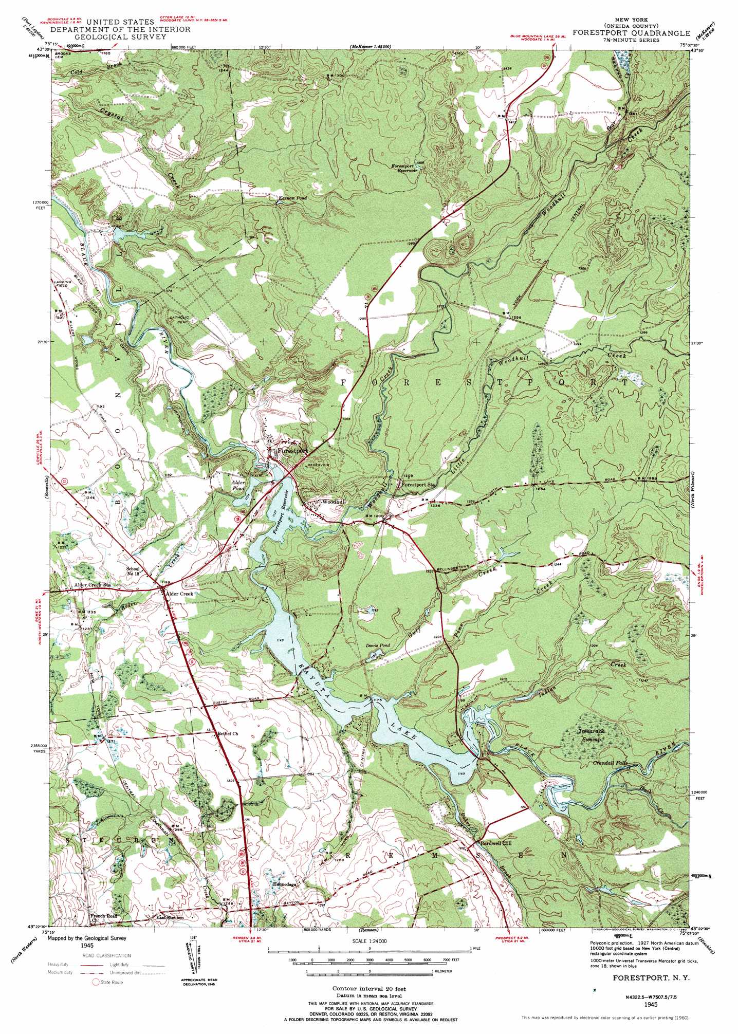
Forestport Topo Map New York
To zoom in, hover over the map of Forestport
USGS Topo Quad 43075d2 - 1:24,000 scale
| Topo Map Name: | Forestport |
| USGS Topo Quad ID: | 43075d2 |
| Print Size: | ca. 21 1/4" wide x 27" high |
| Southeast Coordinates: | 43.375° N latitude / 75.125° W longitude |
| Map Center Coordinates: | 43.4375° N latitude / 75.1875° W longitude |
| U.S. State: | NY |
| Filename: | o43075d2.jpg |
| Download Map JPG Image: | Forestport topo map 1:24,000 scale |
| Map Type: | Topographic |
| Topo Series: | 7.5´ |
| Map Scale: | 1:24,000 |
| Source of Map Images: | United States Geological Survey (USGS) |
| Alternate Map Versions: |
Forestport NY 1945, updated 1958 Download PDF Buy paper map Forestport NY 1945, updated 1960 Download PDF Buy paper map Forestport NY 1945, updated 1960 Download PDF Buy paper map Forestport NY 1945, updated 1960 Download PDF Buy paper map Forestport NY 2010 Download PDF Buy paper map Forestport NY 2013 Download PDF Buy paper map Forestport NY 2016 Download PDF Buy paper map |
1:24,000 Topo Quads surrounding Forestport
Glenfield |
Brantingham |
Thendara |
||
Constableville |
Port Leyden |
Otter Lake |
||
West Leyden |
Boonville |
Forestport |
North Wilmurt |
|
Westernville |
North Western |
Remsen |
Hinckley |
|
Rome |
Oriskany |
South Trenton |
Newport |
Middleville |
> Back to 43075a1 at 1:100,000 scale
> Back to 43074a1 at 1:250,000 scale
> Back to U.S. Topo Maps home
Forestport topo map: Gazetteer
Forestport: Airports
Boonville Incorporated Airport elevation 355m 1164′Forestport: Falls
Crandall Falls elevation 360m 1181′Forestport: Lakes
Alder Pond elevation 342m 1122′Kernan Pond elevation 365m 1197′
Muskrat Lake elevation 394m 1292′
Forestport: Populated Places
Alder Creek elevation 364m 1194′East Steuben elevation 397m 1302′
Forestport elevation 342m 1122′
Honnedaga elevation 376m 1233′
Woodhull elevation 349m 1145′
Forestport: Reservoirs
Davis Pond elevation 359m 1177′Forestport Reservoir elevation 338m 1108′
Forestport Reservoir elevation 397m 1302′
Kayuta Lake elevation 343m 1125′
Forestport: Streams
Alder Creek elevation 348m 1141′Baker Brook elevation 348m 1141′
Bear Creek elevation 390m 1279′
Gulf Creek elevation 349m 1145′
Indian Creek elevation 349m 1145′
Little Black Creek elevation 350m 1148′
Little Woodhull Creek elevation 347m 1138′
Muskrat Creek elevation 385m 1263′
Pine Creek elevation 348m 1141′
Woodhull Creek elevation 343m 1125′
Forestport: Swamps
Tamarack Swamp elevation 369m 1210′Forestport digital topo map on disk
Buy this Forestport topo map showing relief, roads, GPS coordinates and other geographical features, as a high-resolution digital map file on DVD:
New York, Vermont, Connecticut & Western Massachusetts
Buy digital topo maps: New York, Vermont, Connecticut & Western Massachusetts