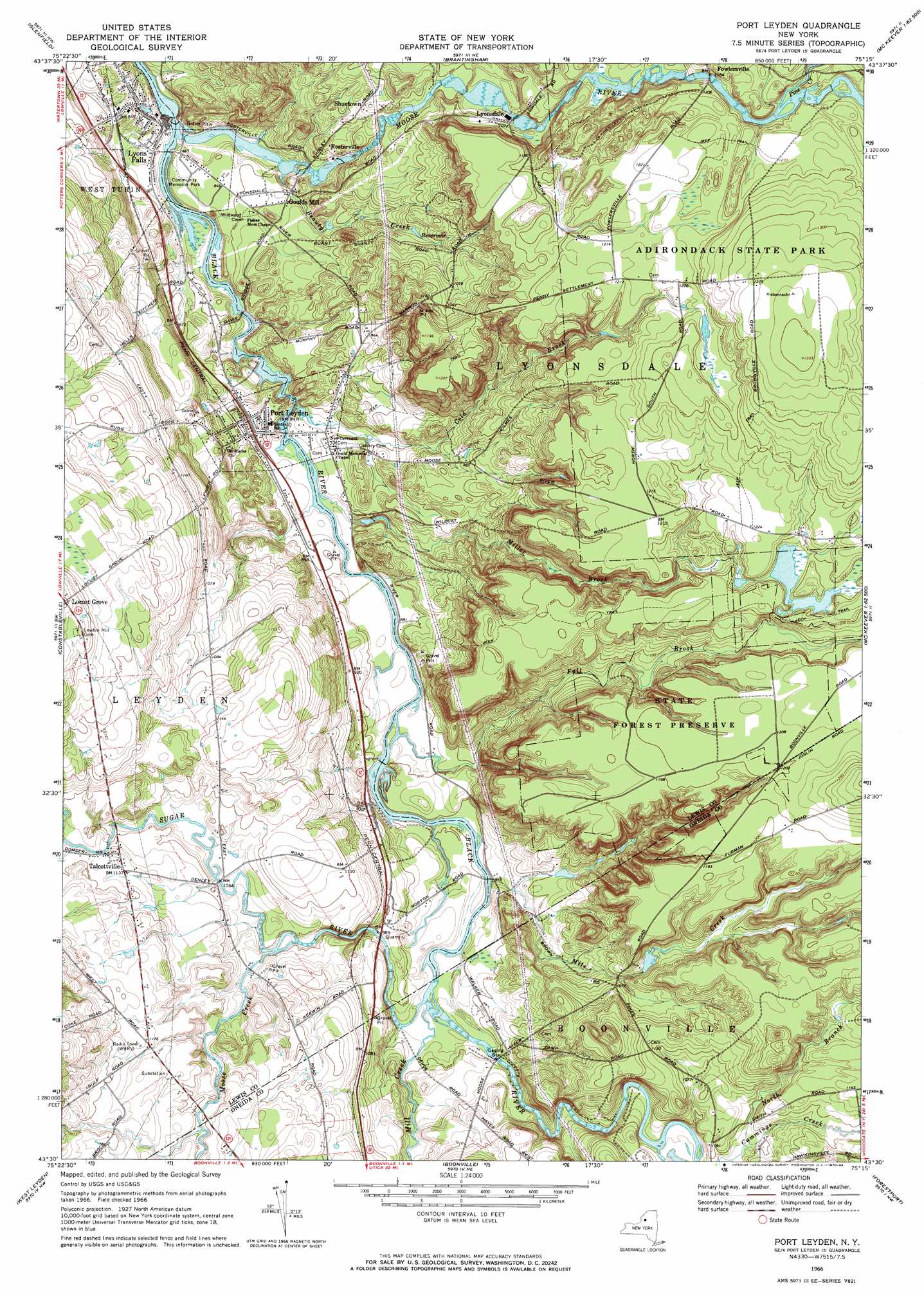
Port Leyden Topo Map New York
To zoom in, hover over the map of Port Leyden
USGS Topo Quad 43075e3 - 1:24,000 scale
| Topo Map Name: | Port Leyden |
| USGS Topo Quad ID: | 43075e3 |
| Print Size: | ca. 21 1/4" wide x 27" high |
| Southeast Coordinates: | 43.5° N latitude / 75.25° W longitude |
| Map Center Coordinates: | 43.5625° N latitude / 75.3125° W longitude |
| U.S. State: | NY |
| Filename: | o43075e3.jpg |
| Download Map JPG Image: | Port Leyden topo map 1:24,000 scale |
| Map Type: | Topographic |
| Topo Series: | 7.5´ |
| Map Scale: | 1:24,000 |
| Source of Map Images: | United States Geological Survey (USGS) |
| Alternate Map Versions: |
Port Leyden NY 1966, updated 1970 Download PDF Buy paper map Port Leyden NY 1966, updated 1984 Download PDF Buy paper map Port Leyden NY 2010 Download PDF Buy paper map Port Leyden NY 2013 Download PDF Buy paper map Port Leyden NY 2016 Download PDF Buy paper map |
1:24,000 Topo Quads surrounding Port Leyden
West Lowville |
Lowville |
Crystal Dale |
Stillwater Mountain |
|
Page |
Glenfield |
Brantingham |
Thendara |
|
High Market |
Constableville |
Port Leyden |
Otter Lake |
|
Point Rock |
West Leyden |
Boonville |
Forestport |
North Wilmurt |
Lee Center |
Westernville |
North Western |
Remsen |
Hinckley |
> Back to 43075e1 at 1:100,000 scale
> Back to 43074a1 at 1:250,000 scale
> Back to U.S. Topo Maps home
Port Leyden topo map: Gazetteer
Port Leyden: Populated Places
Fowlersville elevation 356m 1167′Goulds Mill elevation 263m 862′
Kosterville elevation 286m 938′
Locust Grove elevation 413m 1354′
Lyonsdale elevation 325m 1066′
Maple Lane Mobile Home Park elevation 282m 925′
Port Leyden elevation 272m 892′
Shuetown elevation 295m 967′
Talcottville elevation 346m 1135′
Port Leyden: Streams
Beauty Creek elevation 246m 807′Cold Brook elevation 260m 853′
Fall Brook elevation 265m 869′
Mile Creek elevation 271m 889′
Mill Creek elevation 277m 908′
Miller Brook elevation 265m 869′
Moose Creek elevation 310m 1017′
Moose River elevation 244m 800′
North Branch Cummings Creek elevation 314m 1030′
Pine Creek elevation 359m 1177′
Sugar River elevation 277m 908′
Port Leyden digital topo map on disk
Buy this Port Leyden topo map showing relief, roads, GPS coordinates and other geographical features, as a high-resolution digital map file on DVD:
New York, Vermont, Connecticut & Western Massachusetts
Buy digital topo maps: New York, Vermont, Connecticut & Western Massachusetts