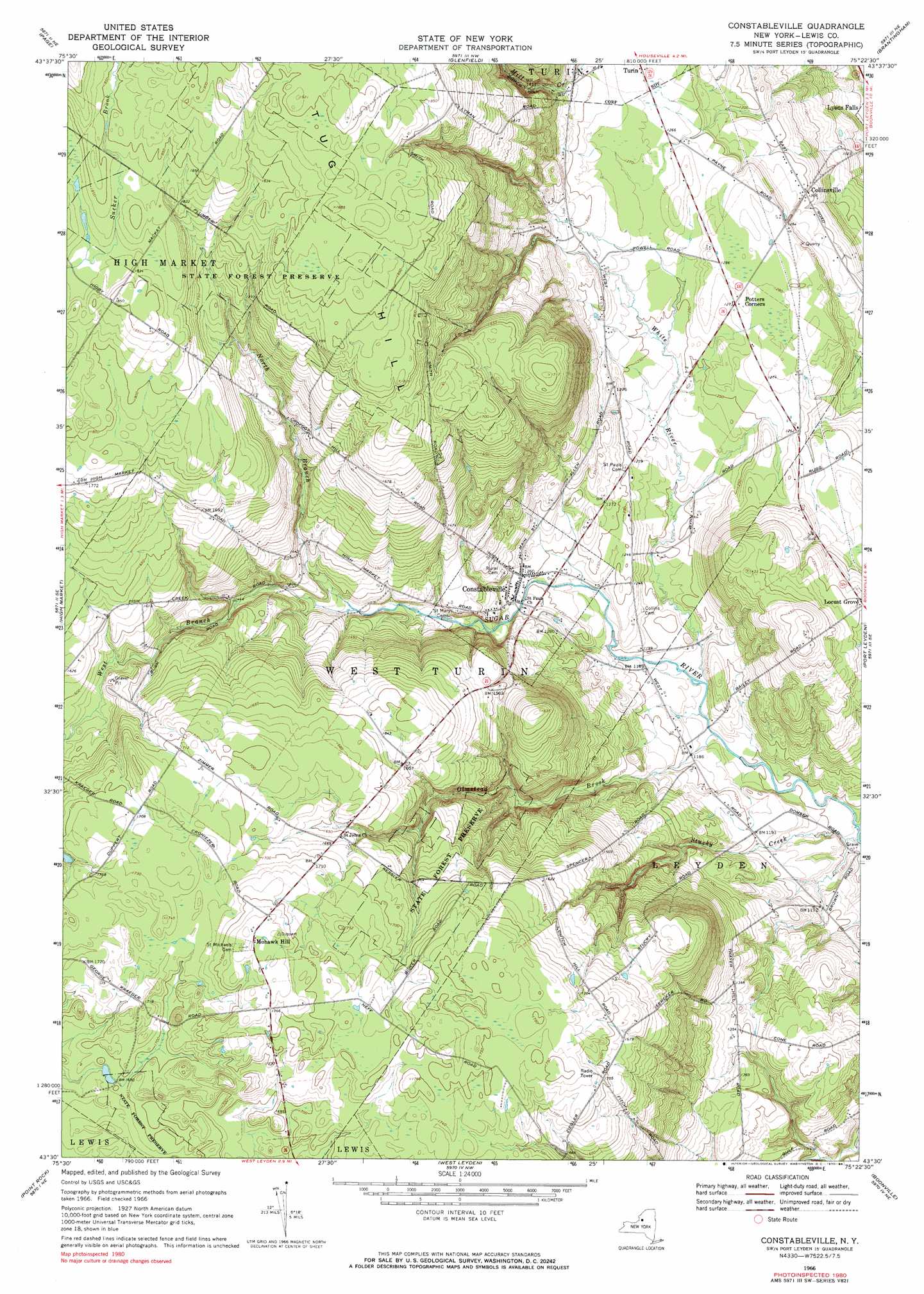
Constableville Topo Map New York
To zoom in, hover over the map of Constableville
USGS Topo Quad 43075e4 - 1:24,000 scale
| Topo Map Name: | Constableville |
| USGS Topo Quad ID: | 43075e4 |
| Print Size: | ca. 21 1/4" wide x 27" high |
| Southeast Coordinates: | 43.5° N latitude / 75.375° W longitude |
| Map Center Coordinates: | 43.5625° N latitude / 75.4375° W longitude |
| U.S. State: | NY |
| Filename: | o43075e4.jpg |
| Download Map JPG Image: | Constableville topo map 1:24,000 scale |
| Map Type: | Topographic |
| Topo Series: | 7.5´ |
| Map Scale: | 1:24,000 |
| Source of Map Images: | United States Geological Survey (USGS) |
| Alternate Map Versions: |
Constableville NY 1966, updated 1970 Download PDF Buy paper map Constableville NY 1966, updated 1984 Download PDF Buy paper map Constableville NY 2010 Download PDF Buy paper map Constableville NY 2013 Download PDF Buy paper map Constableville NY 2016 Download PDF Buy paper map |
1:24,000 Topo Quads surrounding Constableville
New Boston |
West Lowville |
Lowville |
Crystal Dale |
|
Sears Pond |
Page |
Glenfield |
Brantingham |
|
North Osceola |
High Market |
Constableville |
Port Leyden |
|
Florence |
Point Rock |
West Leyden |
Boonville |
Forestport |
Camden East |
Lee Center |
Westernville |
North Western |
Remsen |
> Back to 43075e1 at 1:100,000 scale
> Back to 43074a1 at 1:250,000 scale
> Back to U.S. Topo Maps home
Constableville topo map: Gazetteer
Constableville: Populated Places
Collinsville elevation 368m 1207′Constableville elevation 385m 1263′
Mohawk Hill elevation 542m 1778′
Constableville: Streams
North Branch Sugar River elevation 412m 1351′Olmstead Brook elevation 351m 1151′
Stucky Creek elevation 342m 1122′
West Branch Sugar River elevation 411m 1348′
White River elevation 355m 1164′
Constableville: Summits
Tug Hill elevation 585m 1919′Constableville digital topo map on disk
Buy this Constableville topo map showing relief, roads, GPS coordinates and other geographical features, as a high-resolution digital map file on DVD:
New York, Vermont, Connecticut & Western Massachusetts
Buy digital topo maps: New York, Vermont, Connecticut & Western Massachusetts