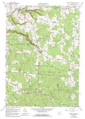
Barnes Corners Topo Map New York
To zoom in, hover over the map of Barnes Corners
USGS Topo Quad 43075g7 - 1:24,000 scale
| Topo Map Name: | Barnes Corners |
| USGS Topo Quad ID: | 43075g7 |
| Print Size: | ca. 21 1/4" wide x 27" high |
| Southeast Coordinates: | 43.75° N latitude / 75.75° W longitude |
| Map Center Coordinates: | 43.8125° N latitude / 75.8125° W longitude |
| U.S. State: | NY |
| Filename: | o43075g7.jpg |
| Download Map JPG Image: | Barnes Corners topo map 1:24,000 scale |
| Map Type: | Topographic |
| Topo Series: | 7.5´ |
| Map Scale: | 1:24,000 |
| Source of Map Images: | United States Geological Survey (USGS) |
| Alternate Map Versions: |
Barnes Corners NY 1943, updated 1957 Download PDF Buy paper map Barnes Corners NY 1959, updated 1961 Download PDF Buy paper map Barnes Corners NY 1959, updated 1971 Download PDF Buy paper map Barnes Corners NY 1959, updated 1992 Download PDF Buy paper map Barnes Corners NY 2010 Download PDF Buy paper map Barnes Corners NY 2013 Download PDF Buy paper map Barnes Corners NY 2016 Download PDF Buy paper map |
1:24,000 Topo Quads surrounding Barnes Corners
> Back to 43075e1 at 1:100,000 scale
> Back to 43074a1 at 1:250,000 scale
> Back to U.S. Topo Maps home
Barnes Corners topo map: Gazetteer
Barnes Corners: Populated Places
Barnes Corners elevation 430m 1410′East Rodman elevation 286m 938′
Barnes Corners: Streams
Denning Creek elevation 428m 1404′Pigeon Creek elevation 482m 1581′
West Branch Deer River elevation 485m 1591′
Barnes Corners: Valleys
Bear Gulf elevation 283m 928′Shingle Gulf elevation 264m 866′
Barnes Corners digital topo map on disk
Buy this Barnes Corners topo map showing relief, roads, GPS coordinates and other geographical features, as a high-resolution digital map file on DVD:
New York, Vermont, Connecticut & Western Massachusetts
Buy digital topo maps: New York, Vermont, Connecticut & Western Massachusetts


