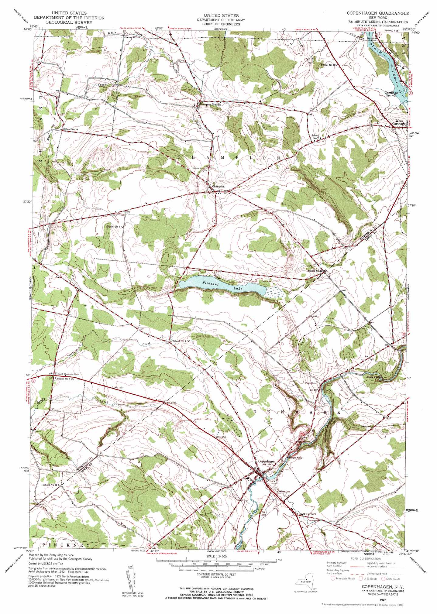
Copenhagen Topo Map New York
To zoom in, hover over the map of Copenhagen
USGS Topo Quad 43075h6 - 1:24,000 scale
| Topo Map Name: | Copenhagen |
| USGS Topo Quad ID: | 43075h6 |
| Print Size: | ca. 21 1/4" wide x 27" high |
| Southeast Coordinates: | 43.875° N latitude / 75.625° W longitude |
| Map Center Coordinates: | 43.9375° N latitude / 75.6875° W longitude |
| U.S. State: | NY |
| Filename: | o43075h6.jpg |
| Download Map JPG Image: | Copenhagen topo map 1:24,000 scale |
| Map Type: | Topographic |
| Topo Series: | 7.5´ |
| Map Scale: | 1:24,000 |
| Source of Map Images: | United States Geological Survey (USGS) |
| Alternate Map Versions: |
Copenhagen NY 1942, updated 1960 Download PDF Buy paper map Copenhagen NY 1942, updated 1960 Download PDF Buy paper map Copenhagen NY 2010 Download PDF Buy paper map Copenhagen NY 2013 Download PDF Buy paper map Copenhagen NY 2016 Download PDF Buy paper map |
1:24,000 Topo Quads surrounding Copenhagen
La Fargeville |
Theresa |
Philadelphia |
Antwerp |
Lake Bonaparte |
Brownville |
Black River |
Deferiet |
North Wilna |
Natural Bridge |
Watertown |
Rutland Center |
Copenhagen |
Carthage |
Croghan |
Rodman |
Barnes Corners |
New Boston |
West Lowville |
Lowville |
Boylston Center |
Worth Center |
Sears Pond |
Page |
Glenfield |
> Back to 43075e1 at 1:100,000 scale
> Back to 43074a1 at 1:250,000 scale
> Back to U.S. Topo Maps home
Copenhagen topo map: Gazetteer
Copenhagen: Falls
High Falls elevation 327m 1072′Kings Falls elevation 258m 846′
Copenhagen: Lakes
Pleasant Lake elevation 326m 1069′Copenhagen: Populated Places
Champion elevation 304m 997′Clark Corners elevation 366m 1200′
Copenhagen elevation 355m 1164′
Copenhagen: Streams
Huddle Creek elevation 211m 692′Mill Creek elevation 213m 698′
Copenhagen digital topo map on disk
Buy this Copenhagen topo map showing relief, roads, GPS coordinates and other geographical features, as a high-resolution digital map file on DVD:
New York, Vermont, Connecticut & Western Massachusetts
Buy digital topo maps: New York, Vermont, Connecticut & Western Massachusetts