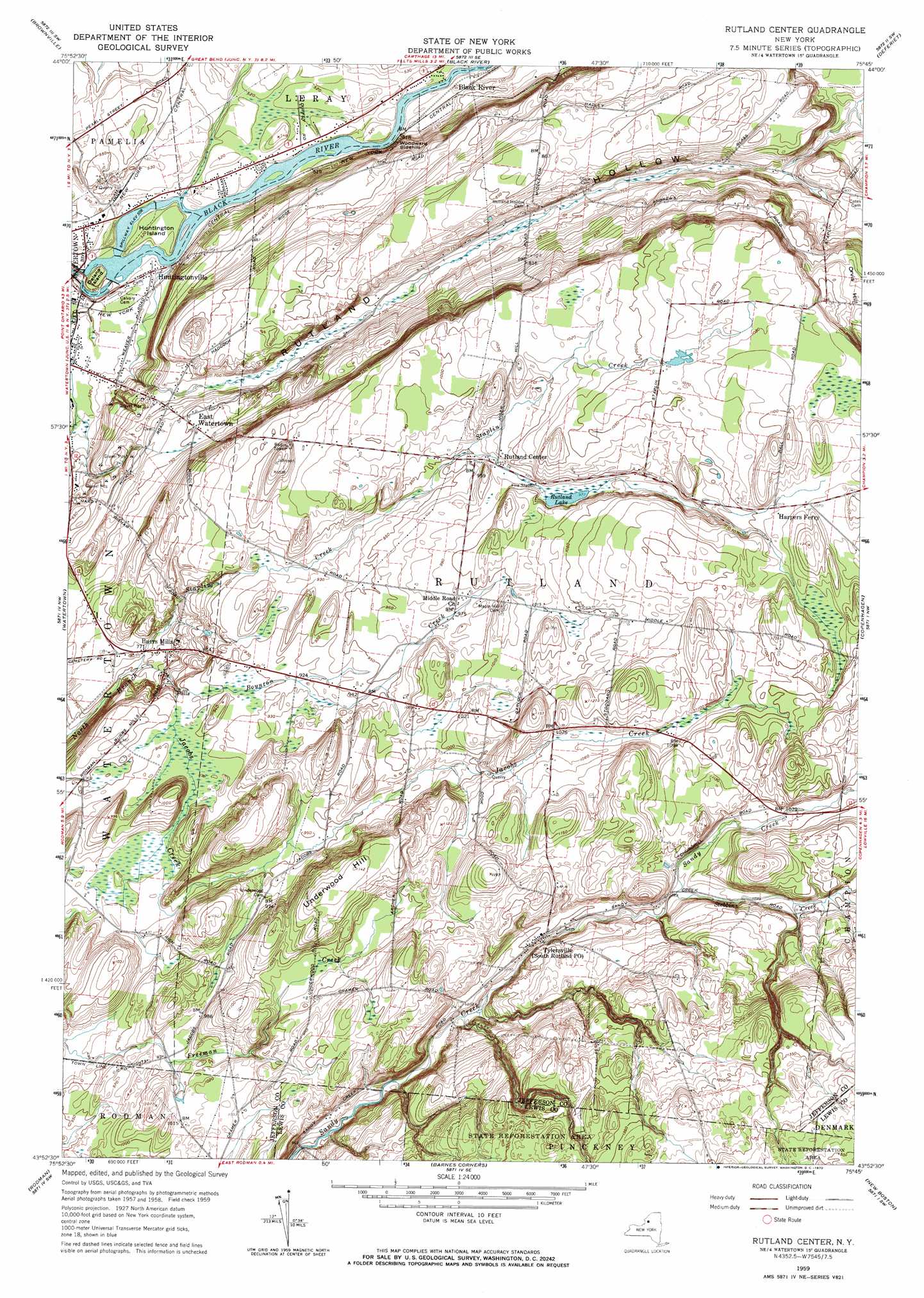
Rutland Center Topo Map New York
To zoom in, hover over the map of Rutland Center
USGS Topo Quad 43075h7 - 1:24,000 scale
| Topo Map Name: | Rutland Center |
| USGS Topo Quad ID: | 43075h7 |
| Print Size: | ca. 21 1/4" wide x 27" high |
| Southeast Coordinates: | 43.875° N latitude / 75.75° W longitude |
| Map Center Coordinates: | 43.9375° N latitude / 75.8125° W longitude |
| U.S. State: | NY |
| Filename: | o43075h7.jpg |
| Download Map JPG Image: | Rutland Center topo map 1:24,000 scale |
| Map Type: | Topographic |
| Topo Series: | 7.5´ |
| Map Scale: | 1:24,000 |
| Source of Map Images: | United States Geological Survey (USGS) |
| Alternate Map Versions: |
South Rutland NY 1943, updated 1954 Download PDF Buy paper map Rutland Center NY 1959, updated 1960 Download PDF Buy paper map Rutland Center NY 1959, updated 1970 Download PDF Buy paper map Rutland Center NY 2010 Download PDF Buy paper map Rutland Center NY 2013 Download PDF Buy paper map Rutland Center NY 2016 Download PDF Buy paper map |
1:24,000 Topo Quads surrounding Rutland Center
Clayton |
La Fargeville |
Theresa |
Philadelphia |
Antwerp |
Dexter |
Brownville |
Black River |
Deferiet |
North Wilna |
Sackets Harbor |
Watertown |
Rutland Center |
Copenhagen |
Carthage |
Adams |
Rodman |
Barnes Corners |
New Boston |
West Lowville |
Sandy Creek |
Boylston Center |
Worth Center |
Sears Pond |
Page |
> Back to 43075e1 at 1:100,000 scale
> Back to 43074a1 at 1:250,000 scale
> Back to U.S. Topo Maps home
Rutland Center topo map: Gazetteer
Rutland Center: Cliffs
Woodward Sidehill elevation 177m 580′Rutland Center: Islands
Delano Island elevation 160m 524′Huntington Island elevation 159m 521′
Rutland Center: Lakes
Rutland Lake elevation 298m 977′Rutland Center: Mines
Watertown Quarry elevation 165m 541′Rutland Center: Populated Places
Burrs Mills elevation 240m 787′East Watertown elevation 231m 757′
Huntingtonville elevation 158m 518′
Rutland Center elevation 295m 967′
Tylersville elevation 320m 1049′
Rutland Center: Streams
Boynton Creek elevation 255m 836′Jacobs Creek elevation 231m 757′
Staplin Creek elevation 236m 774′
Stebbins Creek elevation 320m 1049′
Rutland Center: Summits
Orvis Hill elevation 299m 980′Underwood Hill elevation 348m 1141′
Rutland Center: Valleys
Rutland Hollow elevation 207m 679′Rutland Center digital topo map on disk
Buy this Rutland Center topo map showing relief, roads, GPS coordinates and other geographical features, as a high-resolution digital map file on DVD:
New York, Vermont, Connecticut & Western Massachusetts
Buy digital topo maps: New York, Vermont, Connecticut & Western Massachusetts