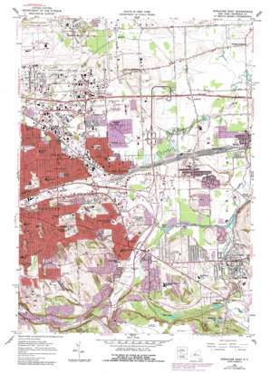
Syracuse East Topo Map New York
To zoom in, hover over the map of Syracuse East
USGS Topo Quad 43076a1 - 1:24,000 scale
| Topo Map Name: | Syracuse East |
| USGS Topo Quad ID: | 43076a1 |
| Print Size: | ca. 21 1/4" wide x 27" high |
| Southeast Coordinates: | 43° N latitude / 76° W longitude |
| Map Center Coordinates: | 43.0625° N latitude / 76.0625° W longitude |
| U.S. State: | NY |
| Filename: | o43076a1.jpg |
| Download Map JPG Image: | Syracuse East topo map 1:24,000 scale |
| Map Type: | Topographic |
| Topo Series: | 7.5´ |
| Map Scale: | 1:24,000 |
| Source of Map Images: | United States Geological Survey (USGS) |
| Alternate Map Versions: |
Syracuse East NY 1938 Download PDF Buy paper map Syracuse East NY 1938, updated 1953 Download PDF Buy paper map Syracuse East NY 1957, updated 1959 Download PDF Buy paper map Syracuse East NY 1957, updated 1962 Download PDF Buy paper map Syracuse East NY 1957, updated 1962 Download PDF Buy paper map Syracuse East NY 1957, updated 1979 Download PDF Buy paper map Syracuse East NY 1977, updated 1978 Download PDF Buy paper map Syracuse East NY 2010 Download PDF Buy paper map Syracuse East NY 2013 Download PDF Buy paper map Syracuse East NY 2016 Download PDF Buy paper map |
1:24,000 Topo Quads surrounding Syracuse East
> Back to 43076a1 at 1:100,000 scale
> Back to 43076a1 at 1:250,000 scale
> Back to U.S. Topo Maps home
Syracuse East topo map: Gazetteer
Syracuse East: Airports
Syracuse Hancock International Airport elevation 125m 410′Syracuse East: Bridges
Ratnour Bridge elevation 129m 423′Syracuse East: Canals
Jamesville Canal elevation 131m 429′Syracuse East: Crossings
Interchange 35 elevation 129m 423′Syracuse East: Lakes
Cedar Bay elevation 128m 419′Evergreen Lake elevation 179m 587′
Lost Lake elevation 182m 597′
Snooks Pond elevation 160m 524′
White Lake elevation 167m 547′
Syracuse East: Mines
Jamesville Rock Quarry elevation 218m 715′Syracuse East: Parks
Chappell Field elevation 144m 472′Doctor James P Burlingham Memorial Park elevation 150m 492′
Hennessy Field elevation 128m 419′
Huntington Beard Memorial Park elevation 164m 538′
Rockwell Baseball Field elevation 172m 564′
Sunnycrest Park elevation 150m 492′
Upper Athletic Fields elevation 152m 498′
Westminster Park elevation 208m 682′
Syracuse East: Populated Places
Cliffside Trailer Park elevation 176m 577′Collamer elevation 139m 456′
DeWitt elevation 142m 465′
East Syracuse elevation 132m 433′
Eastwood elevation 147m 482′
Fayetteville elevation 163m 534′
Foland Trailer Park elevation 118m 387′
Franklin Park elevation 123m 403′
High Bridge elevation 158m 518′
Lyndon elevation 140m 459′
Lyndon elevation 155m 508′
Minoa elevation 126m 413′
Oot Park elevation 145m 475′
Polkville elevation 123m 403′
Schepps Corners elevation 126m 413′
Skytop elevation 176m 577′
Syracuse East: Streams
Bishop Brook elevation 128m 419′Meadow Brook elevation 130m 426′
North Branch Ley Creek elevation 115m 377′
Sanders Creek elevation 116m 380′
South Branch Ley Creek elevation 115m 377′
Syracuse East: Summits
Clark Hill elevation 160m 524′Syracuse East: Valleys
Rams Gulch elevation 139m 456′Syracuse East digital topo map on disk
Buy this Syracuse East topo map showing relief, roads, GPS coordinates and other geographical features, as a high-resolution digital map file on DVD:
New York, Vermont, Connecticut & Western Massachusetts
Buy digital topo maps: New York, Vermont, Connecticut & Western Massachusetts


