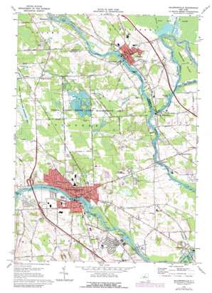
Baldwinsville Topo Map New York
To zoom in, hover over the map of Baldwinsville
USGS Topo Quad 43076b3 - 1:24,000 scale
| Topo Map Name: | Baldwinsville |
| USGS Topo Quad ID: | 43076b3 |
| Print Size: | ca. 21 1/4" wide x 27" high |
| Southeast Coordinates: | 43.125° N latitude / 76.25° W longitude |
| Map Center Coordinates: | 43.1875° N latitude / 76.3125° W longitude |
| U.S. State: | NY |
| Filename: | o43076b3.jpg |
| Download Map JPG Image: | Baldwinsville topo map 1:24,000 scale |
| Map Type: | Topographic |
| Topo Series: | 7.5´ |
| Map Scale: | 1:24,000 |
| Source of Map Images: | United States Geological Survey (USGS) |
| Alternate Map Versions: |
Baldwinsville NY 1948 Download PDF Buy paper map Baldwinsville NY 1957, updated 1959 Download PDF Buy paper map Baldwinsville NY 1957, updated 1965 Download PDF Buy paper map Baldwinsville NY 1973, updated 1974 Download PDF Buy paper map Baldwinsville NY 1973, updated 1978 Download PDF Buy paper map Baldwinsville NY 1973, updated 1978 Download PDF Buy paper map Baldwinsville NY 2010 Download PDF Buy paper map Baldwinsville NY 2013 Download PDF Buy paper map Baldwinsville NY 2016 Download PDF Buy paper map |
1:24,000 Topo Quads surrounding Baldwinsville
> Back to 43076a1 at 1:100,000 scale
> Back to 43076a1 at 1:250,000 scale
> Back to U.S. Topo Maps home
Baldwinsville topo map: Gazetteer
Baldwinsville: Airports
Rabbit Lane Airport elevation 122m 400′Baldwinsville: Canals
Big Ben Cut elevation 110m 360′Baldwinsville: Dams
Lock Number 1 elevation 110m 360′Lock Number 24 elevation 113m 370′
Baldwinsville: Islands
Bonsted Island elevation 112m 367′Fobes Island elevation 112m 367′
Horseshoe Island elevation 112m 367′
Treasure Island elevation 109m 357′
Walter Island elevation 118m 387′
Baldwinsville: Parks
Three Rivers State Wildlife Management Area elevation 125m 410′Baldwinsville: Populated Places
Baldwinsville elevation 116m 380′Belgium elevation 115m 377′
Cold Springs elevation 125m 410′
Hinmansville elevation 115m 377′
Lamson elevation 122m 400′
Lysander New Community elevation 137m 449′
Moyers Corners elevation 123m 403′
Phoenix elevation 113m 370′
Radisson elevation 125m 410′
Red Rock elevation 114m 374′
Three Rivers elevation 114m 374′
Village Green elevation 134m 439′
West Phoenix elevation 116m 380′
Wrights Corners elevation 127m 416′
Baldwinsville: Streams
Crooked Brook elevation 113m 370′Fish Creek elevation 109m 357′
Oneida River elevation 109m 357′
Seneca River elevation 109m 357′
Sixmile Creek elevation 109m 357′
Baldwinsville: Swamps
Peter Scott Swamp elevation 109m 357′Baldwinsville digital topo map on disk
Buy this Baldwinsville topo map showing relief, roads, GPS coordinates and other geographical features, as a high-resolution digital map file on DVD:
New York, Vermont, Connecticut & Western Massachusetts
Buy digital topo maps: New York, Vermont, Connecticut & Western Massachusetts


