Lysander Topo Map New York
To zoom in, hover over the map of Lysander
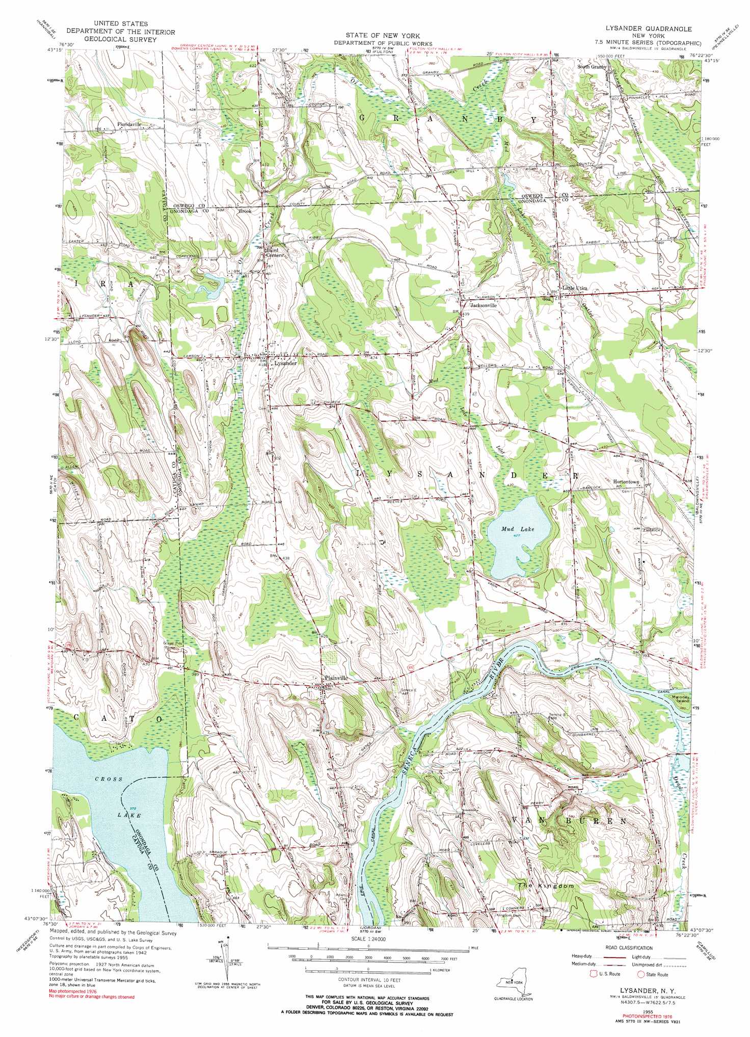
USGS Topo Quad 43076b4 - 1:24,000 scale
| Topo Map Name: | Lysander |
| USGS Topo Quad ID: | 43076b4 |
| Print Size: | ca. 21 1/4" wide x 27" high |
| Southeast Coordinates: | 43.125° N latitude / 76.375° W longitude |
| Map Center Coordinates: | 43.1875° N latitude / 76.4375° W longitude |
| U.S. State: | NY |
| Filename: | o43076b4.jpg |
| Download Map JPG Image: | Lysander topo map 1:24,000 scale |
| Map Type: | Topographic |
| Topo Series: | 7.5´ |
| Map Scale: | 1:24,000 |
| Source of Map Images: | United States Geological Survey (USGS) |
| Alternate Map Versions: |
Lysander NY 1955, updated 1957 Download PDF Buy paper map Lysander NY 1955, updated 1968 Download PDF Buy paper map Lysander NY 1955, updated 1990 Download PDF Buy paper map Lysander NY 2010 Download PDF Buy paper map Lysander NY 2013 Download PDF Buy paper map Lysander NY 2016 Download PDF Buy paper map |
1:24,000 Topo Quads surrounding Lysander
West Ninemile Point |
Oswego West |
Oswego East |
New Haven |
Mexico |
Fair Haven |
Hannibal |
Fulton |
Pennellville |
Central Square |
Victory |
Cato |
Lysander |
Baldwinsville |
Brewerton |
Montezuma |
Weedsport |
Jordan |
Camillus |
Syracuse West |
Cayuga |
Auburn |
Skaneateles |
Marcellus |
South Onondaga |
> Back to 43076a1 at 1:100,000 scale
> Back to 43076a1 at 1:250,000 scale
> Back to U.S. Topo Maps home
Lysander topo map: Gazetteer
Lysander: Islands
Maloney Island elevation 115m 377′Lysander: Lakes
Cross Lake elevation 114m 374′Mud Lake elevation 130m 426′
Lysander: Populated Places
Baird Corners elevation 119m 390′Floridaville elevation 133m 436′
Hortontown elevation 142m 465′
Jacksonville elevation 130m 426′
Little Utica elevation 125m 410′
Lysander elevation 126m 413′
Plainville elevation 149m 488′
Lysander: Streams
Dead Creek elevation 114m 374′Mud Lake Inlet elevation 131m 429′
Mud Lake Outlet elevation 110m 360′
Lysander digital topo map on disk
Buy this Lysander topo map showing relief, roads, GPS coordinates and other geographical features, as a high-resolution digital map file on DVD:
New York, Vermont, Connecticut & Western Massachusetts
Buy digital topo maps: New York, Vermont, Connecticut & Western Massachusetts