Victory Topo Map New York
To zoom in, hover over the map of Victory
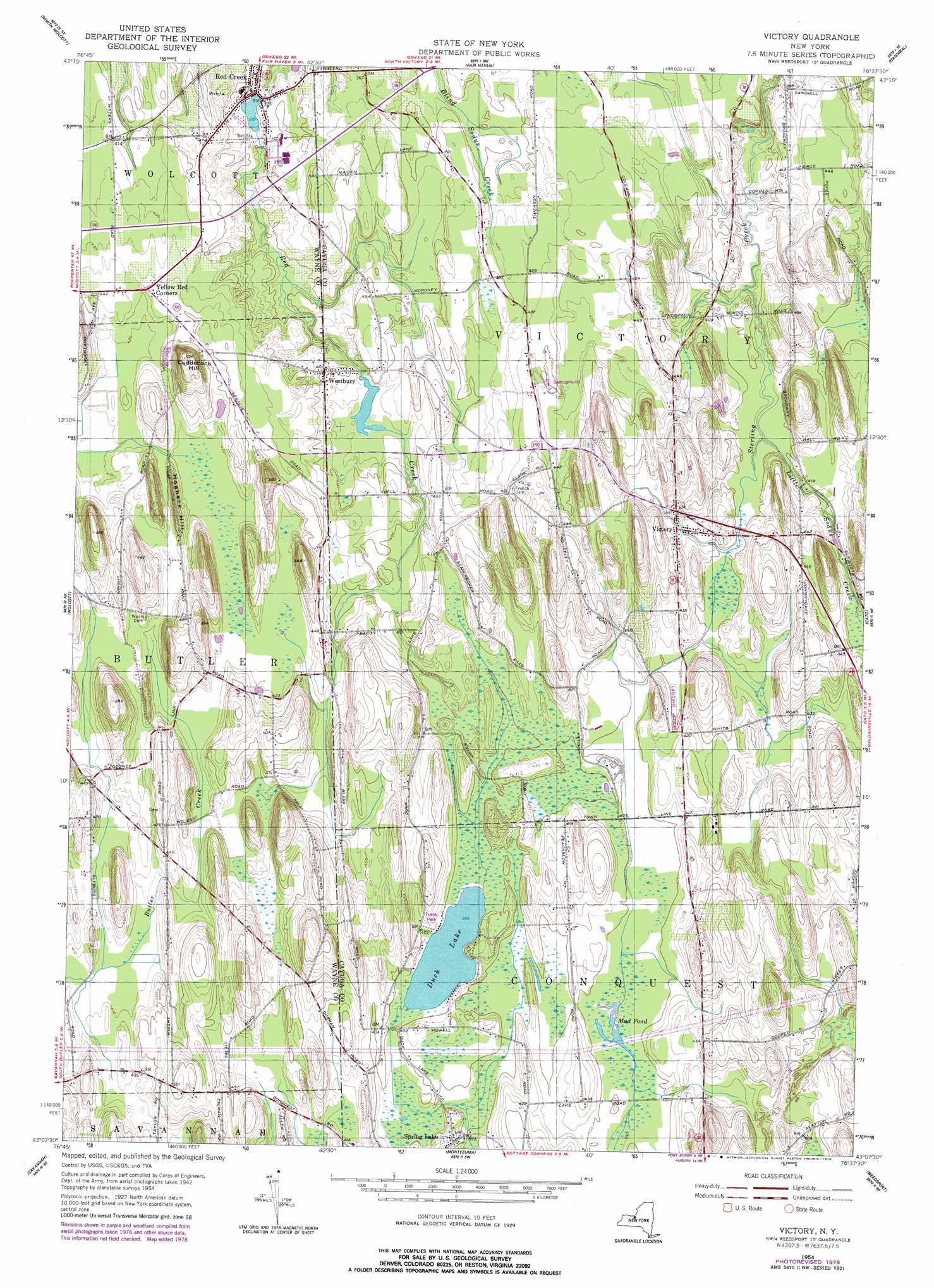
USGS Topo Quad 43076b6 - 1:24,000 scale
| Topo Map Name: | Victory |
| USGS Topo Quad ID: | 43076b6 |
| Print Size: | ca. 21 1/4" wide x 27" high |
| Southeast Coordinates: | 43.125° N latitude / 76.625° W longitude |
| Map Center Coordinates: | 43.1875° N latitude / 76.6875° W longitude |
| U.S. State: | NY |
| Filename: | o43076b6.jpg |
| Download Map JPG Image: | Victory topo map 1:24,000 scale |
| Map Type: | Topographic |
| Topo Series: | 7.5´ |
| Map Scale: | 1:24,000 |
| Source of Map Images: | United States Geological Survey (USGS) |
| Alternate Map Versions: |
Victory NY 1954, updated 1956 Download PDF Buy paper map Victory NY 2010 Download PDF Buy paper map Victory NY 2013 Download PDF Buy paper map Victory NY 2016 Download PDF Buy paper map |
1:24,000 Topo Quads surrounding Victory
West Ninemile Point |
Oswego West |
Oswego East |
||
Sodus Point |
North Wolcott |
Fair Haven |
Hannibal |
Fulton |
Rose |
Wolcott |
Victory |
Cato |
Lysander |
Lyons |
Savannah |
Montezuma |
Weedsport |
Jordan |
Geneva North |
Seneca Falls |
Cayuga |
Auburn |
Skaneateles |
> Back to 43076a1 at 1:100,000 scale
> Back to 43076a1 at 1:250,000 scale
> Back to U.S. Topo Maps home
Victory topo map: Gazetteer
Victory: Airports
Paradise Airport elevation 129m 423′Victory: Lakes
Duck Lake elevation 121m 396′Mud Pond elevation 120m 393′
Victory: Mines
Butler Quarry elevation 126m 413′Victory: Populated Places
Red Creek elevation 104m 341′Spring Lake elevation 126m 413′
Victory elevation 129m 423′
Westbury elevation 122m 400′
Victory: Streams
Little Sodus Creek elevation 119m 390′Victory: Summits
Cuddeback Hill elevation 184m 603′Hogback Hill elevation 147m 482′
Victory digital topo map on disk
Buy this Victory topo map showing relief, roads, GPS coordinates and other geographical features, as a high-resolution digital map file on DVD:
New York, Vermont, Connecticut & Western Massachusetts
Buy digital topo maps: New York, Vermont, Connecticut & Western Massachusetts